
| |||||||||||||

The British Virgin Islands Hello all! As I begin this report on the BVI, we are in Puerto La Cruz, Venezuela, on the northern coast of South America. We will continue to live aboard Indigo Moon while docked at the Bahia Redonda Marina until mid-October, staying well below the hurricane belt until the storm season wanes.
During our six-month journey down through the Eastern Caribbean island chain to South America we were “on the go” southward from January through July. We enjoyed putting off all boat projects that could be done here in Venezuela while docked at the marina for four months. Thus, now is a natural pause where we can catch our breath and update the website. Also, in June we were able to take a quick trip home to Baton Rouge from Grenada. Ed Cullen, staff writer for the Baton Rouge Newspaper, The Advocate, did a feature story on us during our visit. On the upper right section of this home page there is a link to the article, if you are interested. Our stay at the Bahia Redonda Marina will be a record for us. We have never remained tied up in one place for so long. It’s been twenty months since we set out on this adventure and we have covered roughly 10,000 miles, usually never staying in one spot for more than a few days. This will be our first real taste of being "live-aboard-marina-fixtures" (a whole different society and lifestyle than that of on-the-move cruisers). The facilities here at Bahia Redonda are very nice and include a beautiful swimming pool at an adjacent condominium complex, “mini mart” grocery, a fairly good restaurant within walking distance at another nearby marina, and very good security. The docks themselves are as nice as anything in Ft. Lauderdale. Indigo Moon is peacefully moored stern-to, along with about 120 boats from all around the world. We had never done stern-to docking before arriving in Venezuela (a.k.a. "Med-Moor" docking , because this method of docking is prevalent in Europe and the Mediterranean). At this marina, moorings are located out in the channel and provide a method for securing boats’ bow lines. Once the bow lines are tied to the moorings, the boat is backed to the dock and the stern lines are attached to dock cleats. Boats are situated side to side with fenders out. Our first arrival in South America was at the Venezuelan island of Margarita where we stayed almost two weeks at the Marina Margarita before heading to the Venezuelan mainland. There were no docks at Marina Margarita -- just a menacing, solid concrete seawall adjacent to a long, dusty dirt road. They do have shore power and that was nice. Our only access to potable water was from a big tank truck that would pass a hose and pump water directly into the boat's water tanks (with bits of green-scum from the hose). We used a filter and dumped bleach in the tanks and used it for showers only. Only bottled water is safe for drinking in Venezuela. In Margarita, you must use your own anchor to stand off the concrete wall. Like “patting our heads and rubbing our tummies" at the same time, we had to simultaneously drop anchor (at the bow) and let out 100 feet of chain while also backing up to the seawall and managing the dock lines (at the stern). And, of course, we had a cross wind and had to back into a tight spot between two boats already there! Our first try at this was successful, but definitely not graceful. One main "Med Moor" ingredient that we needed: a gangplank, or “pasarela” in Spanish. Without a plank to access Indigo Moon we simply pulled hard on the stern lines to get the boat close to the seawall and then jumped! One time Melissa didn’t quite make it off the boat and wound up crouched with her feet on the corner edge of the seawall with her body precariously over the water at a 45 degree angle. She had to hang on to the dock lines for dear life until I grabbed her and pulled her the rest of the way up (backpack and all). There is no EPA here in Venezuela. Let’s just say that falling into the waters of Margarita Marina would be a very, very nasty fate. After a week of gymnastic leaps from the boat to the seawall and visa versa, getting a pasarela became a priority. Upon our arrival here at the Bahia Redonda Marina in Puerto La Cruz, we were able to hire a taxi with a roof rack to take us to a lumber yard to get a 2x12 plank so we can now board the boat safely. Also, the good news is that the docks extend out over the water so that we are not worried about Indigo Moon's transoms bumping into a seawall. I've got a wild Margarita story about that, but we'll save it for later. We have settled in here at Puerto La Cruz and are delighted with the warmth of Venezuela’s people. There are several taxi drivers here who cater to the marina guests. We have enjoyed employing Carlos Gonzales (a.k.a. “Charlie Alpha” who attended LSU and now imports earthmoving equipment into Venezuela), Arnaldo Añez (the former dockmaster here at Bahia Redonda and former motocross motorcycle Champion in the 70’s - he's a "gearhead" like me and we have a blast exchanging notes on Discovery Channel car shows like "Rides" and "Overhaulin'"), and last but not least is Leopoldo “Leo” Sanchez who is a scream, because he learned to speak English from watching cartoons -- his wild timing and exaggerated pronunciations in English are hilarious, but you better be ready for a big show because he NEVER stops talking. The drivers will take you anywhere and assist with translations and negotiating prices, etc., for just 15,000 Bolivars per hour ($6.00 U.S). Gasoline is virtually free here, making driving amazingly cheap for the taxis. It takes the equivalent of about $3.00 to fill up a car -- yes folks, Three Dollars! Bottled water, at $1.50/gal., is tremendously more expensive than gasoline. Also, beer is very cheap, about 30 cents a can! Sounds weird to say, but it's true that Venezuela is probably the cheapest place on earth for drinking and driving. Inflation has gone wild here, though, and the Venezuela economy is very volatile. To put things in perspective, just a few years ago 125 Venezuelan Bolivars were equal to one U.S. Dollar. Now it takes 2500 to 2600 Bolivars to buy a U.S. Dollar – twenty times as much! And so, we exchanged one thousand U.S. Dollars for Two Million Six Hundred Thousand Bolivars. Thus, inflation is so bad that for a thousand bucks, you can be a multi-millionaire in Bolivars. And this spectacular inflation has taken place in less than a decade. While gasoline and beer are almost free (maybe that's the current government's secret plan), all other goods are very pricey and very low quality. Many goods are simply not available at all. As you all know, a main feature of Venezuela’s current political climate in this election year is the escalating anti-American rhetoric of Venezuela’s President, Hugo Chavez. A Castro protégé, with quasi-communist dictator aspirations, Hugo Chavez has come to power in an age of super-high Venezuelan oil profits. None of that big oil money is finding its way to the poor people of Venezuela's barrios, though. Chavez throws out crumbs and that’s about it. It seems the bulk of Venezuela’s windfall oil profits are being spent by Chavez on his worldwide junkets to develop relationships with anybody and everybody who opposes the U.S.A. It is reported that Chavez also provides significant financial aid to Cuba. Prior to our arrival in Venezuela, we were concerned about the anti-American climate. We also got an earful of additional disconcerting news about Venezuela as we made our way down the Caribbean. An Austrian cruiser, anchored at an island very near where we are at Puerto La Cruz, was shot and robbed (he survived). Also, the owner of the Bahia Redonda Boat Yard (next to the Bahia Redonda Marina where we are) was, along with his wife, murdered “execution-style” early one morning as they drove into the Bahia Redonda complex. Crime has been rising along with inflation and unemployment, and it affects locals and tourists alike. Cruisers began reporting on SSB radio “safety and security” networks and via the internet and magazine articles that, despite being a cruiser’s safe haven and “hurricane avoidance destination” for decades, Venezuela is just not safe anymore. Word "on the street" (or more precisely “in the anchorages”) was that the Venezuelan government could not care less about the safety of tourists (U. S. citizens especially), and that the Coast Guard would not even respond to emergencies, etc. As such, all cruisers planning to head to South America became very concerned, as did we. Keep in mind that most of us cruisers had to either go to Venezuela or Trinidad to be far enough south to comply with our insurance policies which require us to be well south of Grenada for hurricane season. Honestly, neither Trinidad nor Venezuela's mainland are truly attractive "must see" cruising destinations -- both are relatively bad choices compared to idyllic destinations elsewhere. For example, it would be much nicer to be hanging out in the Tobago Cays in the Grenadines, or in Bonaire, but all those places are above the latitude we must stay below for insurance purposes. After much inquiry and soul-searching, we came to the conclusion that Venezuela was no more dangerous than Trinidad (where there have been some 280 murders already this year). In fact, from what we hear now, statistically Trinidad is tremendously more dangerous than Venezuela. So, the only “wild card” in Venezuela would be the political situation. Against the backdrop of all the above, upon our arrival in Venezuela, we were bracing ourselves for the worst. On the contrary, however, we have been delightfully surprised. The people here are genuinely friendly and we are probably safer here than we were in New Orleans and Baton Rouge, and definitely safer than we would have been in Trinidad. The majority of well-educated Venezuelans we talk to in private are down right embarrassed by President Chavez's antics. The less-educated Venezuelans, whether they be either pro or anti Chavistas, don’t seem to have any actual grudge against U.S. Citizens regardless. Besides, Venezuelans are all wearing U.S.A. designer clothes, drinking Pepsi, shopping the Malls, eating Wendy’s and McDonalds, and watching U.S.A. television programs. The women here are into expensive shoes and name brands, and they were born with a deep golden skin-tone of the perfect Coppertone tan. Venezuelan women are the most beautiful you’ll ever see. It’s no wonder why Venezuela wins so many beauty pageants. Plastic surgery is also the rage here and there is a beauty salon on every block it seems. Thus, despite Chavez’s vigorous anti-American rhetoric and socialist aspirations, the people of Venezuela are dedicated capitalists and, although relatively poor due to the terrible inflation of the last decade, they are consumers nonetheless with an insatiable appetite for all things U.S.A. It will be tough for Chavez to ever turn that around! Moreover, the locals here in Puerto La Cruz, which is basically a seaside resort area, are especially “laid back” and great. They have “no problema” with us Norte Americanos and have been very good to the “dos gringos” on Indigo Moon so far. That's enough about Venezuela for now, it’s a BIG story in itself and I’m getting way ahead of myself. The air conditioners are humming 24/7. By 9:00 a.m. the South American sun is hot enough to soak your shirt in less than two minutes. There’s no better place to be than inside the cool AC and be able to begin these updates. The entire Eastern Caribbean awaits us -- so let’s get going and check out the British Virgin Islands first! I. Arrival in the British Virgin Islands In our last installment, we just completed our offshore passage from Ft. Lauderdale to the island of Tortola in the British Virgin Islands – 1130 miles in seven days. Dawn was breaking just as we arrived in the British Virgin Islands. I had been up all night, since 11:00 pm, and had been on watch in seas so rough that a small craft warning had been issued for the last 48 hours. I was exhausted, but also elated that we completed a significant ocean passage without incident. I could not wait to get Indigo Moon tied up and collapse into my bunk.
I had already called the Catamaran Co. to see if I could get into a spot on their docks by Nanny Cay Marina where their charter business is located. The Catamaran Co. does not rent dock space, but graciously allowed me to rent space for a night anyway considering I am a customer who bought a boat through them. As Melissa retrieved the lines, I was informed on the VHF radio by the dockmaster that we could not dock at Nanny Cay and then go to Customs from there. Instead, we were told we had to keep sailing and go to Road Town (the Capital of the British Virgin Islands located several miles farther east on the south shore of Tortola) and anchor there in Road Harbor and go to Customs by dinghy. This was new to us. In the Bahamas, we were allowed to dock and walk to Customs. II. Welcome to the British Virgin Islands Before we go any further, though, let’s all get familiar with the fabulous Virgin Islands! Basically, the Virgin Islands have been a central hub of shipping in the Americas ever since ships first sailed the New World’s seas. The islands were discovered by Columbus in 1493. He named the islands the “Virgins”, allegedly honoring the 11,000 virgins of 4th Century Cologne, all of whom sacrificed their own lives rather than be captured and ravished by the Huns. The location of the Virgin Islands made them a natural rest stop for trade ships carrying cargo between Europe and South and Central America. And wherever sailing ships full of precious cargo congregated, you could bet that the ancillary businesses of pirating and privateering would flourish as well. Infamous pirates like Blackbeard were a permanent fixture in the Virgin Islands. Add in tales of the cannibalistic and fierce Carib natives, slave uprisings, and every form of drama imaginable and it becomes clear that the Virgin Islands have been a dynamic region for centuries with more than enough conflict and conquest to spawn legend after legend. Although initially discovered and settled by Spain, the Virgin Islands were traded, sold, and shuffled between many European nations. The British ultimately held onto the bulk of the Virgins Islands to the East, with the United States ultimately acquiring three large Islands to the West toward Puerto Rico. The border of the two entities is but a mere mile or so between the closest islands of Tortola BVI and St. John USVI. And so, although their governments are different, the islands themselves remain siblings in a very close family -- some islands are situated so closely to each other that from a distance it’s hard to tell where one island ends and the one next begins. The Spanish and Dutch brought slaves from Africa and began cotton and sugar plantations in the mid-1600’s. Those ventures were profitable until slavery was outlawed in England in 1772. By that time, the slave population had increased dramatically in the Virgin Islands. After the abolition of slavery in England, slaves in the Virgin Islands began to rebel en masse. These violent rebellions, coupled with dwindling European demand for West Indian sugar at the time, resulted in the absolute failure of the sugar plantations. By the mid-1800’s all whites were gone and the slaves were the exclusive inhabitants of the islands, living off the fruits of the land and sea. Not much happened for a century thereafter. But, once air travel became more and more economical, the tourist trade flourished. Most notably, the charter boat industry has absolutely exploded in the Virgin Islands, especially within the last ten years! Today, scores of charter boat companies maintain hundreds and hundreds of boats here. Sailors come from all over the world to enjoy what many call the best cruising grounds on this planet. The charter fleets have grown significantly in just the last five years that Melissa and I have been visiting the Virgin Islands. We were also amazed at how many catamarans are now in the charter fleets! On our last charter in the Virgin Islands in 2003, we saw a few catamarans and certainly no Lagoon 380’s like Indigo Moon. During our visit this time, there were scores of Lagoon 380 and 410 catamarans everywhere in great numbers and the sheer number of all types of catamarans was astounding. The cats are really taking off in popularity and charterers are demanding the space and comfort that catamarans are famous for these days. The BVI are comprised of twenty or so main islands, scattered from east to west over an area twenty miles wide, and from north to south over an area of about ten miles long (with the exception of Anegada, located about 15 miles northeast of the main BVI island group). Four islands, Tortola, Jost Van Dyke, Virgin Gorda and Anegada, are relatively large islands. The majority of the smaller islands form two chains that surround Sir Francis Drake Channel. Except for Anegada ("the drowned island" comprised of low-lying coral and reefs), BVI islands are mountainous and of volcanic derivation.
Refer to the above map and let's get further oriented. Anegada is a very low lying, flat island surrounded on the southeast by a reef that is HUGE and has claimed many a vessel. In fact, many charter companies won't let charterers sail to Anegada unless supervised in a flotilla. The reef extends out so many miles that you can hit it before ever seeing Anegada. Known for good snorkeling and for lobster dinners at Neptune's Reef, we visited Anegada on prior trips. South of Anegada, the southeastern chain of islands starts with Necker Island and ends with Norman Island. Working from top to bottom, Necker Island is privately owned by billionaire Richard Branson. Perhaps his affinity for the Virgin Islands explains the Virgin name used in his many enterprises. Virgin Gorda is next and hosts the Bitter End Yacht Club (in North Sound across from Prickly Pear Island), which is a world-class sailing resort that includes a full service hotel with rooms in independent buildings on the hillsides, offering panoramic views of North Sound. Bitter End also operates a marina and fleets of sailboats, from daysailers and Hobie Cats up all the way up to 38 foot cruising yachts that are available for the guests' use. Also, the Biras Creek Resort operates on the south side of Virgin Gorda at North Sound. It is not a sailing focused resort like Bitter End, but instead offers privacy and luxury that is top notch. Another famous location, "The Baths", is situated on the southern end of Virgin Gorda. At The Baths, huge, smooth boulders lie directly on the shore. Like an aquatic Stonehenge, the boulders look a bit out of place. In between the boulders, numerous emerald pools with perfect sand bottoms make for a wondrous sight. Rays of sun cut through the spaces between the boulders, making skylight type effects upon the brilliant clear pools. Next is Ginger Island which is not developed. After that is Cooper Island. On the northwest end of the island, there is a nice, isolated resort named Cooper Island Beach Club. With a perfect open-air restaurant, looking west through the beautiful palms on a pristine beach, you can eat a very good dinner and witness the sunset of a lifetime while gazing out over Sir Francis Drake Channel and the peaks of St. John. The resort, much like Bitter End, has rooms in small, private, independent buildings spread out on the hillside overlooking Sir Francis Drake Channel. Next are Salt Island and Dead Chest, both undeveloped. In between Salt and Dead Chest, the wreck of the RMS Rhone lies on the bottom. It was used in the 70's movie The Deep, starring Nick Nolte, Jaqueline Bissett, Robert Shaw and Louis Gossett Jr. It's a favorite snorkel and dive spot and is a protected Marine Park. Believe it or not, we still have not made a dive there. Hey, we have to leave something new for our next trip, right!? Then comes Peter Island. It is very exclusive and hosts the Peter Island Resort. Like Biras Creek, Peter Island Resort is a perfectly landscaped tropical paradise and has marina facilities as well. Finally, the southeast chain of islands ends with Norman Island. It is famous for many things. First and foremost, it is believed to actually be Robert Louis Stevenson’s “Treasure Island” and it has a couple of interesting caves on the northwest point (Treasure Point). These caves, set in shear rock cliffs, are open to the sea and you can snorkel into them. There are walls of coral beneath the surface outside the caves, dropping down twenty feet and beyond. Lots of tropical fish congregate there. The caves do in fact look like a good place to tuck away some treasure. That alone is a great reason to put Norman Island high on the list. Second, Norman Island is famous for Willy-T’s, a 100 foot long steel-hulled schooner that is a permanent fixture. Anchored in a big protected bay called “The Bight”, The William Thornton (a.k.a. Willy-T’s) is a bar and restaurant that keeps Norman Island hopping. Its reputation is one of wild parties and debauchery. Ok, so that's the southeastern chain of islands that protect Sir Francis Drake Channel from the Caribbean Sea to the south. The chain of islands to the northwest protects Sir Francis Drake Channel from the Atlantic Ocean to the north. Starting from top to bottom in the same fashion, The Dogs are first and are uninhabited but provide wonderful snorkeling. Next are the four islands that fan out around the northeast end of Tortola: Guana, Camanoe, Scrub and Beef Islands. Guana has a small private resort. Camanoe has a few private homes, but no resorts. Scrub has a good restaurant and some developments. Beef is very developed with an airport. Then comes the big island, Tortola, where Road Town is the capital of the BVI (on the southern shore). Tortola has many attractions, including small Cays that are almost connected, like Frenchman's Cay at West End, and Nanny Cay (not shown). Finally, to the northwest is Jost Van Dyke and little Jost Van Dyke. JVD is very lightly developed and is most famous as the location of Foxy's Bar. More on that later. And so, while we make our way around the BVI, refer to the above map to get your bearings! III. Sailing the British Virgin Islands In large part, our prior wonderful experiences while chartering sailboats in the British Virgin Islands resulted in our decision to sail away on our own boat. The Virgin Islands are astonishingly picturesque: cobalt blue and turquoise waters; high mountains with lush greenery; cloud patches casting slow-moving shadows across those bright-green mountains; and, all that as we sail along in with the warm sun on our tanned shoulders in January! Jimmy Buffett's Manaña lyrics are apropos: Yeah, they're freezin' up in Buffalo stuck in their cars, and I'm lyin' here 'neath the sun and the stars. . . It is truly magical. On top of all that, sailing is ridiculously easy in the BVI. As the easterly trade winds blow across the Atlantic, the seas build. The Virgin Islands themselves, however, form a protective barrier that insulates sailors from the seas of the open Atlantic Ocean to the north and the Caribbean Sea to the south. Within the protected confines of Sir Francis Drake Channel you still get 100% of the trade winds but only 25% of the seas. It is a perfect world-class sailing playground. Sailors with very minimal experience can safely sail in consistent trade winds and relatively calm seas. Plus, you can always see the next island to which you are headed, which technically means you are only “piloting” and not “navigating.” Also, there are hardly any shallows or reefs to hit and the few to watch out for are well-marked and you should have no trouble whatsoever unless you take chances or don't use caution in those few areas. The islands’ steep mountains usually continue at the same angle into the sea, making waters deep very close to shore. I always joke and say that you would probably ram the bow into a mountain before ever running aground here. Accordingly, it’s a very safe place to sail compared to the Bahamas, for example, where treacherous reefs are lurking everywhere for miles and miles. The array of coves and beaches and restaurants and hikes and snorkel spots in the BVI seems endless. And every destination is picture-postcard gorgeous! Also, considering the global appeal of the BVI, you will see some of the finest sailing yachts in the world here. It is not uncommon to find yourself sharing an anchorage with yachts costing tens of millions of dollars. Once the hub of 1700's trade ships, the Virgin Islands are now a hub for the finest pleasure yachts in the world. Our arrival here in the Virgin Islands on our own boat is quite simply amazing and falls under the category of “not in our wildest dreams” did we think we would ever get to do this! IV. BVI Customs and Immigrations - Sometimes you have to go through Hell before you get to Heaven Knowing we must proceed to Road Town and anchor before we can go to Nanny Cay Marina presents a challenge. First, we will have to find a spot to anchor. The dinghy engine will have to be hoisted off the stern rail (where it is stowed for offshore passages). The dinghy will have to be unlashed and dropped down. The heavy outboard engine will have to be lifted by hand and crane and then mounted on the dinghy. We will need to get all our papers together and get cleaned up. Then, we’ll have to ride in with the dinghy and walk to Customs. So, although we thought we had already “made it” to the BVI, our celebration was a wee bit premature. The hardest part of the passage will be NOW: getting anchored and to Customs. I am a zombie at this point -- so tired that the "tunnel vision" feeling is setting in. As we approach Road Town, I wonder: can I physically pull all this off? Well, regardless, it will be a good test to see what a now 50-year-old Buddy can and can’t do!
We anchored in water 30 to 40 feet deep in Road Harbor in front of Customs, just upwind from a rocky shoreline. The trades were kicking and it was rough for an anchorage, one to two foot seas. In an anchorage that deep, we put out 100 feet of chain plus an additional 100 feet of rope spliced to the chain to get enough scope to feel good about not dragging into the rocks. Anchoring in deep water means I can’t just drop the anchor with the windless and all chain, but must also manually handle cleating off the anchor rope rode, as well as fashioning a rope bridle. All of that required muscle and energy I just didn’t have in reserve. I was so tired I just strived to focus and keep all my fingers! Getting the outboard on the dinghy was the physical equivalent of wrestling a grizzly bear in these conditions. Despite short tempers and a few cross words, Melissa and I managed it all in short order. I grabbed a quick shower and shave and was got nicely-dressed. Melissa got cleaned up as well. After gathering the boat papers and passports, we were ready to go. Ok, we are anchored; now where is the dinghy dock for Customs???? We look at the cruising guide book and the information is not clear. In the coming months, we will get used to vague maps and directions. We see the big, concrete Ferry dock in front of the building identified as Customs according to the guide book, but it is bustling with large ferry traffic, and it looks like suicide for both us and the dinghy to tie up there. We decide to negotiate the rough waters of the Harbor in our dinghy to round the cruise ship docks and go to the dinghy dock of Village Cay Marina located a half-mile or so further inside Road Harbor. Despite being the first week in January, it feels HOT here; we were wearing coats when we left Ft. Lauderdale on December 27th, seven days ago. We can’t walk straight and are still rocking and rolling. We realize we are suffering from ‘land sickness’. We walk several dusty blocks through bustling tourists and traffic to the building by the ferry dock and, sure enough, it is the Customs office. We can see Indigo Moon just offshore and are reassured that she seems to be holding her ground in the windy conditions in the outer Harbor. I am wondering: why is this so difficult? Why couldn’t we have gotten a cab to Customs from Nanny Cay Marina? Why do I have to put my boat at peril? Why is there no safe dock for dinghies to dock at Customs? Why are there no signs? I had to tie the dinghy up at a marina anyway, so what’s the difference between tying up Indigo Moon or the dinghy? No use asking these questions, though, because “it is what it is” as they say. Melissa and I enter Customs upstairs and are handed a pre-printed legal-sized form with five self-carbon copies attached. We fill it all out, providing detailed vessel and passenger information. I am literally ill now. Swaying back and forth and reeling from the heat, I feel very nauseated at the counter. We pay the cashier and get a stamp and a receipt and a permit for the boat. Okay, so now Indigo Moon is cleared in. We are then sent downstairs to Immigration with the pink, bottom copy of the six-copy form to clear in Captain and crew with Immigrations. I am thinking the worst is over. As I wobble down a hallway to the Immigrations Office with Melissa in tow, I see the infamous “yellow line” and stop. The door of the Office is open and fifteen feet away the Immigrations Officer is seated behind her desk, giving a British cruiser Holy Hell. Within a few seconds of seeing this, I realize she is one of the most caustic humans I have ever seen (and that means something coming from a litigation lawyer). The Brit throws his hands up and leaves, red-faced in exasperation and without any satisfaction. He brushes by me on his way out (mumbling death threats, I think). I stand there, behind the yellow line, and take a deep breath while I wait for the Officer to invite me in. The Officer is a very dark-skinned African-West Indian lady, a BVI islander in her late fifties or so. Her hair is pulled very tightly back in a ponytail. Her white shirt and khaki pants are starched, neat and snug. Sitting very erect and proper behind her desk, the scowl on her face looks permanent, as if cast in clay. Her office is approximately twelve by twelve feet, with dirty, dingy concrete walls that have not been painted in a long, long time. I sway and wait and sway and wait and watch her from behind the yellow line. I know she sees me, but she refuses to make eye contact. She gets some staples out of a desk drawer and fiddles with her stapler for a solid minute, grimacing at its inner workings through her oval, wire-rimmed glasses. She tries to get it to work, but it just won’t. I figure she needs to fix it before turning her attention back to official business and to me -- maybe my form will need stapling? She eventually opens her desk drawer, though, and slowly places the stapler in the drawer, as if gently laying down a dead bird. After all that, I figure she’s going to call me in. No dice. Instead, she shifts gears and focuses intense concentration upon rearranging the three spray cans of strawberry Glade air freshener she has on her desk. She has those long custom-painted fingernails that are so popular these days. As she continues manipulating things on her desk, it appears probable that her efforts are nothing more than a subterfuge to watch her expensive fingernails flash through the air and click into action. After touching everything on her desk, twice, she sighs and picks up a catalog for ladies’ clothes and lingerie and starts thumbing through it. Another minute passes. I have now decided that I must have had a stroke and that I am surely dead and must be in purgatory. This can’t be real! Can it? Well, whether I’m dead or not, it’s a “Mexican Standoff” now! I will not cross the line without permission and give her the satisfaction of admonishing me. She will not speak nor acknowledge me. I’ve been in this type of “Twilight Zone” before, practicing law in front of the occasional trial judge who apparently forgot to take Prozac that morning. Five minutes pass, no kidding, and no one “blinks.” I’ve been eyeing the sign on the door, though. The door is wide open, but the sign on the door says "Knock Before Entering" and is clearly intended for when the door is closed, right? I think: Gee, I can’t reach the door from the yellow line anyway. Finally, I figure the only way I can break the ice and absolutely deprive the Wicked Witch of the West Indies from springing her trap is to try and knock. I lean way out, risking the yellow line, and manage to get the very end of a knuckle to scrape the very edge of the door. She never looks up from her catalog, but sharply barks one word: “COME!” You’ve got to be kidding?! I am tired and I have no patience left, but, I manage to bite a hole in my tongue. I hand her the faint, bottom pink copy of the six-page Customs form and the passports. She immediately snaps “I cannot read that form – go outside and fill it out!” I take a deep breath and go outside in the hall. Melissa convinces me that all I need to do is fill in the passenger/passport information again (all that is really relevant to Immigrations). With paperwork filled out again, I return to the yellow line and manage to get back inside. I hand the Wicked Witch the form again. She looks at me like I am Charles Manson and with severe disgust she shouts: “I ordered you to fill this out and you did not do what I ordered you to do! Why did you not follow my ORDERS! GO FILL IT OUT!” She slings the form back at me. I simply say “I’m sorry, I misunderstood -- I did not think you needed the technical vessel information.” I go outside, and completely re-do the form and continue to play “revolving door Hell.” Halfway through the 30 minutes of torture, I manage to retaliate. Pretending to be “fat, dumb and happy” (not much of a stretch), and as if I had not noticed her intentional, cosmically nasty behavior, I decide to strike up a friendly conversation anyway. While she clicks her fingernails on the desk and studies my papers looking for more reasons to harass me, I give it a go in the friendliest tone a human can produce: "You know, Officer, it is such a pleasure to be back in the BVI. Your country is the most beautiful place I know. How is the New Year treating you, Officer? Did you have a nice New Year’s celebration here in Road Town?" Then, in a crescendo of the absurd, with all her paperwork demands finally met and having no more fodder for my torture, she demands 20 cents. Not having any change on hand, I dig out a dollar bill. She takes it and roots around in a green-zippered bank bag for a good minute and finally reaches out very slowly and gently places three quarters down on my side of the desk. Only a moron would ask where his nickel is! As the old joke goes, “My momma raised ugly children, not stupid children!” I carefully picked up my 75 cents and split! Although it was surely an unpleasant ordeal, I manage to win! I don’t raise my voice. I don’t storm out. Instead, I get up and thank the Officer for her help (much to her puzzled dismay). I walk out and close the door (that will put and end to that part of her sick game for now). There are three other cruising couples in line outside now, all “cheating” by redoing all their paperwork per Melissa’s warning before entering; that will really ruin the Wicked Witch’s morning! I ask them all if they have 20 cents in change. None did. I gave each one of them a quarter and informed them that the Officer inside thinks that a quarter is 20 cents and that they will need the quarters. We all laugh and they are set! I also explain the NO “open door” policy here and that they must knock if the door is open, etc. About this time, maybe 10:30 a.m., the Officer opens the door I closed. She sees that a line has formed. She walks back to her desk momentarily and then turns and emerges from her “Chambers” staring straight ahead and walks without comment past all eight of us cruisers as if we were not there. Upon leaving the building, Melissa and I saw her outside, clicking her nails on a newspaper and sipping a soft drink at the little kiosk by the Customs building. Who knows how long it took the other couples to check in. Over time we learned that the Customs and Immigration Officers of the BVI are earning a spectacularly bad reputation in general. Recently, in the Caribbean Compass Newspaper, there was a story about allegations that some BVI Officers have now gone as far as to engage in aggressive, illegal acts of boarding vessels, withholding passports, and using intimidation to extort undue fines from cruisers. V. Cruising versus Chartering In the spirit of even-handed reporting of our adventures, we feel it is necessary to relate not just the good experiences, but some of the bad ones too. Our experiences while checking into the BVI are related herein above to demonstrate how different and difficult things can be for cruisers on their own boats versus vacationers traveling to the BVI to rent a charter boat. On our previous BVI charter trips, the charter company met us at the Ferry Dock with a nice van and whisked us to our boat. No paperwork is done by a charter customer; only the little declaration forms we received on the airplane and a giggle about the quick tip of the Passport to the "evil-eyed" Immigration Officer at the Ferry Dock. All other cruising papers are handled by the charter company. As a cruiser on your own boat, however, it is a different world out here and we were caught by surprise at how stunningly rude and awful the Immigration Officer was and how inconvenient the entire check-in process was compared to West End in the Bahamas, for example, where the process was easy and the Officers were civil and friendly. But, valuable lessons were learned. Many of the British Islands farther south in the Caribbean use the same British six-copy form. When filling them out down island, I pressed on the pen so hard it was if I was trying to etch stainless steel with a Dremel tool! That put an end to any further form games. Plus, like Cool Hand Luke, I "got my mind right" and accepted and expected that all future interaction with British Officers would be caustic (and it was). After checking in with Customs and Immigration, we dinghied back to Indigo Moon, still anchored securely in the bouncy harbor. After hoisting the dinghy up, we were quickly underway and headed back to the Marina at Nanny Cay! It was great to be tied up at the dock after seven days at sea, and wonderful to be surrounded by the beautiful mountains of Tortola and its surrounding azure waters. The warm tropical breeze and the island’s beauty mix a most-powerful cocktail for the senses. We were so happy to be in port and through with Customs and Immigration. Now we have truly made it to Paradise and can finally exhale and say “we made it!” In further contrast, however, to arriving in the BVI as a charter boat customer (with a clean boat and clean bunk sheets neatly turned down), we’ve now got big work to do! After a seven day passage, Indigo Moon needs TLC. That afternoon we get an extra burst of energy – from where I don’t know. Instead of going to sleep, we thoroughly wash the boat and even raise the sails fully and rinse them in the calm lee of the marina in the afternoon. After washing several pounds of ocean salt from the boat and its rigging, I walk, hitchhike and taxi my way several miles to NAPA in Road Town to buy a battery for the generator (the only thing the boat needed after the ocean passage). Meanwhile, Melissa stays behind to clean the inside of Indigo Moon and get everything ship shape and put away. By sunset, we have the genset battery installed and Indigo Moon is 100% ready for a fabulous frolic in the Virgin Islands. We stayed a couple of nights in the Marina and enjoyed air conditioning and a motionless boat as we caught up on our rest and visited the wonderful folks at the Catamaran Company’s office at Nanny Cay.
Finally, rested and re-energized, we are ready to set out to enjoy the most beautiful islands your mind's eye can imagine. After all that work, now we can shift into vacation mode and kick back and relax like the hundreds of charter boat vacationers here. V. Paradise Found: Cruising in the British Virgin Islands We were starting out from the west end of Sir Francis Drake Channel and, therefore, the western end of the BVI. As such, all the remaining islands of the BVI are upwind in the steady easterly trade winds. We decided to first spend a couple of days heading to the far eastern end of the BVI to the island of Virgin Gorda. Thereafter, we would be poised to slowly work our way back on leisurely downwind runs to various destinations. The Plan: one night at Norman Island; one night at Cooper Island; and, then to the Bitter End Yacht Club in the North Sound of Virgin Gorda where we will stay as long as we like and go from there!
The next day, it’s off to Cooper Island for another laid-back evening. We went ashore to the Cooper Island Beach Club for dinner and I got my “fix” of Chicken Roti, a local chicken dish that is done to perfection at the Cooper Island Beach Club. Basically, roti is a very thin crepe filled with a spicy chicken stew -- when done right it's awesome. Here is a link to Cooper Island Beach Club if you want more information.
The next morning we set sail early and headed to Virgin Gorda. Named as “The Fat Virgin” by Columbus, the capital of the BVI was once located here. The island is about ten miles long and has many interesting topographical features.
Another reason we sailed straight to Bitter End Yacht Club is that our dear friend, Pam Wall, was selected to be part of a prestigious team of world-renowned women sailors to conduct a week-long women’s sailing school at Bitter End Yacht Club. Pam is about 5’3” tall and has more energy than the Sun! She and her awesome Aussie husband, Andy, built their own sailboat, Kandarik, and sailed it around the world with their two kids. Pam and Andy live in Ft. Lauderdale now, where she works at West Marine in the Outfitting Department. Andy is an expert sailboat rigger and is in high demand, sometimes being flown to far off places to work on sailing yachts, the owners of which will not let anybody touch their rigging but Andy – he’s that good! Pam is the most effervescent person you’ll ever meet and has a zeal for all things cruising and sailing. Her presentations on “Cruising in the Bahamas” and on “Safety at Sea” are regular installments at all the major boat shows nationwide where she serves as the Ambassador for West Marine. She is simply the coolest of the cool. You can’t help but just love her! Melissa and I met Pam when we bought Indigo Moon in Ft. Lauderdale three years ago. Needing to outfit the boat before delivering it to New Orleans, our “lucky stars” were aligned the first day we walked into the Ft. Lauderdale's West Marine Superstore and were greeted by Pam Wall. Explaining the New Boat Owner’s Outfitting Program, Pam immediately became our personal outfitter. Thereafter, we pulled three shopping carts through the store and began filling them as if we won the Lottery. I would grab something and put it in the basket and Pam would say: “Oh, no – you want this instead” and would explain why. Talk about a lifesaver! She saved me time, money and frustration, and every single suggestion she made was 200% “spot on.” Since that first chance meeting, Pam has provided support and services to Melissa and me no matter where we are in the World, and we always know we have a true friend just a phone call away. She’s priceless! And so, with that introduction, now you know why we wanted to see our dear friend, Pam, while she was teaching at Bitter End. We invited Pam and a few or her students over to Indigo Moon for a visit one afternoon. It was the first time Pam got to see Indigo Moon in person!
We thoroughly enjoyed having Pam and her students aboard. Bitter End Yacht Club is a fabulous development. I suggest that Bitter End is a perfect location to have guests visit us who would prefer to stay in a hotel instead of on the boat. Here is a link to Bitter End Yacht Club. The grounds around Bitter End Yacht Club are a tropical paradise. Melissa and I grabbed up the camera one day and did a walking tour. Here we go:
Melissa and I really enjoyed being at Bitter End on our own boat. When we chartered in the BVI, there was always a schedule – a pressure to keep moving to a new anchorage every night and see all we could see in one week. It was much different to be in the BVI on our own open-ended schedule. We can stay in Bitter End for a week or a month if we want to! We continued our tour of Bitter End by hiking up a trail that leads around a mountain to the Biras Creek Resort. Back when we jobs and paychecks, Melissa and I stayed at Biras Creek Resort once back in June of 2000 -- very exclusive. Here is a link to Biras Creek .
As we finished our hike, we made a pass through the Yacht Club. The Women’s Sailing School was underway. Pam Wall was teaching proper methods for cleating off lines. In the early mornings they had classes onshore and in the late mornings and afternoons they took to the boats and sailed North Sound.
After saying “Hello” to the sailing students, Melissa and I walked a little further around the beaches of the Bitter End Resort.
We had a fabulous reunion with Pam. We all remarked how lucky we all were to be able to run into each other in the pristine setting of Bitter End Yacht Club. It’s said that “cruising” is “repairing your boat in exotic places.” Sure, that’s true. But “cruising” is also sharing the most beautiful places on earth with fabulous friends and that is what makes it so much fun! We stayed several days at Bitter End and finally felt fully rested and relaxed after our big passage. Ready to do some island hopping, we bid farewell to Bitter End and North Sound (for now). On a perfect afternoon, we raised sails while still on our mooring and slipped the line. As we sailed outbound in North Sound, we left Prickly Pear Island to starboard. There on the beach was the entire Women’s Sailing School Class, having beached their small sailboats for a rest. I blew the air horn and they all saw Indigo Moon under full sail, headed out. Instantly, they all started jumping and cheering and waving wildly! I answered with another blast of the horn and removed my cap and bowed as flamboyantly as any 1700’s Privateer. What a great moment! So, where are we going next? Only about five miles away is Lee Bay on the west side of the nearby island Great Camanoe. This calm anchorage is set in a small bay that is situated at a low spot between two mountains on the lee side of the island. A comfortable breeze funnels through this opening. It is secluded and the beach is undeveloped. Melissa and I anchored here at Lee Bay on the first night of our first trip to the BVI. I will always remember that first night. I woke up at about 2:30 a.m. and poked my head out into the cockpit to find the most amazing"storybook sky" I'd ever seen before or since! Just above the mountain peaks of Tortola, a yellow crescent moon perfectly floated on a few thin clouds, and the entire scene reflected perfectly upon the calm waters of the bay. No kidding, the finest illustrator alive could not have painted a nighttime sky quite as magical. So precious an image, I simply had to study it for thirty minutes and store it permanently in my mind's "hard drive" before going back to my bunk. That's only one of a thousand precious memories of the BVI's infinite natural beauty. With that in mind, it will be fulfilling to have some quiet time and reflect on life in Lee Bay; we've done quite a lot since that first visit. Only a handful of boats can fit deep into Lee Bay proper at one time, so while you might have a neighbor or two, it won’t be crowded like some of the other anchorages and mooring fields with fifty boats around you, etc.
We enjoyed a couple of peaceful nights at Lee Bay. During the day, we snorkeled and kayaked. At the southern end of Great Camanoe, a short paddle from Lee Bay, we enjoyed kayaking very close to dramatic rock cliffs soaring straight up one hundred feet or so. Deep cuts in the cliffs create tide pools and caves that dwarfed us as we paddled along silently in slow swells that undulated in and out of the various caves and cuts. We were in awe of the beauty and the gentle rhythm of Mother Ocean.
After our “get away” at Lee Bay, we headed for Trellis Bay at Beef Island – a whopping three miles or so away! Not even worth raising the mainsail, we motor sailed with the jib to get there. Despite having chartered bare boats in the BVI three times previously, there are still many places we have not yet explored. There are scores of anchorages, coves, and beaches in the BVI. Even if you come back year after year on week-long trips, you may never actually be able to do it all. For good reason, that is why so many people come back to the BVI and keep "discovering" it. This is our first-ever visit to Trellis Bay. Located at Beef Island and literally adjacent to the Beef Island Airport, we always passed it by, thinking that hanging out in the flight pattern of an airport would be un-cool. Despite the incongruence of combining a beach development with an airport, the place has a great vibe. As we entered the Bay it was “chock-o-block” full of boats. No moorings available. All the little anchor spots here and there were full! What’s up? Hey, the Full Moon Party is tonight! WOW, we had no idea and just stumbled in on the right afternoon. Side Note: Anchoring vs. Mooring in the BVI Many BVI bays and coves are mooring fields that require a rental payment for the use of a mooring for a night - $20 -$25 mostly, but up to $65 in a few really posh places like Peter Island. In a majority of the bays, the water depths are pretty deep (30 to 60 feet) right up to the shoreline, making anchoring a challenge. In anchoring terminology, “scope” refers to the length of anchor rode (in chain and/or rope) that needs to be deployed to provide secure anchoring. Although the subject of scope can get complicated with lots of “what if's” let’s just say here that a scope of 5 to 1 (a length of anchor chain/rope five times the depth of the water) is the minimum. So, if the water depth is 40 feet (you also include the height of the bow roller off the water to calculate this number), you need 200 feet (five times that much) out in rope/chain to make sure your anchor will hold. Basically, the rope/chain must be long enough so that it never pulls up on the anchor, but instead swoops down to the bottom at such a long angle that a significant portion of the chain/rope lays on the bottom and pulls on the anchor at an angle parallel to the bottom. Again, that's a simplified, general explanation -- get five anchoring "experts" engaged in a discussion and it may get pretty spirited. Okay, so now figure in that the longer the chain/rope is between a boat and its anchor, the greater the “swing circle” of the boat is when the wind and currents change. Thus, the deeper the water and the greater the swing circles, the farther apart boats must anchor from one another not to collide as conditions change. Thus, the plethora of BVI mooring fields serve two main purposes: 1) the inexperienced charter boat vacationers do not have to know how to anchor and/or worry about dragging; and, 2) you can safely fit twice the number of boats in a bay with moorings because you don’t have to worry so much about a large swing circles and boats colliding in the night when winds and currents often change – a big advantage with the hundreds of charter boats swarming the area. Securely bolted to big chunks of concrete on the bottom, and not needing the long scope to keep an anchor set, moorings have much smaller swing circles. Mooring fields are so thick in many places that anchoring is just not possible and you have to get a mooring, or find a tiny spot somewhere in very shallow water, usually precariously close to the shore or rock/reef bottoms. In remote Lee Bay where we anchored, there is a sand patch of about 50 yards by 30 yards right by the shore in one spot only. I knew where it was from prior trips. Everywhere else in the Bay is coral and rocks. There are a few anchoring spots in the BVI, but you have to know where to look. Part of the “entertainment” of sailing in the BVI is watching people on charter boats try to pick up a mooring line and get tied up. Mooring balls have a “pendant line” about 20 feet long that either floats or has a small float on its loose end so you can snag it with a boat hook. Once the pendant line is in-hand, the boat is tied to the pendant line by passing a rope through the looped end of the pendant line and cleating the rope ends back to the boat, etc. Well, here is where physics come into play. Here are the relevant factors: 1) 25,000 to 35,000 pound sailboat; 2) 110 pound woman; and, 3) a telescoping, ten foot long boat hook made of thin aluminum pipe with a plastic hook on the end. A common scenario: A man at the helm approaches the mooring ball at about four to six knots and puts the boat in neutral about ten feet away from it. The woman on the bow uses a boat hook to snag the mooring’s pendant line. The 110 pound woman with little aluminum boat hook tries to stop the forward momentum of a ten to fifteen ton sailboat still doing three knots. Either the woman lets go and loses the boat hook, or she manages to hold on as she’s drug down the length of the boat, etc. One cruiser reportedly saw a couple really screw up. The boat hook was pulled out of the wife’s hands and her husband left the helm and jumped in after the boat hook. Trouble is he left the boat in gear! With wife still on the bow, he was in the water and the boat was cruising away from him through the mooring field with nobody at the helm, all as the wife was screaming for folks to get out of the way. Not Good! Not Good! It takes a little practice to get used to managing heavy boats. Most of the wild mooring gaffs occur in the first half of the week. By the end of every week, that group of week-long charters has gotten the hang of it. Nonetheless, most couples still temp fate by putting their weakest links in the wrong places. When anchoring and mooring, men should always be on the bow, grabbing lines and managing anchors with their physical strength, etc., while women should be at the helm driving the boat where physical strength is not an issue. You rarely see this, though, and even seasoned cruisers will often send their wives to the foredeck to wrestle ground tackle and lines rather than relinquish the helm to “the little woman.” There is really no reason for it. When equally trained and as experienced as their male counterparts, women are better machinery operators. Back when I used to sell heavy construction equipment in the 70’s, a study revealed that women heavy equipment operators were more productive with less wear and testosterone-tear on the machinery. Thus, the woman should be at the helm driving the boat while the man manages the heavy lifting of anchors and lines (and diving over for the boat hook if necessary). When a BVI mooring field is full, you either have to find a place to anchor or move on to another bay. That is why it’s recommended that you get underway early enough everyday to make it to a new BVI destination before noon. That way, you’ll get a mooring and be able to kick back and not worry about it. NOW, back to Trellis Bay! Cruising slowly around Trellis Bay, we find the mooring field is full. There is a very shallow area to the south of the Bay. It’s too risky. Over toward the north side of the Bay, there is a restricted area, the ferry docks, and a fairway channel that the ferry uses. We have learned it’s best to cruise an anchorage very slowly and thoroughly and really figure things out, instead of jumping on the first open spot. Sometimes there is a reason for a spot being open in a full anchorage. I finally decide there is ONE viable spot in Trellis Bay and we go for it. Close-quarter anchoring is an imperfect art, but an art nonetheless. We’ve done it a thousand times now, but you still never know exactly how you’ll sit until the anchor sets and the wind and current take over. BINGO! On the first try Indigo Moon has her place. Sure, the ferry passes right by us, but we have a front row seat for the Full Moon Party! Trellis Bay has a busy ferry dock, and Beef Island Airport’s runway is literally on the shore to the north. There’s a lot of traffic. We even see some of the students from Pam Wall’s sailing school heading home and we wave goodbye! With travelers and all their suitcases coming and going, Trellis Bay is probably one of the worst anchorages in the BVI in terms of “getting away from it all.” But, the crescent beach is pretty and Aragorn’s Art Studio is located there, along with an internet café, restaurants, gift shops, and a small stage for local, cultural shows, etc. It’s an art-rich environment and is hands-down the coolest place in the BVI in terms of an artsy destination. Not a typical trinket and souvenir junk shop at all, on the contrary this place has original art being created on location. They even have a kiln to fire their own pottery. Here is a link to Aragorn's Art Studio. The big draw at Trellis Bay is the monthly Full Moon Party, where two steel mooring balls are filled with firewood and set ablaze. A blow torch was used to cut figures and shapes into the mooring balls so that they are open to the air and fires can be set inside. Just to make things even more interesting, the mooring balls are set on pedestals just a few inches off the water in the shallows off the beach, like giant golf balls teed low to the water. When set ablaze, art combines fire and water. Very cool. Here is a photo tour of our afternoon and evening at Trellis Bay:
Early the next morning, we sailed out of Trellis Bay. The Full Moon was still up and “partying” in the light of dawn. We left early to head to one of our favorite snorkel spots: Monkey Point near White Bay at Guana Island. Only about three miles away from Trellis Bay, Guana Island is just offshore from the east end of the big island of Tortola. Guana’s Monkey Point comes very close to Tortola, forming a somewhat narrow channel between it and Tortola. There are only about four park moorings there, with 2 hour limits and no overnight mooring allowed. We knew from prior trips that if we wanted a mooring there, we had better beat the crowd.
Melissa and I went snorkeling and saw many beautiful species of fish, as usual. There was also a flock of about 50 pelicans diving all around us having their breakfast. Then, a giant school of about 100 huge Tarpon began swimming back and forth in the area, dwarfing Melissa and me. Melissa, unnerved by the combination of pelicans diving from above and the giant tarpon just inches below, swam back to the boat. I continued to snorkel with the tarpons and it was very cool. There were also large schools of small “silvers sides” shiners, which I assume attracted both the pelicans and the tarpons. I encouraged Melissa to try again and assured her that I had never heard of a tarpon attacking anybody. But, she was already thinking “bait balls” of silver sides and big tarpon going wild, and she didn’t want to be in the middle of a large-scale wildlife breakfast-time event. Nonetheless, we had a great time and a laid back morning. Where to next? Cane Garden Bay on the north shore of Tortola! Jimmy Buffet’s song, “Please don’t say Manaña, if you don’t mean it” speaks of this idyllic anchorage: “Things will get better, at least that’s what they say, as soon as we sail into Cane Garden Bay. . .” The sail from Monkey Point to Cane Garden Bay is along the northern shore of Tortola and is thus on the open Atlantic side of the island where the seas are unprotected and the trades blow right at you. When we sailed into the BVI from Ft. Lauderdale, we basically headed directly at Cane Garden Bay. Much calmer than when we first arrived on Tortola, it was a nice sail on the Atlantic side in moderate seas and a good breeze of about 18 knots. Doing over 8 knots under sail alone, we make short work of the trip.
Sailing in the BVI provides sights of beauty that reach deep into the soul. Lush mountains and bold rock formations float in brilliant shades of blue and turquoise sea. As the sun rises over Tortola, the shadows of the mountains are magical, providing dark backdrops for the bright white sails of boats underway in the sun, etc. The contrasts are so striking, you find yourself having to catch your breath and then smiling because you realize it’s not a dream.
Cane Garden Bay is as divine a palm-lined beach as you’ll ever see. The Bay's bottom is unusually flat and shallow for a good fifty yards out and makes for one of the finest swimming beaches in the BVI. It can be crowded when cruise ships are in (tourists are actually bused in from Road Town on the south shore of Tortola). On days when no ships are in, however, the beach is sparsely populated. Cane Garden Bay is also one of the few places in the BVI where you can easily set your anchor in the same clean sand bottom that makes the beach so nice. You can anchor in eight to ten feet of water with plenty of space to swing. There is a big mooring field too. Lucky for us, close to shore is a strip of open water wide enough to anchor in between the beach swim area and the mooring field. There is one catch: this anchorage is on the Atlantic side and has no protection other than a very shallow reef (you enter the bay through a narrow, marked channel). So, if the Atlantic is rough or has large swells, Cane Garden Bay can be untenable. Cane Garden Bay hosts a grocery store and several restaurants and bars like Quito’s Gazebo (where Quito plays live music), Rhymer’s Beach Club and Myett’s Garden and Grille Restaurant. Here are some scenes of Cane Garden Bay:
When planning to go cruising, one of the “visions” that kept me “on the beam” for this adventure was to one day be on the beach at Cane Garden Bay and looking out at my own boat anchored only a stone’s throw away. And so you ask, now that you made it, Buddy, is it everything you hoped for? Is it truly a dream fulfilled? Just like most achievements in life, in some ways it has exceeded my wildest dreams, and in other ways it has not lived up to the fantasy. But, that’s a book in itself. Let’s just say it felt great and it has all been well worth it. I wouldn't change a thing! We had a great day at Cane Garden Bay. After returning to the boat, we swam to the beach from Indigo Moon and soaked in the turquoise shallows. The sun began to set and the lights of the beach bars shimmered on the sea.
Just at dusk a Fontaine Pajot charter catamaran loaded with French folks came in and anchored way too close and just upwind of us. Literally, there was a 400 yard patch of open water, but they anchored right on top of Indigo Moon and dropped only about 20 feet of chain. I just didn’t feel like getting into it with them, and it was calm, so I decided to take my chances and let it ride. We grilled a nice dinner and enjoyed the music from Quito's that drifted out over the anchorage. About 10 p.m., I went out on deck one last time to make sure we were not going to be invaded by the French. Their anchor seemed to be holding. I was about to go below when my peripheral vision caught sight of a big flash offshore in the Atlantic to the northwest of us. I stared out into the blackness for a few minutes and, sure enough, another big lightening strike illuminated a huge bank of big clouds about ten miles out. Oh, Great! We had quit regularly listening to the weather a week ago. In the BVI it’s easy to get complacent about weather, what with all the protected anchorages and mooring fields to run to. I switched on the VHF radio and picked up NOAA weather radio out of Puerto Rico. My-oh-my! A big line of storms and a strong frontal system is coming in from the northwest. And we are in one of the worst anchorages you can be in for that scenario. This is when living on a boat gets interesting. Instead of going to bed, we cranked the engines, dug out a “Q-Beam” spotlight and raised anchor. If big swells do come in, we can’t be anchored this close to the beach or right behind the French catamaran. We cruised around the mooring field in the dark, using the Q-beam to see where we were going. We ultimately picked a spot out in the middle of the mooring field where we had some running room and where we were not too close to any other boats. We checked the visible lines of the mooring very carefully for any fraying or chafing (some moorings are newer than others) and we made sure we were on a good, strong mooring. Ok, so it was 11:15 p.m. by then. We were in a better spot if it got rough, not only because we were away from other boats but also because if it got really bad and we had to get underway, we could simply drop the mooring line and would not have to raise an anchor, etc. We hit the sack as the weather front approached. Fast forward. At 2:30 a.m. we were awakened by ten foot swells coming in and BREAKING over the outer reef that protects Cane Garden Bay. The wind and current were holding all the boats almost “beam to” the swells so that most of the boats were rolling side to side. It was unbelievable. Indigo Moon has never rolled side to side that much; maybe as much as 15 to 20 degrees. There were at least twenty monohull charter sailboats in the mooring field. I have never seen sailboats roll from side to side that violently! Easily, they rolled a steady 45 degrees from side to side dipping toerails constantly as I watched their masthead anchor lights cut forty-foot arcs in the black sky. I saw one Beneteau 473 close to us (a big 47 foot sailboat) really pitching too. The 473’s stern kept coming so far out of the water that the dinghy (tied on and trailing behind) was yanked by its taught painter and kept going all the way under the stern of the big sailboat and hitting the rudder before the stern slammed back down and popped the dinghy back out to yank the painter taught again – like pinching your fingers together on a wet watermelon seed and shooting it out! The dinghy kept getting pounded like that, over and over. It was wildly violent and sickening to watch. We could not sleep. It was even too bad for Melissa to sleep and that's saying a lot! Surely, nobody was asleep in the whole Bay. But, oddly enough, we were the only boat with cabin lights on and with people up and around on deck checking things out. We were holding our own and not in danger, but it was terribly uncomfortable. Unless we absolutely had to, it would be down right stupid to try to negotiate the narrow channel and leave Cane Garden Bay in the dark, so we hung on and waited for first light. As soon as we could barely see, we dropped the mooring line and headed out the narrow channel as swells broke on both sides! Looking back as we negotiated the channel, there were still no signs of life on any other boat, but wait . . . I saw some navigation lights on a moving boat – it was the Frenchmen who anchored so close to us! He must have had a wild time getting his anchor up so close to the beach in the big swells! Melissa and I made our way to Gun Point and around the west end of Tortola on the exact route we took when making landfall from Ft. Lauderdale. At dawn, we arrived in Soper’s Hole, West End, where there was only one open mooring. We snatched it up and were glad to be in calm waters! Soper’s Hole Marina is in West End Bay, a narrow bay that runs deep into a valley between Tortola and Frenchman’s Cay. It’s a tight, crowded bay and is up to 60 feet deep so that anchoring on the inside is just not practical – there is a packed mooring field and if you can’t find an open mooring, you must move on to another bay. It was still very squally and windy. All morning we saw a procession of the boats that eventually bailed out of Cane Garden Bay, cruising around West End only to find there was no room. We decided to stay at in West End a few days while the bad weather passed through.
We were excited because our friends, Nick Chiapinni and Thea Bushnell, were coming to visit. For those of you who have kept up with our triplogs, you will remember that we met Nick and Thea in the Bahamas and we spent quite a lot of time “buddy boating” with them. They were aboard the 41 Morgan Out Island Ketch “Blue Bonnet” and they still live aboard her in Ft. Lauderdale. Nick and Thea originally considered making the offshore trip from Ft. Lauderdale to Tortola with us, but both had various delivery jobs as Captains that conflicted. No, worries! We will all get to sail together in the BVI anyway – and better yet, it will be Thea’s first time here! They flew into St. Thomas and caught the ferry to West End where there is also a Customs office. All we had to do was kick back on our mooring and wait for their arrival. And here they are: Buddy made a short run in the dinghy to the West End Customs dock and fetched them!
After catching our breaths and getting Nick and Thea installed in “their” port hull, we set a plan to cruise the BVI all over again with our guests. We studied the weather and it was expected to really kick up out of the east in two days, so we decided to head all the way east to Bitter End again to position ourselves for yet another “downhill run” though the BVI. We departed Soper’s Hole at West End, Tortola, and tacked the entire length of Sir Francis Drake Channel to Virgin Gorda and the Bitter End Yacht Club. At the end of the day, the Furuno Chart Plotter’s red track-line of our past course looked as if we had sewn a perfect zigzag stitch of red thread on the chart from one end of Sir Francis Drake Channel to the other. Here are some photos of our sail:
We had another lovely visit at Bitter End Yacht Club. It was really cool for Melissa and me, because on prior one-week charter trips, we never were able to go to the same place twice. So, by returning to Bitter End it was really dawning on us that, hey, for right now we actually live here. Priceless! After giving Nick and Thea a thorough tour of Bitter End, we studied the weather again and decided to head all the way back to the west end of Sir Francis Drake Channel, where we could find calm in the 25 to 30 knot winds and Atlantic swells that were forecasted. We had a romp of a fast downwind run from Bitter End to Norman Island, hitting a few showers along the way. By early afternoon we were tucked nicely into The Bight at Norman Island. Of course, we visited the Willy-T. Sometimes you go there and nothing happens. Other times, beautiful ladies get boozed up and decide to take off their bikinis and jump naked into the water from 30 feet up on the upper aft deck, all while the crowd cheers. I think they get a free shot of tequila and a stick-on Willy-T’s skull and cross-bones temporary tattoo for that! The parties can get pretty wild. Here is a link to Willy-T’s website if you’d like to see more: William Thornton I remember several years ago, when Melissa and I were on our second charter trip to the BVI, we met four families from the Midwest who pulled in and moored next to us at Norman Island. It was mid-afternoon and they were aboard a 47 foot catamaran. Melissa and I were on the smallest Moorings boat available – a little 33 foot Beneteau monohull. We went over and spent a little time on the 47 foot cat, meeting these very nice folks, all of whom had great kids ranging in ages eight to fourteen, etc. I asked them if they were going to Willy-T’s for dinner. They said they were. I remarked: “Well, you know ladies sometimes take their clothes off and jump off the stern of Willy-T’s.” That remark went without comment and I don’t think they thought I was serious. Later that evening, Melissa and I were already at Willy-T’s, waiting on our steaks to be served, and in came the whole crew of the 47 foot catamaran. They took up a couple of big tables and we said hello, etc. Willy-T’s was quiet and nothing much was going on. About 10 minutes into our meals, a boat load of people arrived that included several very shapely bikini-clad young women. They were already “partying hard” and in rare form. Up the stairs to the upper aft deck they went, off came all the swim suits and all of them jumped. Of course, then they had to swim around to the dinghy dock adjacent to where we were all eating, get out naked, put on their bikini bottoms and walk topless and giggling right by us on the way to the bar on the lower aft deck bar where they disappeared from view to claim their prizes. It was surreal, like a bizarre mutation of a Vegas floor show; eating a nice steak dinner while watching pretty topless girls, etc. There was quite a mixture of facial expressions coming from the Midwesterners! The women looked shocked and covered their mouths. The men were shocked too, but their mouths were wide open. The expressions on the 12 and 14 year old boys’ faces were the best, though -- grinning as if they had just won a new Lamborghini Diablo! Their affect was “WOW! This is the coolest thing that has ever happened to me in my life! This is the coolest vacation I’ve ever had in my life!” After the excitement died down and I was sure everybody was breathing normally again, I looked over in “deadpan” straight face to the Midwesterners and said “I told you so!” We all got a big laugh out of that. When they finished up dinner, they had to grab the teenage boys "by the scruff of the neck" to get them in the dinghy. Willy-T’s is a great place to visit, if for no other reason than it is impossible to predict what will happen in the next thirty minutes. Something interesting is always going on. Maybe an 80 foot wooden schooner is entering the Bight under full sail. Maybe the cook just threw some food out the galley portal and the resident school of big Jack fish are tearing up the water (nothing hits the bottom here – even bones from buffalo wings are inhaled whole by the big Jacks the instant they get within an inch of hitting the water’s surface). Maybe there is a wild, inept attempt by a boatload of drunks to grab a mooring line nearby. There is always something playing out on the iridescent waters of The Bight. On this trip, Willy-T’s had a few partiers but nothing to write home about. We gave Nick and Thea the full tour of Norman Island, and they bought us lunch at Willy-T’s. We snorkeled in the treasure caves and also enjoyed a beautiful hike around the island. On previous trips, it never dawned on us that there might be a good hiking trail on the island. As cruisers now, we don’t have tunnel vision about doing “water only” things. We are on the water so much now that we often look inland, beyond the shore, to see what might also be interesting there. On Norman Island we found a really neat hiking trail that afforded spectacular vistas of The Bight, Sir Francis Drake Channel, and the Caribbean Sea. Here are some pictures we took during our hike:
Just when you think you’ve seen it all, what do we find? A helicopter pad on the high ridge above The Bight! I mean, really, why would there be a helicopter pad here on an uninhabited island?
I later asked a bartender at Willy-T’s about the helipad. He said: “Mon, dey got plentee people with so much money dey crazieeee! Dey fly in from all over and partee, Mon!” Who knew?! Ok, so I picture some “kept” chick filing her fingernails and bored in some penthouse somewhere, and her boyfriend saying: “Hey, what the hell; I’m bored – let’s jump in the chopper and get wasted at Willy-T’s – remember the last time when you jumped off naked in front of those Midwesterners? That was cool!” I guess there’s another world out there that us "poor folks" don’t know about. Anyway, our hike was very, very cool and I have to rate it as the new number one attraction of Norman Island for us. Here’s a look at the caves and our snorkeling at Norman Island's Treasure point:
Norman Island was a lot of fun on this trip and Captains Nick and Thea were already commenting that they have not been on a trip this fun in a long time, nor been this comfortable – ever – while staying as guests on sailboat. Well, it was time to move on. We needed some fuel for the generator and the wind was really kicking up. So, we decided to head back to Soper’s Hole at West End to get some fuel and a mooring for the night and then move on from there. Hooo Mama! It’s ripping! 25 to 30 knots of wind! We have a reef in the main and are skipping along at 8 to 9 knots. Not too many other boats are out in these high winds, but a few are braving the conditions.
We made it into Soper’s Hole and managed to get fueled up. Although the bay of West End is protected from open water and rough seas, the wind was still ripping through the mooring field at up to 28 knots and no charter boats were leaving. We, along with several other boats were on the prowl for a mooring, slowly motoring around the mooring field for twenty minutes trying to anticipate a departure – exactly like trying to nab a parking place in a full parking lot. And cruising this mooring field was a challenge. The moorings are so close together, we literally had to wait for boats to swing “just so” in the wind in order quickly throttle Indigo Moon’s 22 foot beam between them. Making for even more excitement, several charter crews shouted as we passed very closely: “Whatever you do STAY AWAY from the metal sailboat!!! He ran into us!” Sure enough, all the way in the back of West End, where you might find a tiny patch of water to try and anchor in, there was an aluminum monohull bouncing off some old wrecks moored back there. He was surely stinking drunk or nuts, trying to get an anchor down. A quick look at his boat and I called him “MAD MAX” because his metal boat looked like a chaotic seagoing version of the menacing, post-apocalyptic vehicles in the Mel Gibson Mad Max films. Ok, so we kept an eye on MAD MAX while we cruised the mooring field. It’s not good enough to make your way to a mooring when you see a boat leaving; you’ll be too late. You must look around and identify “departure type” activity such as people opening sailbags, or donning sailing gloves, or someone on the bow with a boat hook or gloves on studying the mooring line, etc. Then you must quickly head up real close and see what they do. Of course, sometimes it’s a false alarm, just like the lady at the Mall with the open trunk and ten packages going in, but who gets in thereafter, starts the car, and decides to file her fingernails for two days. . . . We missed a mooring; too far away and three other boats swarmed it. Hmmm . . . it was clear that not many moorings were going to open up and the boats cruising the mooring field were increasing in numbers. It was getting a little too crowded with folks on charter boats who drive a sailboat one week a year, and I got that feeling that we should just suck it up and go somewhere else. Even if we got a mooring, odds were we would get hit by a charter boat or MAD MAX in the high winds that were making boat handling tricky in the very close quarters. So, we opted to go around to the north side of Tortola and show Nick and Thea Cane Garden Bay. The north shore of Tortola was just barely in the lee of the east southeast winds and we made it to Cane Garden Bay without any true rough stuff. And while Sir Francis Drake Channel on the south side of Tortola churned in 30 knot winds, here is what Cane Garden Bay looked like:
Cane Garden Bay was a good call because it wasn’t crowded at all and we were able to anchor in close to the beach again. No invasions by the French this time. I told Nick and Thea about Melissa and me getting “whacked” by the swells in Cane Garden Bay a week ago and we all made sure that the weather was not forecasting any wind shifts to the northern quadrant, etc. Good news! With the forecast in place, Cane Garden Bay will be perfect and comfortable. We had a great evening and went ashore where Nick and Thea treated us to a delicious dinner at Rhymer’s Beach Bar. The food was awesome and the company even better.
Back at the boat, we listened to music coming from Quito’s and chilled out on deck before hitting the sack. By the next morning, the weather system that brought the high winds yesterday was still moving through as rain drifted down the mountains above Cane Garden Bay:
As we pulled out of Cane Garden Bay, our next stop was easy: the island of Jost Van Dyke, just a couple of miles northwest of Cane Garden Bay. The close proximity of all the anchorages is why the BVI is the best charter grounds you’ll find (not cruising grounds, mind you; cruising is NOT the same as chartering. The best cruising grounds are remote, hard to get to, have lots of lobsters under the boat and nobody else within miles of the anchorage). It’s was still overcast. We made it into Great Harbor of Jost Van Dyke. Cut deep into the south shore of the island, it is protected from the Atlantic Ocean to the north. The winds, however, were still ripping hard from the east and creeping around the southeastern point of Great Harbor in a “cape effect” that kept things pretty sporty. After looking around, I found a nice patch of sand bottom pretty far out in the bay, but very close to a reef near the eastern shore. I was trying to duck out of the wind and still have some swinging room. Jost Van Dyke is one of the few places with scant moorings and lots and lots of anchoring spots. Trouble is, charter boaters are notoriously bad at anchoring, either being out of practice or having no experience in the first place. So, my strategy is to NEVER anchor somewhere out in the middle where the enemy can surround me! But, anchoring close to reefs and rocks is risky too. To be comfortable, when I anchor in a tight place or hug a shore, I like to take a handheld electronic depth sounder and cruise the area in the dinghy. I make sure that we can swing 360 degrees in a 150 foot radius and not hit anything. Then, I use a “looky bucket” (plastic bucket of which I cut out the bottom and replaced with glued-in plexiglass so that it can be pushed under water while allowing me to see the bottom as well as the anchor), or snorkel to check the anchor and make sure we are set perfectly. If all that passes the test, we erase the track line on the GPS, reduce the scale on the GPS to the lowest setting and let the GPS make a new track line of how we are swinging at anchor. Once that’s recorded, we can shut everything down. If we ever suspect we are dragging, we can fire the GPS back up and see if we are swinging on the same trackline or if we have dragged anchor and are generating a different trackline. Sounds like a lot of work to get set up, but it pays off in the middle of the night when squalls like to sneak up on us. By contrast, here is how some charter boaters anchor: 1) stop the boat with reverse; 2) drop anchor and all the chain in a pile on top of the anchor; and 3) immediately jump in the dinghy and head to the bar. No backing down and setting the anchor, no checking the anchor, no waiting to let a swing circle be established, etc. So, it’s “every man for himself” here in “charterland.” When you are protecting your own boat from the charter fleets, it requires additional measures.
Jost Van Dyke is best-known for Foxy’s Bar and Grill. There is an “Old Year’s” party at Foxy’s that is world famous. Of course, Melissa and I were a few hundred miles offshore for New Year’s Eve and missed that. Nonetheless, Foxy’s is a hot spot and is definitely on the charter boat trail, yet Melissa and I always managed to miss it on prior trips. The founder, Foxy Caldwell, is a local musician and legendary entrepreneur who managed to turn bare feet, a guitar, and a hammock into an industry. His website is: Foxy's We spent a couple of days at Jost Van Dyke. By day two, the weather cleared and we had a nice morning “walkabout” on the beach at Jost Van Dyke and got to meet Foxy. Here’s a look:
After enjoying Jost Van Dyke, with Nick and Thea still with us, we decided to go to Customs at Jost Van Dyke and check out of the British Virgin Islands and head to St. John in the U.S. Virgin Islands. Our Customs and Immigration experience there was not nearly as bad as Road Town, and we are pretty sure that Jost Van Dyke has the reputation as the least hostile BVI office. The next report will shift gears as we visit the United States Virgin Islands and our most favorite island in the world, St. John. Stay tuned for the long haul! We still have to cover the U.S. Virgin Islands and the Leeward and Windward Islands of the Caribbean, all the way from St. Martin to Grenada, before we get you caught up to us here in Venezuela! As we wrap up this installment, we are still enjoying it here in Puerto La Cruz, Venezuela, and accomplishing many major boat projects. The most daunting so far was the creation of large, canvas sunshades for Indigo Moon. Here in the tropics, the sun is relentless and sunshades are a good idea to protect the boat and keep the cabin ten degrees cooler (placing less demand on the AC systems). We actually brought all the materials with us and had purchased rolls of sunbrella canvas and fittings at the Sailrite store in Ft. Lauderdale. The shades came out great but required a solid week of non-stop canvas work. The job required over 300 feet of stitching and 32 stress/pull point reinforcements, etc. In addition, I completely refurbished the bimini top and installed all brand new zippers, plus sewed new curtains for the whole boat. I also created a helm caddy with various pockets and pouches for binoculars and gear while at the helm, and a lifeline-mounted pouch for ropes used with the man overboard equipment. Basically, over the course of two weeks I manufactured a row of stitches that would span well beyond the length of a football field. My Sailrite sewing machine has really been great, but wrestling large canvas panels through the machine is a physical workout. Also, cutting large sections of material is a challenge on a boat. It sure would have been nice to have big wooden living room floor or sail loft floor to work on. Regardless, I got it done, and for a beginner at canvas making, I am elated with the professional results. On a steep learning curve, I am quickly becoming proficient as a quality canvas maker. Here is a look at the sun shades:
And so, with canvas work completed, we have many projects still on the list, such as stripping and varnishing all the exterior woodwork. We will continue in “project mode” and make the most of our downtime while waiting out hurricane season. We hope to be done with projects soon, though. I’ll keep writing while working on projects and will get all of you caught up to Venezuela in the near future! Until next time, hoping this finds everyone happy and healthy,
If you would like to receive an e-mail notifying you of updates to the web site, subscribe here. |

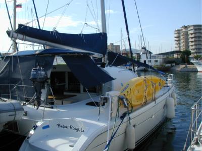
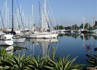
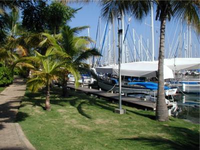
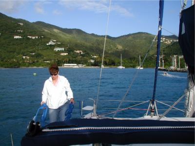
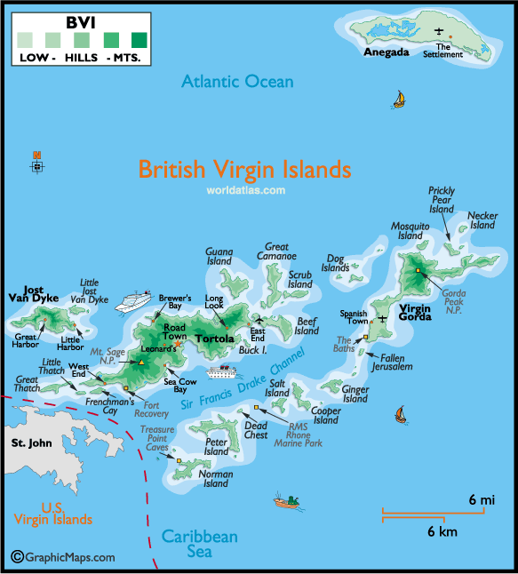
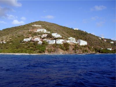
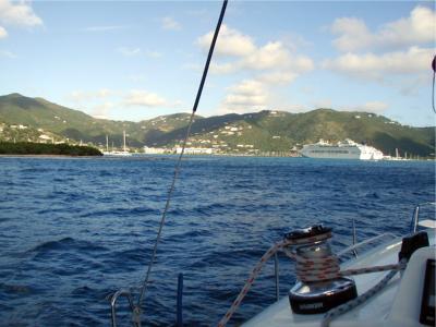
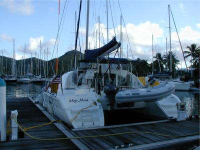
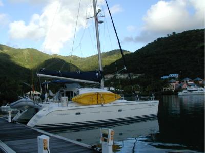
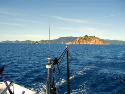
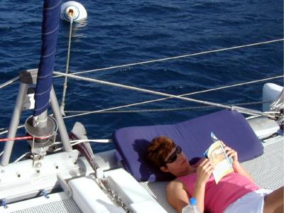
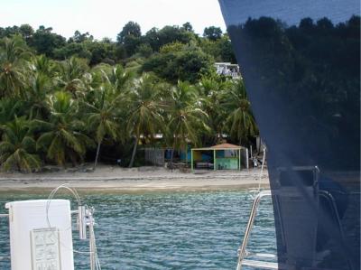
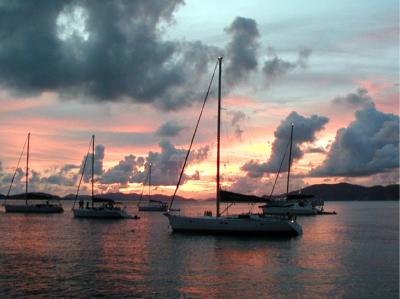
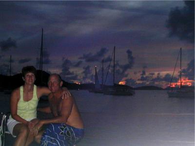
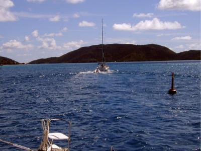
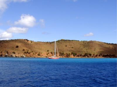
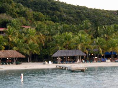
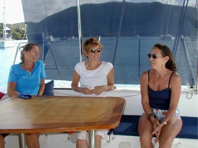
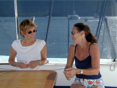
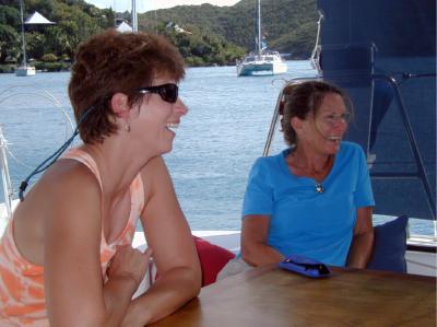
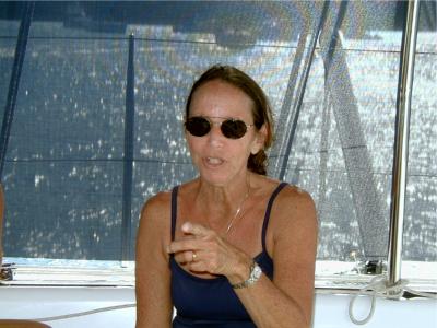
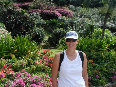
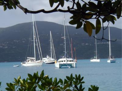
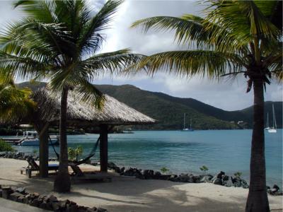
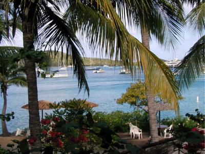

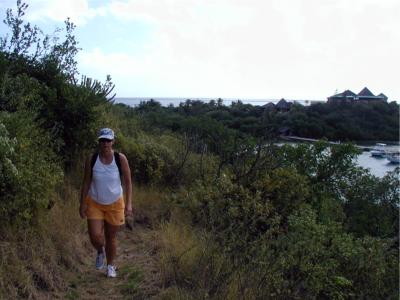
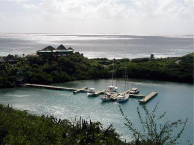
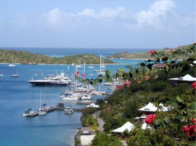
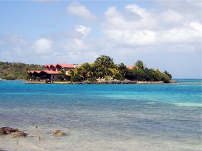
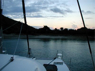
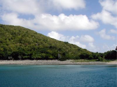
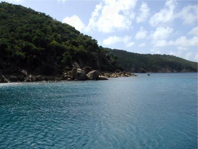
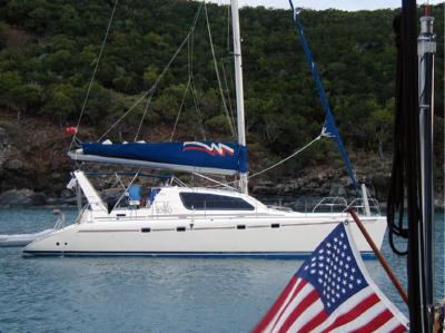
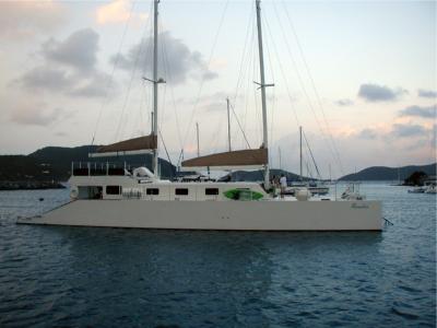
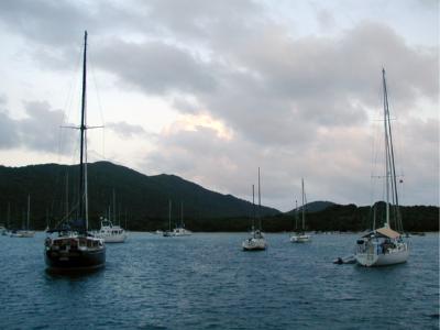
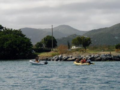
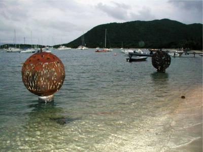
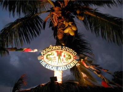
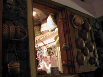
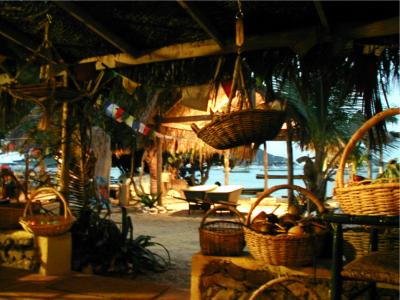
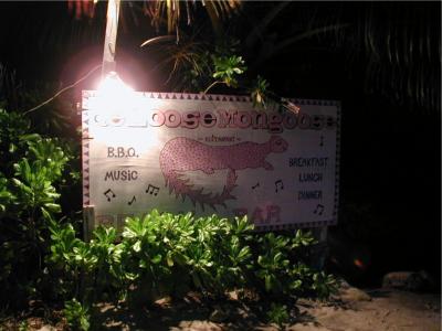
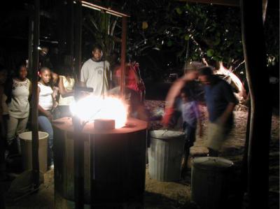
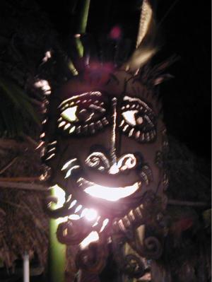
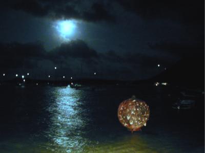
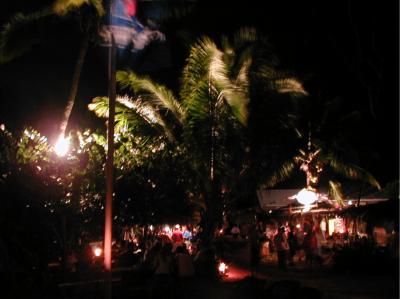
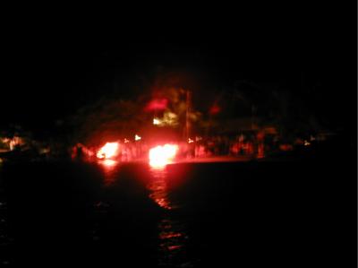
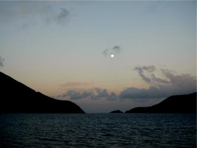
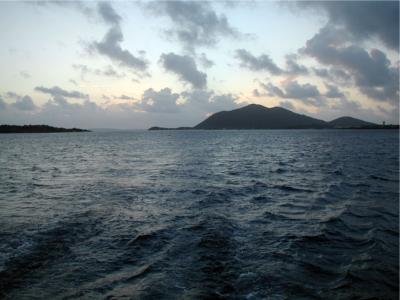
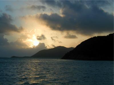
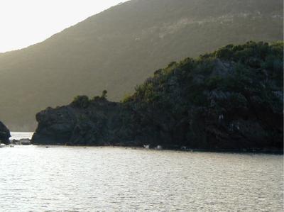
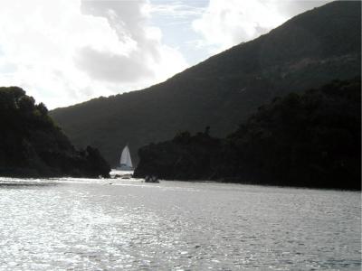
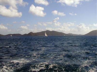
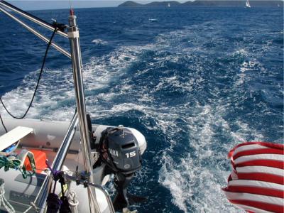
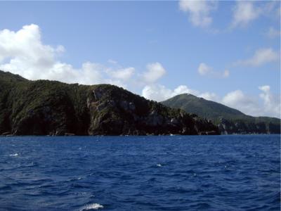
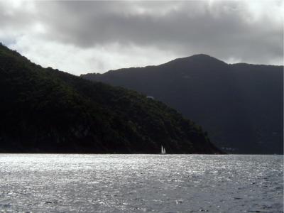
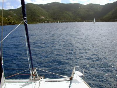
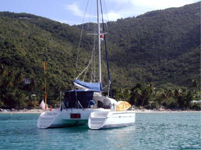
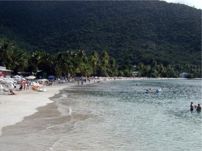
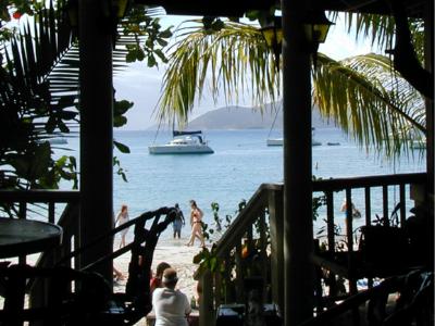
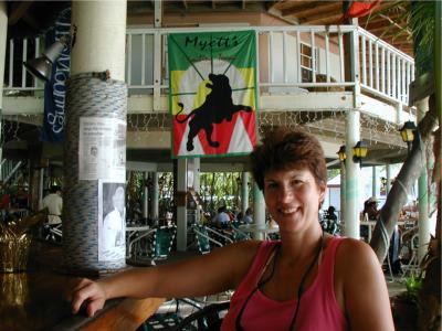
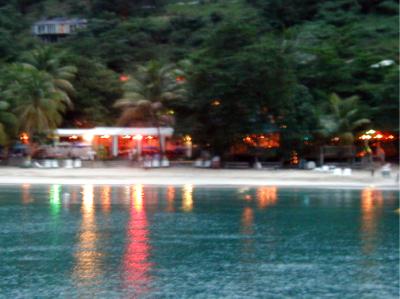
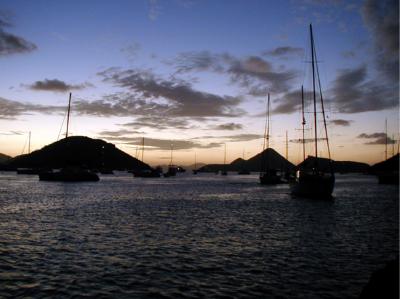
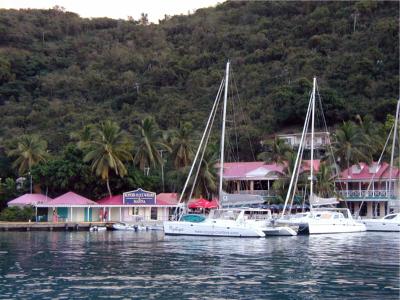
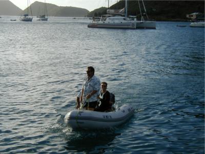
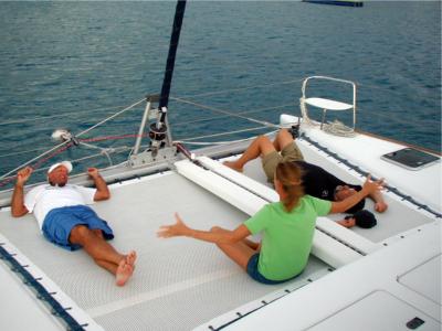
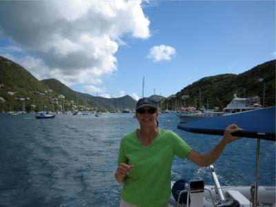
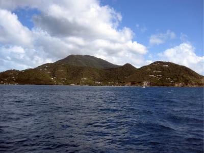
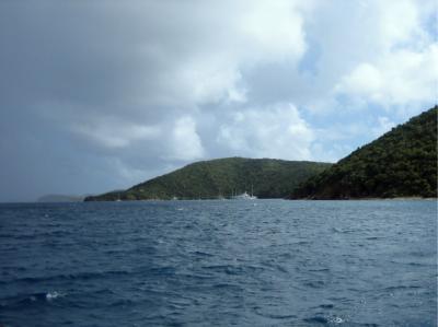
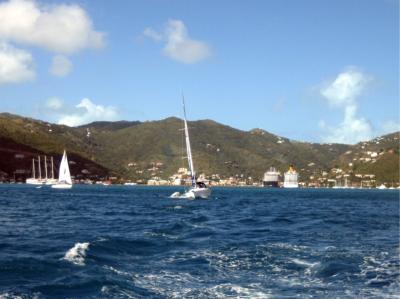
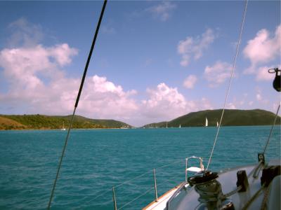
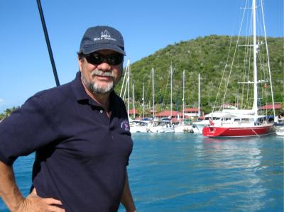
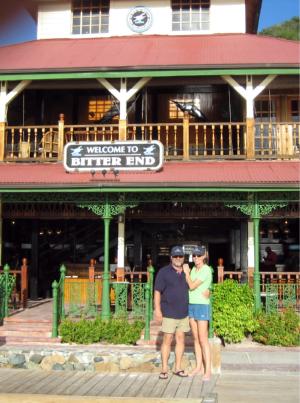
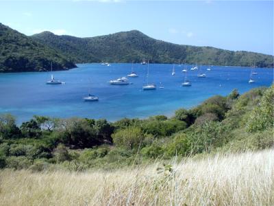
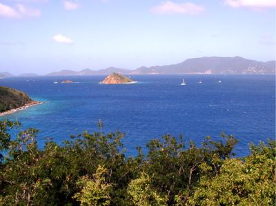
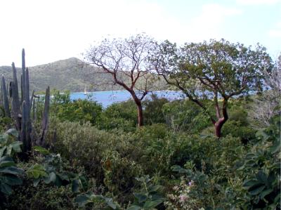
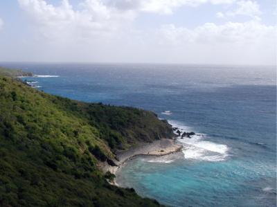
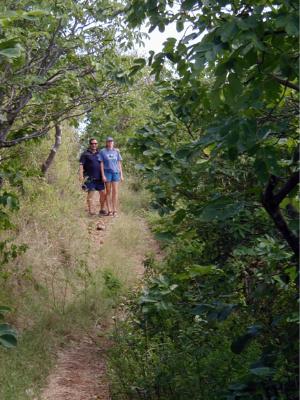
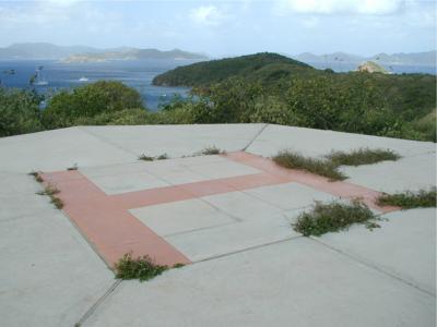
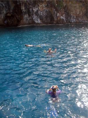
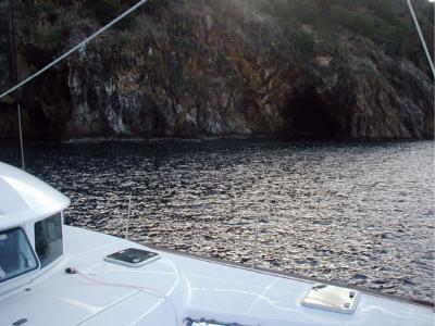
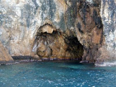
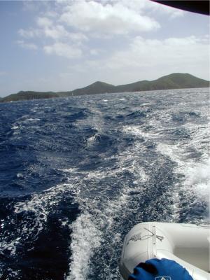
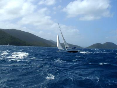
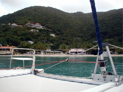
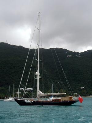
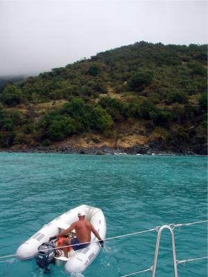
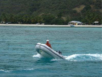
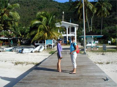
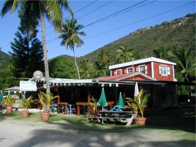
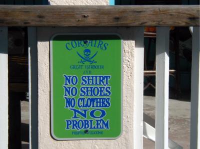
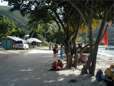
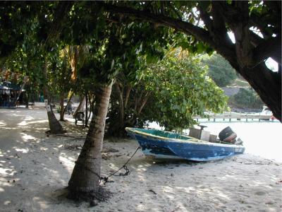
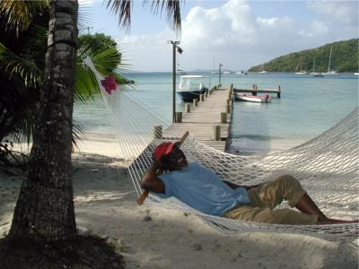
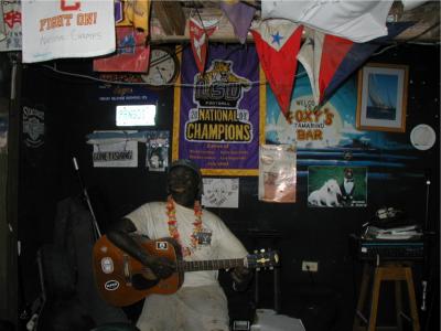
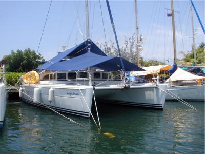
|
![]()