
| |||||||||||||

I. Introduction This report will be an amalgam of three different Belize experiences. Once again, this installment is an unusual one in that our final impressions about a destination have challenged us to go beyond a simple “we did this and we did that” trip report. As you surely have noticed over the years, a few of our trip logs include commentary about our personal thoughts and impressions regarding general issues that arise from time to time . . . issues that can shift our focus beyond a particular destination and even beyond cruising altogether. We don’t plan it that way. It happens when our experiences at any given locale spark totally unexpected emotions and impressions that powerfully catch us by surprise. The fact is that the true personality of any destination is always unexpected to some degree. And we never know when our particular experiences will be set against certain circumstances that cause us to feel strongly about and reflect upon issues that fall outside the straight-line commentary of a routine trip report. These occasional episodes of broader contemplation are as much a part of cruising as anything else is. Against that backdrop, Belize is yet another one of those destinations that generated issues we did not expect. No matter what we think we know, or how many things we read, or how many sources we study, or even when we have actually been to a destination on vacation before, we just never know how our cruising experiences there will measure up. It is one of the great mysteries of cruising. The timing of our visit, whether or not we arrive in a particularly “good” or “bad” season for whatever reason, and even our past cruising experiences in other locales all play a part in forming our ultimate impressions after cruising a certain area. Moreover, the more we cruise, the broader our range of “good” and “bad” becomes and the better our ability to recognize and appreciate genuinely superior cruising grounds. Let's face it, Sizzler’s steaks are pretty good until you visit a Morton’s of Chicago or a Ruth’s Chris. Of course, the good news is that cruising is “all steak” to some degree, but the truth is that all "tropical paradises" are not created equal in terms of cruising fun. Many places we been over the last five years have simply lived up to our very high expectations. The Virgin Islands, for example, are touted as one of the finest cruising grounds on the planet. And our first-hand experiences fully support that. We were not surprised by what we found while cruising there. It’s indeed as fabulous as we envisioned it to be. In the "surprise department", however, some surprises are “good” ones, such as the Los Roques and Aves islands off the coast of Venezuela. We were not expecting the beauty and scope of that area, not to mention the idyllic cruising experiences we enjoyed there. Of course, some surprises are “not so good.” That is where Belize comes in. In fact, plainly put, Belize far and away wins the prize for us as the one single destination to date for which we had stellar, solid expectations of a cruising paradise yet found it very disappointing from a cruising perspective in the end. (Note the emphasis on cruising). II. Setting the stage for high expectations We made a total of three separate trips to Belize: one by flying into Belize four years earlier in June of 2004 and then two trips aboard Indigo Moon in hurricane season 2008. In 2004, on our fly-in trip to Belize, we visited friends Steve and Karen Adams at their summer house on the south shores of Ambergris Cay. We went SCUBA diving in the famous Great Blue Hole and also toured part of the jungle to climb the “Altun Ha” Mayan ruins. We already owned Indigo Moon. She was docked in New Orleans and we were still six months away from setting sail. We were squarely in the middle of the transition from our land lives and careers into the excitedly anticipated, yet still personally undefined, adventure of cruising. The transition period is a very strange time indeed: liquidating a shore-side life in preparation to head out to sea. Much soul searching is done and many questions keep resurfacing as subcategories within the realm of “gee . . . what do you think cruising will really be like?” Cruising books and magazines only go so far and it does not take much common sense and intuition to quickly figure out that much of the information out there in print is often glamorized, biased, promotional, or at best a mere collection of personal opinions more so than objective facts. Take for example the “bare minimalists” who claim living on a cramped boat with no creature comforts and no auxiliary engine is spiritually liberating. Or, in contrast, the cruisers who have every conceivable creature comfort on a million dollar yacht and revel in their “escape” from civilization. The term "cruising" can mean many, many different things. By the very nature of the ultra-broad landscape of personal cruising styles and opinions, the question of “what cruising is like” is very difficult to answer, even after you do it yourself. Any one person’s experiences are related through their personal filters of bias, taste, ideology, and finances. The Indigo Moon site here is certainly no exception. Our reports are by us, about us, and convey our personal commentary and no one else’s. And so, the huge, looming, ominous, and unanswerable question for all new cruisers is not really "what cruising will be like?" Instead it is: “What will cruising really be like for them personally?” The truth is that there are no preliminary answers to be had. All one can do is get out there and personally obtain post-experience results. The only way anyone can really know what several years on a boat is like is to do it their way on their boat and see it through their eyes. Regardless, you get the point. I don’t know of one single pragmatic person out here cruising who claims that their pre-cruising armchair “daydreams” ultimately “squared” perfectly with their actual experiences (both good and bad), of living aboard. Anyway, against that backdrop, let's shift our focus back to Belize. In 2004, during our pre-cruising summer vacation visit to the Adams’ house on Ambergris Cay in Belize, one morning I joked as we all sat on the balcony overlooking the Caribbean sea, sipping coffee: “You know . . . hot damn! Just think! One day you might just see Indigo Moon anchored right here! Right here in front of your beach house! Isn’t that wild!” It was one of those pre-cruising declarations that concurrently seemed totally ridiculous yet completely possible. Many such silly/serious destination daydreams flew through our heads while preparing to go cruising. In fact, as the day to go cruising neared, it became impossible for Melissa and me to separate fact from fiction. Plans drifted around in our heads, untethered and awash on unpredictable currents of uncontained emotion and crass speculation. As the day to begin our cruising adventures neared, the only thing that became unmistakably certain was that all our “destination daydreams” and expectations were going to be tested and tempered "true" or "false" by reality, come what may. And so, in this installment we will compare our 2004 fly-in trip to Belize with our two Indigo Moon trips into Belize in 2008 and examine how in the world our expectations and the ultimate outcomes of cruising in Belize could be so astonishingly incongruent. Rather than wrangle our commentary into three independent chronologies, this trip report on Belize will be somewhat of an amalgam as to the 2008 experiences and a very “loose fit” that also provides a retrospective from our 2004 trip. All that said, before we get down to the nitty-gritty, let’s peruse the obligatory overview of the area and get a feel for Belize (derived from wikipedia). III. Overview of Belize Once known as British Honduras, Belize is home to many cultures and many languages. “Kriol” and Spanish are widely spoken as well as English. Belize’s neighbors are Mexico’s Yucatan to the north and Guatemala to the south and west. Belize’s entire eastern border is formed by coastline that fronts the Caribbean Sea.
Belize is a tiny country; with only 8,867 square miles it is roughly the size of New Jersey. With a population of only 320,000 people (2008 est.), Belize has the lowest population density in Central America and one of the lowest in the world. Culturally, Belize considers itself to be both Caribbean and Central American. It is the only country in Central America that is English-speaking and Belize is a favorite with Louisianans who often buy retirement condos and vacation homes there on the outer islands. An absolute underwater wonderland of Caribbean reef diving and great offshore fishing lies just off the coast of Belize where depths plunge to over 600 feet and beyond within a mile off the barrier reef. But, as we'll see, Belize also presents significant challenges in navigation, weather, seas and anchoring. Belize’s population is predominantly Kriol Black, comprised of descendents of African slaves who mixed with other races in the region so as to create what is known as the Kriol culture. It is a culture unique to the region when compared to the predominately Mayan, Ladino, Latino, and European white groups in neighboring Central American countries of Guatemala and Mexico. The origin of the name Belize is unclear, but one theory is that it is a derivation of the Maya word “belix” which means "muddy water" and may have been attributed to the muddy Belize River. Long before the Spanish conquest of Central America in the 1500’s A.D., the Mayan Civilization had developments in Belize dating back to 1500 B.C. and enduring until severe droughts and overpopulation unraveled the great Mayan civilization in about 800 A.D. The Maya inhabited the region starting in the second millennium B.C.; however, much of Belize's original Maya population was wiped out during the general decline of the great Maya Civilization. Three Maya groups still inhabit Belize: The Yucates (who fled Mexico to escape the Caste War of the 1840s), the Mopan (indigenous to Belize but originally forced out by the British, they eventually returned from Guatemala to evade slavery in the 19th century), and the Kekchi (who also fled from slavery in Guatemala in the 19th century). Whatever was left of Mayan Civilization in Belize, it would all begin to come to an end in the 1500’s when Spain laid claim to Belize. But, it would not end without a fight. When Spanish colonists tried to settle the inland areas of Belize in the 1500’s, Maya rebellions and attacks forced them to abandon the efforts. English and Scottish buccaneers known as “Baymen” were the first to successfully settle on the coast of Belize in 1638, using the reefs as shelters from which they could attack Spanish ships. These attacks by British Baymen were eventually quelled by Spain and the Baymen turned instead to cutting timber in Belize, harvesting “logwood” during the 1700s. The wood yielded a fixing agent for clothing dyes that was vital to the European woolen industry. The Spanish granted the British buccaneers a right to occupy (but not own) the area, and to cut logwood in exchange for an end to their piracy activities. In the early 1700s, Africans were brought to the settlement from Jamaica to work as slaves in the timber harvesting trade. As early as 1800 Africans outnumbered Europeans in Belize by four to one. Also, mahogany had replaced logwood as the main export. Thus, the British presence in Belize began under Spain’s agreement to merely allow the British to occupy it and harvest timber, not to own any property in Belize. This ambiguous and shaky foundation would eventually lead to modern day disputes. As time went on, British settlements grew and remained in place. Whether or not as squatters or landowners from a legal standpoint, Britain slowly developed and gained control of Belize. The British ultimately appointed a superintendent over the Belize area in 1786. Prior to that time, the British government did not initially recognize the settlement in Belize as a colony for fear of provoking a Spanish attack. The settlers themselves had established their own laws and forms of government nonetheless. Wealthy settlers controlled the local legislature (known as the "Public Meeting") as well as control of most of the settlement's land and timber. The Spanish, who claimed sovereignty over the whole of Central America, repeatedly tried to regain control of Belize. Spain's last effort occurred on 10 September, 1798, when the people of Belize decisively defeated a Spanish fleet at the Battle of St. George’s Cay. The anniversary of the battle is now a national holiday in Belize. With Spain’s efforts frustrated, in the early 1800s the British sought greater control over the settlers by threatening to suspend the powers of the Public Meeting unless it observed Britain’s admonitions to abolish slavery. The abolition of slavery was honored in 1838 but in reality it did little to change working conditions for slaves who stayed and became laborers in the Belize settlements. Former slaves of the colony were indispensable in the mahogany extraction process. The Public Meeting was able to retain this workforce by limiting land ownership and employment opportunities amongst those of African descent. A small number of elites controlled the settlement's lands and commerce, and former slaves had freedom but still had no choice but to continue to work in timber cutting if they were to stay in Belize. In 1836, after the emancipation of Central America from Spanish rule, Britain claimed the right to administer the region. In 1862 Great Britain formally declared it a British Crown Colony, subordinate to Jamaica, and named it British Honduras. As a Crown Colony, Belize began to attract British investors from back home. By the late 1800s, the Belize Estate and Produce Company became preeminent and eventually acquired half of the privately held land in Belize. In the unexpected category, Belize has a distinguished history of sport bicycling. Governor Monrad Metzgen of Belize organized the first ever Belize Cross Country Cycling Classic in 1928. The “British Honduras Cyclists Association” was formed and the state of the roads in Belize became an issue thereafter. More emphasis was placed on the need for more and better roads to accommodate the bicycle race and perhaps commerce too. Is there any better example of quirky British priorities and unconventional routes to progress? At any rate, the Bicycle Classic still races annually in Belize and is a national event that is very popular. Belize continued to slowly develop, but The Great Depression of the 1930’s caused a near-collapse of Belize’s economy. British demand for timber plummeted. Adding insult to injury, a fierce hurricane ripped through Belize in 1931. Demonstrations and riots took place soon after the hurricane. The year 1934 marked the beginning of an Independence Movement, all in response to anger over what was perceived as inadequate relief efforts and callous indifference by Britain in the aftermath of both the severe economic depression and the destructive natural disaster. In response, the Belize government repealed criminal penalties for workers who broke their labor contracts and granted workers the right to join unions. Economic conditions improved during World War II (1939-1945) when many Belizean men entered the armed forces or otherwise contributed labor to the war effort. Following the war, however, the colony's economy again stagnated. Britain's decision to devalue the British Honduras dollar in 1949 worsened economic conditions again. In response, a group of activists in Belize formed the People's Committee, which demanded independence, ultimately forming the People's United Party (P.U.P), and setting into motion an agenda aimed at total independence from Britain. Constitutional reforms were initiated in 1954 and a whole new Belizean Constitution was adopted in 1964. Britain ultimately granted British Honduras “self-government” in that same year of 1964 (one step short of full independence), and the head of the P.U.P. —independence reformist, George Price, became the colony's first prime minister. British Honduras was officially renamed Belize in 1973. Progress toward peaceful independence, however, was hampered by Guatemala asserting a claim of sovereignty over the whole territory of Belize. When Belize finally attained full independence from Britain on September 21, 1981, Guatemala refused to recognize the new nation. About 1,500 British troops remained to protect Belize from Guatemalan threats. Guatemala formally succumbed and recognized Belize's independence in 1992 in exchange for advantages in an extensive agreement. The following year the United Kingdom announced that it would end its military involvement in Belize. All British soldiers were withdrawn in 1994, apart from a small contingent of troops who remained to train Belizean troops. It was not over yet, though. In 1993, Belize’s newly elected Prime Minister suspended the agreement that was previously reached with Guatemala, claiming it was too onerous. So, the border dispute between the two countries again reared its ugly head. Border tensions continued into the early 2000s, although the two countries cooperated in other areas. Belize now has both the P.U.P. and the U.D.P. political parties, and power has gone back and forth. In 2005 there was civil unrest caused by discontent with the P.U.P.-run government, including tax increases in the national budget. On February 8, 2008, Dean Barrow of the U.D.P. was sworn in as Belize's first Black Prime Minister. (Side note: while we were visiting Guatemala in 2008, it was customary to see Guatemalan maps and major attractions like the large-scale geographical relief model of Guatemala in Guatemala City include all of Belize as part of Guatemala. Belize is considered by Guatemala as its 23rd department . . . a state of Guatemala if you will . . . and most Guatemalans I spoke to don’t mince words. They consider the Kriols to be squatters at best and thieves at worst; illegal landholders who should be run off. Considering the strength of the sentiment, I was always afraid to ask precisely why Guatemalans think they have a right to land that was clearly settled and worked by someone else for centuries.) As of March 2007, the border dispute with Guatemala remained unresolved and still quite contentious. At various times the issue has required mediation by the United Kingdom, Caribbean Community heads of Government, the Organization of American States, Mexico, and the United States. A British garrison was dispatched to Belize at the request of the Belizean government. Notably, despite these disputes, both Guatemala and Belize are participating in the confidence-building measures approved by the OAS, including the Guatemala-Belize Language Exchange Project. Belize has a tropical climate with up to 180 inches of annual rain in the south and as little as 50 inches in the north. The dry season lasts February to April. This is very important to cruisers. The months of March, April and May are the “dry” months of settled weather when trade winds are less fierce, squalls and frontal systems less likely and the reefs and outer atolls most accessible and enjoyable. There is very little protection for mariners out amongst the reefs of Belize and its waters are located on a windward coast. Most all of the hundreds of tiny, low lying cayes (islands, pronounced “keys”) of Belize’s great reef provide virtually no wind protection. Even more challenging, many “recommended anchorages” are behind cayes that are so small they offer only partial wave protection as well. Making conditions more taxing still, the majority of the anchorages we visited were deep, had rubble, muck/mud, or grass bottoms, and offered poor holding all while being in very close proximity to shallow reefs that would be disastrous to drag upon. Such anchoring conditions always add to a mariner’s concerns about unsettled weather. And of course, Belize is surely at risk for hurricanes from June through November, with chances rising statistically toward the latter part of the season. The western Caribbean is notorious for the very quick formation of tropical storms late in the hurricane season. All things considered, Belize is known for having a glorious but frustratingly short prime cruising season from March to May. Cold fronts can plague the region in winter months and winds up to 50 knots are not uncommon in the passing of such fronts. Summer thunderstorms of epic proportion pack a tremendous punch of brief but gale force winds and very powerful lightning. Basically, Belize is a very hostile environment weather-wise for significant portions of the year. Here is a list of hurricanes that have made landfall in Belize; 1931: an unnamed hurricane destroyed over two-thirds of the buildings in Belize City and killed more than 1,000 people. 1955: Hurricane Janet leveled the northern town of Corozal. 1961: Hurricane Hattie struck the central coastal with 190 mph winds and a 13 foot storm surge. 1978: Hurricane Greta caused more than $25 million in damages along the southern coast. 2001: Hurricane Iris made landfall at Big Creek and Monkey River Town as a 145 mph Category Four storm with gusts to 180 mph. The storm demolished most of the homes in the area and destroyed the banana crop. Also, the deadliest SCUBA diving accident in history occurred when a very large dive boat broke loose from a dock in Big Creek during the height of the storm and capsized in only 12 feet of water. Seventeen vacationing divers and three crew members perished (more on that later). Overall, the price tag of hurricane damage in Belize has been minimal over the years only due to the fact that Belize is simply not very developed. In fact, sixty percent of Belize is thick jungle/forest, some of it mountainous. Of the remaining forty percent of Belize, much of that is scrubland and coastal marsh. Only twenty percent of Belize is subject to (and perhaps even fit for) human uses such as settlements and agricultural in the form of banana farming and agriculture. Despite its small footprint, agriculture is an important and consistent sector of the Belize economy nonetheless. Sugar is the top money crop. Rice and bananas are produced too, with the banana industry providing the most jobs. The popular banana producer in Belize is the brand name “Fiffy”” because their bananas are alleged to be fifty (“fiffy”) times better than everyone else’s in the “Banana Republics” of Central America. Tourism and construction have recently gained importance with the development of resort and vacation housing and tourist services on the larger out islands of Ambergris Caye, Caulker Caye, and Chapel Caye. Oil producers have done some exploration in Belize and they are certain there are at least some oil deposits in Belize, but it has not become an oil rich country nor been targeted for major production as of yet. In 2006, oil was struck in the town of Spanish Lookout, and the first-ever producing oil well there presents a host of new prospects and problems for Belize. It remains to be seen if oil will become a factor in the Belize economy and how oil riches might color any potential claims to Belize by Guatemala. As far as tourism is concerned, Belize has much to offer: the barrier reef, river rafting and kayaking, jungle and wildlife reserves, Mayan ruins, and the largest cave system in Central America. In 2007, tourist arrivals totaled 251,655 (over 210,000 from the U.S.A.) and tourist receipts were estimated to be just over $183 million. Popular attractions in Belize: Reefs of Belize: The barrier reef runs a full 240 miles just off the coast of Belize. There over five hundred square miles of patch reefs, coral heads, protected waters and shallow water habitat areas including extensive marshland in the mainland’s coast. Three of the only four coral atolls in the Western Hemisphere are located off the coast of Belize, one of which includes the Great Blue Hole. The Blue Hole is a huge underwater sinkhole off of the coast of Belize at the Lighthouse Reef atoll. It is about 60 miles from the mainland. The hole is almost a perfect circle that is 1,000 feet in diameter and about 500 feet deep. The formation came to be when the ceiling of a huge underwater limestone cave collapsed. The cave was not always underwater as can be gleaned from the stalactites that still appear on perimeter portions of cave’s ceiling that did not collapse (you have to dive to 135 to 140 feet and in the company of sharks to see the stalactites). The cave formed during lower sea levels in the last ice age. The Great Blue Hole was made famous by Jacques-Yves Cousteau who took his research ship, the Calypso, there. It was before the days of strict reef preservation and Cousteau dynamited a channel that was necessary to navigate the Calypso into the formation.
It was back then in 1971 that Cousteau used his small submarines to explore the Great Blue Hole, detect the stalactites, and unravel the mystery of how such a brilliant and perfectly round cobalt-blue jewel came to be in Belize’s Lighthouse Reef. And divers still flock to experience what Cousteau described as one of the most interesting dives in the world. Mayan Ruins of Belize: There are about a dozen Mayan sites scattered around Belize. We visited "Altun Ha", ruins that are located about 30 miles north of Belize City and 6 miles inland from the Caribbean. "Altun Ha" is a modern name given the site by translating the name of the nearby village of Rockstone Pond into Maya. The real name is unknown. The largest of Altun Ha's temple-pyramids, the "Temple of the Masonry Altars", is 54 feet (16 m) high. An image of the temple is the logo of Belize's favorite beer: Belikin. Altun Ha covers 5 miles and the central one-square mile of the site has remains of some 500 structures. Archeological investigations show that Altun Ha was founded in about 200 B.C. and was developed between 200 to 900 A.D. It had a population of about 10,000 people. The site did not come to the attention of archeologists until 1963, when it was discovered from the air by pilot and amateur Mayan historian Hal Ball. Starting in 1965 an archeological team led by Dr. David Pendergast of the Royal Ontatio Museum began extensive excavations and restorations of the site, which continued through 1970. The most precious modern find at the site was an astounding ten pound jade carving of the Mayan Sun God Kinich Ahau. This piece is considered one of the national treasures of Belize and is said to be the single largest Mayan jade carving ever found anywhere in the world. The Mayan ruins and the reefs of Belize combine to make it a very popular destination. Lagniappe: Other fast facts: Belize’s national flower is the Black Orchid, the national bird is the Keel Billed Toucan, and the national tree is the Mahogany. Belize's national animal is the Baird's Tapir, the largest land mammal of the American tropics, also known as the “mountain cow” (although it is actually related to the horse and the rhinoceros). Alright, that’s a good start on understanding a little bit about Belize. Let’s get to the trip reports! IV. Departing the Rio Dulce and entering Belize at Punta Gorda Our first trip aboard Indigo Moon into Belizean waters was in July of 2008. It was supposed to be a SCUBA diving adventure and amazing tour of the beautiful reefs of Belize, all while relaxing in protected waters behind a huge barrier reef. We had only been on the Rio Dulce for a couple of weeks to wait-out tropical storm Alma. Once the coast was clear weather-wise, we departed Mario’s Marina on the Rio Dulce early in the morning and headed out, planning to spend quite a while in Belize before finally heading back into the Rio Dulce for the storm season. To depart the Rio and check out of Guatemala we had to anchor out at Livingston at the mouth of the river and go in to see Raul the yacht agent and have him take our passports to Immigrations, etc. After an hour with Raul, it was midday. We made haste to make it to Punta Gorda on Belize’s southern coast (see map above) to check in at the Customs and Immigrations Offices and then try to make it seven more miles or so to a protected anchorage by sunset. It would prove to be an arduous undertaking. For one thing, Punta Gorda does not have a harbor at all. Its “anchorage” is an open shoreline with a big, ragged, weathered concrete dock. Located in a completely open roadstead, and open to the trade winds, it is not anything you can really describe as a harbor. Upon our arrival there, between three and four o’clock in the afternoon, the seas were not awful from a sailing standpoint, but it would be very challenging to anchor and drop the dinghy in the three to four foot open seas. In the excitement of dealing with anchoring in the sea conditions at Punta Gorda, and with daylight burning, for the first time ever I did not take the time to go forward and raise our yellow quarantine flag (Q-flag). In all of our experiences in dozens of countries, no one ever seemed to care anyway, except in Venezuela where they did NOT want the Q flag flown and required instead that the Venezuelan courtesy flag be flown at all times. The seas were so rough I left Melissa on board for “anchor watch” and to protect The Moon. As I looked back at Indigo Moon at anchor, she was riding the seas and her bows were coming all the way out of the water, halfway to the keels! It was some of the roughest anchoring we had ever done. Once at the city dock, and seeing the jagged face of the solid concrete wall, I set out a stern anchor to keep the dinghy off the dock and seriously questioned whether or not we would come through the episode unscathed. There is one aspect of Punta Gorda that is very convenient, nonetheless, and that is the fact that both the Customs and Immigrations Offices are located directly on shore at the foot of the dock. I nervously walked up the dock at a fast pace, wanting to minimize both Indigo Moon’s and the dinghy’s exposure to the harsh conditions. My hopes for an expedited experience were quickly shattered. The scene was all too familiar: official business in Belize is done in the exact same fashion and attitude as is customary in the British Virgin Islands. The Immigrations lady was gone, off on an alleged errand to buy a birthday gift. The Customs lady could not process anything until the Immigrations process was complete. So I would have to wait. But, in the meantime, the Agriculture Officer was there and offered to process papers having to do with his authority. He asked: “Is this your first time in Belize?” to which I replied, “Yes sir.” He then informed me that, considering I did not fly a yellow Q-flag, I was going to be fined Five Hundred U.S. Dollars! We could both see Indigo Moon bouncing up and down out there, with no Q-flag. I was having those same thoughts that all persons have who have been perfect drivers but ran their first stop sign ever and got caught. There was no use being mad. I knew I was supposed to fly a Q-flag and it was my fault. I kept my cool and simply said: “I am very sorry. It is my fault and I should have raised the flag. The seas are so rough, was worried about the anchor holding and managing the dinghy in the rough seas. I simply got too busy forgot the flag and that is not a good excuse.” The agent gave me a long, penetrating look, turned and looked out at Indigo Moon bouncing around, and then spoke with a musical “Kriol” accent: “I goin’ to give you de warnin’ . . . tis you furss time. Now on . . . betta fly de flag.” Okay, so that’s a bit better than the B.V.I. where they would waive a fine the day Hell freezes over. So, I did get a break and was thankful for that. Ten bucks later, the normal agricultural fee was paid and I was done with the Agriculture Department, narrowly missing a huge fine. I then waited for the Immigrations Officer. Forty-five minutes passed. My thoughts harkened back to the British Virgin Islands where we waited over an hour for an Immigrations Officer who, during business hours, had unapologetically gone to get her fingernails painted. Yes, this was a familiar dance indeed. I knew all too well what to do: force myself to let go and relax. Melissa and Indigo Moon would simply have to hang on for dear life, and Melissa is a strong swimmer. I surrendered, let go of the anxiety and instead began to nose around the offices and study the posters, bulletin boards, and do some eavesdropping on the locals’ conversations so as to get a feel for the place. Belizeans love big posters of full-bodied bikini-clad dark-skinned Kriol Belizean women thigh deep in the turquoise waters. Many such posters tout the locally brewed “Belikin” beer and such posters even hang inside the official offices. Let’s just say they like their bathing beauties with “junk in the trunk.” In the meantime, while I grinned to myself about all that, a boat load of backpackers arrived, brought in via a water taxi from the Rio Dulce. They needed to catch a bus leaving in fifteen minutes and they became frantic when they discovered the Immigrations lady was gone with no E.T.A. About ten minutes later, the Immigrations lady finally strolled in: a young, very curvy woman with skin the color of dark chocolate. She looked as if she just stepped out of a slick MTV video: fancy nails, hair braids, and totally “styling out.” She made no apologies for her absence and simply walked stone-faced to her desk and in a fluid motion she began processing one of the backpackers’ passports as if she had been behind her desk all along. One backpacker sheepishly looked at me and said “you were here first, do you want to go before us.” I looked at the Immigrations Officer. She kept her head down, busily stamping one of the backpacker’s passports. I said “Thank you, but that is up to the Officer. This is her office. She will tell me when to come forward.” The Officer did not look up, but my comments forced her to break a smile. Once all the backpackers were processed, the Officer completed my two passports and I paid the fees. Then it was ten paces across a common waiting area to the Customs Office where the door was open but now no one could be found there either. I waited ten minutes. There were more beer posters to be studied. I finally walked out the front of the building to the street and there was a crowd watching some disturbance a block away. I recognized the Customs Officer and politely informed her I was through with Immigrations. She explained that “a man is fighting with the police.” So, we all watched a little while longer. Nothing else seemed to be happening, so I apparently missed the excitement and she was then ready to come back inside. Once back in the Customs Office, the Officer took my all completed and stamped forms and my fees and disappeared into a back room. Ten minutes passed. Ten more minutes passed. I could hear her: she was obviously fighting with a recalcitrant printer. I finally called out: “Excuse me Officer, is there a problem?” “Printa no workin’; no receipt.” “Do I need a receipt to be legal?” “No.” “Then please do not worry about it; I’ll just take my papers please . . . I need to go if it is okay. It’s getting late.” So, finally, an hour and a half later, I made it back to the dock where the handle on the front of the dinghy got a good thrashing from the concrete wall. When the backpackers came in, someone moved my dinghy and did not reset the stern anchor. By the time I got back to Indigo Moon, Melissa was very concerned that I had been gone so long . . . “What happened???!” I laughed and simply said “Welcome to the B.V.I.” (British Virgin Islands). Nothing further needed to be said. As one cruising friend put it "in the B.V.I. they send them all to ‘rude school.’” Belize is well-known for the authorities and a goodly number of the people being unfriendly and gruff as a whole, just like the B.V.I. Anyway, we pulled anchor, thankfully with no harm done to Indigo Moon and no fines incurred. We were on our way but pressed for daylight. We would be in trouble if we did not reach the small anchorage before dark. You cannot risk navigating Belizean reefs at night. Luckily, we arrived in the “nick of time” but the anchorage was deep, almost 30 feet, and very tight considering the amount of scope (length of anchor chain/rope) that would be needed in such deep depths. Very shallow reefs and bottoms surrounded the area, making it a “no drag” zone and successful anchor-setting mandatory. With fins, mask and snorkel I tried to dive the anchor and check it in the waning twilight. The water was too murky to see the anchor from the surface and dive straight down on it, so I had to try and pull myself down the rode thirty feet down to the bottom and then along the 120 more feet of rope and chain to reach the anchor. I tried six times before running out of daylight. I never could hold my breath long enough to make it all the way to the anchor. As such, we had to anchor “blind” in a tight spot. All things considered, our first day in Belize was anything but relaxing. Overnight, the winds died down and thankfully our first night at anchor was a calm one. We were in “go mode” and weighed anchor at the crack of dawn, determined to make full days underway on a mission to move north. V. Punta Gorda to Garbutt Cay It was thankfully calmer when we began Day Two of our Belize adventure.
One thing on the agenda during this first Indigo Moon run into Belize was to try and make it all the way north to the premier resort island of Ambergris Cay and the town of San Pedro in order to see our friends Steve and Karen Adams. Steve is a Baton Rouge attorney whom I have known for years and he and Karen would be on vacation at their summer house on south Ambergris Cay. But it would take another two days to get that far north. We enjoyed very calm seas and light winds, sometimes just motoring and sometimes using the jib too in order to augment the engines. As always, it was fabulous to be underway again in open water and enjoy the solitude and serenity that comes from being miles away from land and miles away from other people.
Belize is a treacherous navigational environment by nature with hundreds of square miles of reefs and cays and shallow hidden hazards. It is one of those places where a small, unmarked four-foot-depth rock/reef hazard may be located within an area that is huge and navigable all around it. By the naked eye, Belize’s coastal waters look wide open spaces that are speckled with a sparse sprinkling of tiny cays. Your eye tells you that you should be able to sail without a care in the huge expanses of open waters between all the keys. Unroll a chart, however, and a spectacularly complex underwater topography is revealed. Some areas are impossible labyrinths that are not even charted at all and will test any mariner’s eyeball navigation skills. Other areas are vast expanses of deep "safe" water. The sea surface provides little or no warning and it can be quick disaster for those who sail in a carefree fashion. Charter companies limit sailing to certain areas only. Adding to the Belize challenge, the quality of navigational charts and cruising guides (ours had home-made hand-sketched charts instead of excerpts from actual charts) have much less detail than the polished products available for the Bahamas and the Eastern Caribbean. We even found some of the navigation information to be unreliable. Also, the electronic cartography on the GPS “C-Map” charts is virtually useless in many areas of Belize. For example, there is a well known and highly traveled cut through the outer reef at San Pedro on Ambergris Cay. But the GPS cartography has no detail about it at all. Ambergris Cay appears as a vague yellow blob with no bottom details for the waters surrounding it. What all this means is that Belize requires a serious shift toward seat-of-the-pants eyeball navigation and good light.
By the end of day two, we made it to Garbutt Caye, where another suggested anchorage was located per the guidebook and local knowledge. Again, we were very disappointed. In shallow areas, rubble and dead coral prevented setting the anchor. The only place to set the anchor was in one small, deep area where the bottom was soft and offered poor holding, all in close proximity to nearby islands and shallows This would become much the norm in Belize. We were not anchored very long before a local came by. It was Harry, the self-proclaimed Mayor of the Garbutt Cays. He has no constituents, however, other than his dog named “Lion.” A truly weathered and rugged soul, Harry lives out in the Garbutt Cayes, out there in the middle of nowhere. He was very friendly and offered lobster tails for sale, all while assuring me that I was anchored in the only place possible. I didn’t really notice it instantly, but it dawned on me that it was very refreshing to be in waters where a local came along side and spoke English. After a couple of years in South and Central America, I kept spitting out spurts of bad Spanish and getting back Kriol English. And I was studying Harry. His boat was an old fiberglass runabout that was literally falling apart. His outboard (too small for the boat) was broken. It was stuck in forward gear (he had to time his landing at The Moon by killing the engine and “coasting” in). Harry’s hair, a mop of dreadlocks and tangles, was burnt orange-brown on the top from the tropical sun and it bristled out in graduated shades of color, looking much like what you would expect if a dark-haired doll had washed up on the beach and baked in the tropical sun for a few years. A very interesting mixture of African, Indian and European ancestry could be seen in Harry’s features. Quite the ambassador of the Garbutt Cays, Harry invited us to stay longer. He said he would be happy to come aboard and sail with us to show us ways through tricky reefs and access special places only he knows about. He also complained that Tropical Storm Alma had ruined the visibility in the water and he was having trouble finding lobster. We told him we appreciated his offer, but were on a schedule to try and meet some friends on Ambergris Caye. By the time we were through visiting with Harry, I was left with an appreciation of just how extremely harsh and desolate it is out in the low-lying tiny cays of Belize, even more so than the harshest areas of the Bahamas. Below the surface of the waters of Belize, there are wondrous reefs and sea creatures, but on the surface there is nothing at all, nothing but an almost featureless horizon and total exposure to the extreme elements of the tropics. Basically, Harry’s appearance was that of someone who might just as well be living in the middle of the desert. Before saying goodbye to Harry we bought twenty dollars worth of lobster tails from him. Thereafter, we cooked our usual lobster and pasta dinner as the sun was getting low in the sky. Just at sunset, two boatloads of fishermen in open, outboard powered boats beached nearby on a tiny island and set up to sleep in the open, all while “no see ums” and biting bugs were swarming so badly that we closed up the boat and ran the generator and air conditioning for a couple of hours. I don’t know how in the world the fishermen withstood the insects. They must have had very good repellent, thick skins, or simply suffered. By the next morning, the weather Gods were still cooperating and the winds were light that night so as to allow us to survive the tight and tenuous anchorage without mishap. VI. Garbutt Cay to Cay Caulker When I awoke at first light, the fishermen were long gone. We never heard a sound when they departed.
We set out from Garbutt Cay for another very calm day of motoring and motor-sailing and made it all the way past Belize City, St. George’s Cay, Chapel Cay and to Caulker Cay, situated just seven miles south of Ambergris Cay. Indigo Moon makes a great little motor trawler on extremely calm days like this. For this leg of the trip, we began the day in a huge, wide channel to the south of Belize City that runs inside the reef system. In this area the autopilot could be set without any worries. With no traffic at all, I polished stainless, did little tinkering jobs on deck, and enjoyed the day while keeping a casual lookout.
While underway, we were also taking advantage of the very calm weather conditions to deviate out of the channel now and then to spot reefs, investigate possible storm anchorages, and establish our own reliable waypoints for cuts, channels, and routes. Much like a bread trail, we were carefully creating our own “safe route” to find protection or run back to the Rio Dulce in the event that a tropical storm or hurricane presented. But, I began to quickly realize that night travel would be risky and that perhaps you could not safely run at night inside the reef. The rivers from Guatemala and Belize dump huge logs and lots of trash into the sea, all while the trade winds and currents send all the flotsam and jetsam in the upper Caribbean westward to the area as well. It all mingles and stacks up in the waters of Belize.
The larger expanses of deep-channel inner reef areas below Belize City give way to comparatively very shallow areas and narrow cuts between groups of cayes as you head north of Belize City. It is there that we began to encounter large, shallow bays. Many times, depths were only six feet for miles and miles. It was a blessing that we had such calm, sunny weather and could ply all these waters for the first time in perfect eyeball-navigation conditions. It made for a much safer indoctrination.
By nightfall, we were anchored nicely at Cay Caulker, even picking up a wifi internet signal at anchor. The next morning, we went in and explored the island and bought a phone card so that we could use a pay phone to call Steve and Karen. Belize’s phone system and cable company blocks the internet use of SKYPE, so we could not make calls on our computer over the internet. Also, the TIGO cell phone we had just bought in Guatemala did not work in Belize either. Belize is very proprietary in its services and all things are very expensive! In Guatemala, a new cell phone was twenty dollars. A new cell phone in Belize was two to three hundred dollars! So, we opted to buy a pay-phone time-card to use at pay phones on the streets. We were able to get in touch with Steve Adams that way and they were in at their beach house and would be expecting us. VII. Cay Caulker to San Pedro Cay Caulker, and its much larger sister Ambergris Cay, are the only offshore islands that are publicly developed in Belize that I know of. There are lots of very small private developments and private islands and private beaches, all festooned with “no trespassing” and “private beach” signs. Cay Chapel, just south of Caulker is a private development. As for public tourist islands, Caulker and Ambergris are about it. Cay Caulker has now become the “last stand” of a sleepy paradise in Belize. It remains a tiny laid-back tourist town with dirt streets. The town of San Pedro on neighboring Ambergris Cay was once revered as the pure essence of the “sleepy seaside Caribbean village” but now San Pedro is a traffic snarl of golf carts, cars, and delivery trucks all racing to serve the ever growing population. In fact, a keen eye is now required by pedestrians in downtown San Pedro to keep from getting hit by fast moving traffic: more on San Pedro later. During our stay in Belize, locals were buzzing about movie star Leonardo DiCaprio allegedly buying a whole Cay to develop. When Hollywood discovers paradise and moves in, it is usually the beginning of the Hard Rock stages of tourism. But as for Cay Caulker, the traffic is mostly foot, bike, and slow golf cart, and it still feels very remote indeed. There is a tiny airstrip on Cay Caulker and the water taxis run from Belize City and Ambergris Cay, but it still retains its character of being disconnected from the hustle and bustle of the Mad World. Lets look around:
Belizeans love to misspell words on signs and use Kriol misspellings of English, all as if the same guys who name rap bands are also in charge of all graphic design in Belize. Much of Caye Caulker’s appeal comes from funky clues that reveal the presence of island society eccentricities. For example, what small community would be complete without a crazy cat person? On the main street along the windward shore, there is a large, walled lot that hosts about fifty cats, several independent junk piles, and a small shack of a local’s home. Cats are draped over everything. Piles of cinder blocks and other scrap areas have become “cat temples” within the Land of Cat. On the tops of the solid concrete fence, guard cats walk the perimeter, or else just crouch and watch the world go by. Every now and then, a wild skirmish breaks out somewhere, sometimes out in the open, and sometimes under a scrap pile where muffled thumps and muted caterwauling indicates that an intruder has made it deep into the temple’s cat-a-combs. These spats are over as fast as they flare up. I approached one cat on the fence. When I got close, it was obvious that the one-eyed, notch-eared tomcat was not a character that one could try and pet without a proper introduction, or at least references. There are two signs nailed to a tree. One sign says: “Private Property . . . Keep Out . . . No Unauthorized Person In Yard . . . Thank” The other sign says: “No Obscene Language In Yard . . . Keep Yard Clean.” Looking at the crazy scene, you immediately come to the conclusion that the second sign must be addressing the cats!
Just when I thought the “No Obscene Language” sign was a little peculiar, a block later a group of local guys, some of whom appeared to have quite a serious buzz on, were having the most repulsive vulgar discussion imaginable.
On the west side of the island where we were anchored, things were hopping in the Lobster business. Lobster Season had just opened up and scores of shallow draft sailing vessels came in to unload their catches at the small processing plant. These boats carry, or tow, a half dozen or so small canoes and a crew of just as many men. They use the small canoes to individually work the hundreds of square miles of reefs and coral heads, free diving and harvesting the Caribbean Spiney Lobster. Some of these guys dive to depths of 60 feet without SCUBA tanks.
And while Caye Caulker is tiny and somewhat remote, modern day ills are an issue. Signs inform tourists that illicit drugs are VERY illegal in Belize. Apparently, there were rumors in the past that small amounts of drugs were ignored, or that drug use on the beach is acceptable . . . all misinformation. Drugs, of any quantity are illegal in Belize and penalties are often harsher than in the U.S.A. Also, signs remind tourists and locals alike that AIDS is an issue, even on tiny Caye Caulker. There is also a Police Station on Cay Caulker.
A walk to the north end of the island takes you to a truly infamous landmark. Situated on the very northern tip of Cay Caulker, on the windward shore and at the cut that allows fast moving tidal currents to reach the bay, The Lazy Lizard water front bar is an old Cay Caulker watering hole. Its slogan is “A Sunny Place For Shady People.” Complete with crumbling seawall for sunbathing, shallow water swimming hole, picnic tables in the water, and rickety diving board, it is "one of a kind." Add in the old, colorful and super-funky “Heritage Cruz 2” Rasta cabin cruiser tied along side and the Lazy Lizard looks like a rustic movie set designed for a Caribbean Rastafarian movie scene. Captain Ron II, maybe?
Cay Caulker is my favorite anchoring place inside Belize’s barrier reef. The prevailing easterly trades make the west side of the island a good shelter, even though you are totally exposed to the west. There is a patch of sand bottom in five to six feet of water that catamarans and shallow-draft monohulls can use. The rest of the anchorage has blade grass and sand and is ten to fifteen feet deep. The best news: if you drag toward the west, there are miles of open water and a flat sand and grass bottom with depths of about fifteen feet. Basically, if you have a decent anchor and 100 feet of chain out, you may drag anchor and wind up anchored somewhere different after a storm, but one thing is for sure, you won’t hit anything or run aground for miles and miles. We weathered some severe storms in the anchorage in Cay Caulker and did not drag. For one thing, it is shallow close in to shore and you can easily dive the anchor and make sure it is buried perfectly. One calm day we took Indigo Moon around to the outside of the island and anchored inside the main reef to snorkel and lobster hunt. That meant picking our way through coral heads and finding a patch of sand big enough to anchor in without dragging onto the reefs.
That is a pretty good introductory look at Cay Caulker. There is not much there, to be honest. There are a few decent small hotels and a half dozen or so decent restaurants and that’s about it. As such, it may be exactly what you are looking for. At this juncture, let’s shift gears and digress so as to highlight the experiences we had in Belize long before we ever untied Indigo Moon. VIII. Our Belize experiences in 2004 Belize first appeared on my "mental radar" back in the late seventies and early eighties. New Orleans native, Colin Clark, was then-owner of Sailboats South, a sailboat dealership where I bought my first sailboat: a Hobie 16 Catamaran. I became fast friends with Colin and many others in the New Orleans sailing crowd. In the summer of 1982, I worked briefly for Colin, running the shop while he and a friend sailed a thirty-six foot Ericson sailboat from New Orleans straight across the Gulf of Mexico to the Mexican Yucatan and then on to Belize. I just about died from jealousy at the time! Colin came back with stories of adventure in the form of thirty foot waves for days while making the Gulf of Mexico crossing. As for San Pedro and Ambergris Cay in Belize, he described it as a perfect Caribbean paradise where lobster tails were as big as eggplants, it was a cheap shangri la, and there was golden opportunity for developing a charter business. The stories took on mythical proportions. I lost touch with Colin after several years, but during the time I knew him well, he doggedly pursued attempts to start up some type of sailing enterprise in Belize, always reporting that he was “cultivating” locals and trying to get final approval from the government. In the late eighties, friends like billfishing experts Bobby and Linda Carbo from Slidell, Louisiana, kept my dreams of Belize kindled . . . their reports confirmed the laid-back allure of San Pedro on Ambergris Cay, and they regaled us with amazing tales of fabulous fishing in the Caribbean wonderland of Belize's blue water. Then, in the 1990’s I met fellow Baton Rouge Attorney, Steve Adams. He and his wife, Karen, built a beachfront summer home on south Ambergris Cay. They are avid SCUBA divers and have years and years and years of SCUBA diving experience. Steve is a Certified Dive Master. Of course, they too had great stories of a Belizean paradise. So, for three decades, reports of Belize kept coming up, over and over again, in my personal relationships. Finally, in 2004 I got my first look at Belize in person when Steve and Karen graciously invited Melissa and me down for a week. We took a dive trip to the famous Blue Hole and to Lighthouse Reef. We went into the jungle on the mainland and saw the Altun Ha Mayan ruins. It was a fantastic, fun trip. But at the time, Melissa and I did not realize that, even after our visit to Belize, we were still virtually clueless as to what challenges would be met while sailing our own boat in those waters. For example, let’s look at the 2004 Blue Hole SCUBA diving trip. We departed San Pedro aboard the dive boat “Miss Gina” operated by Ramon’s, the swankiest dive operation on Ambergris Cay. The seas were very rough that day! The wind was howling and the seas were really big as we met the open sea just beyond the unmarked channel through the reef at San Pedro. After a long, wet, pounding ride out to the Lighthouse Reef Atoll, we arrived at the Blue Hole where, even inside the reef and even in the Blue Hole itself, it was still rough. I really did not ponder whether or not these were routine sea conditions. I was too preoccupied with worrying about surviving a 140 foot dive and was focused on the task at hand, not Belizean boating weather in general. It had been a while since Melissa and I had been diving and it was a challenging effort. I struggled too much on the rough surface before we ever descended and burned so much air that in the end I had to ‘borrow’ some air from the dive master’s tank on the way up. As for the Blue Hole itself, we found it very boring as a dive and more a “bragging rights” dive than something truly intriguing. For a hundred feet, all there is to see is a sheer vertical limestone wall with no features and no fish. Then, at about 130 feet, you can swim out under a ledge and see one or two old stalactites for literally a minute before you have to start surfacing due to air constraints and the time required for numerous decompression stops after a 130 to 140 foot dive. The school of sharks fifty feet below the stalactites area was “interesting,” but it is reported that the sharks are not even native to the Blue Hole and are there as a result of the dive boats intentionally chumming the water with bait to attract the sharks and add some needed excitement to the dive. Basically, for me, and in light of the famous photographs, the best place to see the Blue Hole is from above by aircraft instead of below by SCUBA gear. It is much more wondrous and stunning from the air. After the Blue Hole dive, we went to nearby Half Moon Cay for a picnic lunch and then dove Lighthouse Reef after the lunch break.
A big afternoon thunderstorm moved over us and, after settling down, it blanketed us with a cloudy afternoon of drizzle. We dived at the Lighthouse Reef under gray skies and light rain. It was a drag because coral and other colorful creatures lose much of their brilliance when the sun is isn't out. Despite this bad weather luck, we enjoyed the dive and it was obvious that Lighthouse Reef is a spectacular dive in every sense of the word. Upon our surfacing from the dive, however, we learned that there was trouble in paradise. One of the dive boat’s diesel engines would not start. We were at least an hour-and-a-half or maybe even two hours from San Pedro at full cruise speed. Limping in on one engine would mean arriving way after midnight! After all the divers were back on board, we drifted while the Captain and crew tried everything imaginable to get the other engine started. With the sole of the cockpit open to reveal the engines, and with the divers all scattered around the gunwales, we observed the crew working on problem. First they tried rearranging batteries. We watched as they moved heavy 8D batteries around. These weigh about 150 pounds each, and once loose in a rolling boat they can easily smash limbs and break bones. One guy hurt his wrist. After moving all the batteries around, there was still no joy! The engine would not crank. They tried installing a different starter . . . and still no joy!
We were out of options. They fired up the one engine and the new plan was to keep limping in and be met by an open boat . . . a fast center-console multiple-outboard boat in the twenty-five to thirty foot range. We would be off-loaded in the open sea and then make a run for it in the smaller faster, open boat. The sun was setting by the time the “rescue boat” met us somewhere in the open sea outside the main reef off of Belize City. Passengers walking the decks of a Carnival Cruise Ship underway nearby must surely have thought it a big drug deal . . . two boats meet in open water at dusk; numerous large black bags are quickly transferred; then the loaded boat speeds away toward the mainland. As we pulled close for the transfer, I told Melissa that once we were in the new boat we needed to run for a spot as close to the transom as possible, the heavy fulcrum area in that style boat that would pound the least in high seas. We managed to get behind a high bulkhead and right in front of the area where the outboard engines are mounted. Perfect! Miraculously, the crew managed to transfer all the people and all the heavy bags of dive gear without incident and without the D.E.A. getting involved. We waved goodbye to the Captain and crew of the Miss Gina. Our new captain piloted the speedboat while his friend who knew how to navigate the complex reefs and mangroves in the dark assisted. Within fifteen minutes of getting underway darkness fell just as a fierce thunderstorm engulfed us and sheets of rain came down while huge lightning strikes produced a strobe-light effect. In the flashes, I could see folks in the front of the boat flying off the seats and pounding back down in the rough seas, all hanging on for dear life. Melissa and I hunkered behind the aft bulkhead and had a much smoother ride. We were going so fast that hardly any rain was hitting us . . . we were shielded by the bulkhead. And we were laughing uncontrollably. Yes, we thought it was all fun and games. We finally got back to Steve and Karen’s house around 10:00 p.m. and were in bed by midnight. The next day we recalled the adventure on the high seas. It was so much fun! Really. Steve apologized that it was so rough and turned into such an ordeal and I said “Are you kidding?! That was awesome! Don’t tell them at Ramon’s Village Dive Center but I would have paid extra for all the added excitement. It was a real adventure!” Even though we already owned Indigo Moon at the time, and she lay sleeping at a dock in New Orleans, nothing ever crossed my mind about what kind of “adventure” in Belize that really would have been on our own boat. Being able to “get off the merry-go-round” at the end of the evening of the Blue Hole dive trip made it all fun. The boat breakdown, the bad weather, and the rough seas were not our problem . . . at the end of the day we stepped off on a dock and all our troubles were over. Today, I know all too well that the entire world shifts more than you would ever believe when you are the Captain and it is your boat in the grip of weather and rough seas and there is no “going home” at the end of the day. There is only hanging-on and hoping that tomorrow will offer a reprieve. Anyway, back to our 2004 vacation adventure. After the Blue Hole dive trip, we spent another day of fun on the water. Considering that Steve and Karen have been landowners and regulars in San Pedro for decades, they know many locals. A couple of brothers, Danny Guerrero (a licensed tour guide) and his brother “Cheeto” operate a fishing/guide service on Ambergris Cay, among other things. We spent a day trip with them. First, we fished on a secret “washing machine” reef of theirs for small snappers. Then we all went lobster hunting. We all hunted, but it was only Danny who found the lobsters. Cheeto did the cleaning. After getting enough fish and lobster for a good lunch, we went to the Guerrero family beachfront property on the north half of the island where Danny and Cheeto grilled a pan of the best fish and lobster taco fixings that I am sure I will ever eat in my life. Steve and Karen’s daughter, Samantha, and her boyfriend were along too. We had a perfect day.
To end our week in Belize, we all flew back to the mainland of Belize and spent the night in a hotel in Belize City, with a next-day plan to visit the Mayan ruins at Altun Ha and the Maruba Jungle Resort. Altun Ha is a nice ruin: remote, no crowds at all, and laid back. It is where the most precious Mayan jade carving known to man was discovered. During our time at the ruins, we only saw four other people! That's a great way to enjoy an area!
Finishing out our week in Belize in 2004, on the last day we visited the Maruba Jungle Resort, a wonderful retreat and spa on the mainland. We had lunch and then Steve and Karen recommended that Melissa and I do the “mud massage” as a couple . . . they would wait for us. So, Melissa and I went for it. We were led into a very nice thatch-roofed hut with two beds and were instructed to remove all our clothes, put on what is best described as a tiny, useless paper thong, and lay face down and wait. Even though it was midday, the hut, with very low overhangs and a high ceiling was very dark and cool. Candles were burning. Enya music softly radiated from a portable CD player in the corner. Melissa and I each lay on our respective beds. We looked at each other and giggled like kids going skinny dipping. In a minute or so, a woman and man, both Mayan, entered the room. They started slathering us down with mud and administering very thorough massages. The woman tended to me and the man tended to Melissa. With eyes closed, I drifted off into "Enya oblivion" for several minutes. At some certain moment, I decided to open my eyes and look over at Melissa and when I did I almost burst into laughter. How absurd it looked . . . that I was paying some guy seventy five bucks to rub mud all over my virtually naked wife! I closed my eyes again and resisted comical thoughts. I kept my eyes closed until the massages were over. When we were done, I sat up and looked at Melissa. She was totally covered in mud and had hibiscus blooms stuck face down over the nipples of her bare breasts and a third bloom adorned her mud-sculptured hair. We started laughing uncontrollably. The staff kept a straight face. They obviously had lots of practice with that. We were led outdoors in the bright midday sun toward an open area of walled ruins with no roof. There, a large “ball and claw” bathtub awaited us, already full of clear water. About halfway down the path, my muddy little paper thong was coming apart and looking more like flotsam debris stuck to a naked shipwreck survivor who just washed up on a muddy riverbank . . . so I gave up and pulled it off and walked naked the rest of the way to the tub. It’s not like the thong was hiding anything anyway. We soaked off the mud and then showered off in the outdoor shower nearby. After getting dressed we returned to the lobby of the resort. Karen was laughing and Melissa and I were still giggling. Karen had given us no details at the outset other than “you need to try it” and she was eager to find out what we thought. We all had a good laugh. You can check out the Maruba Resort here: It was time to drive to the airport and catch our flight back to Baton Rouge and our 2004 Belize vacation was over. Now, let’s shift gears and fast forward and return to the 2008 Indigo Moon report. As we sat at anchor on Indigo Moon at Caye Caulker in 2008, poised to head to Ambergris Caye the next day, Melissa and I tried to recall the details of our 2004 Belize vacation adventures and our impressions of the trip back then. Amidst recalling those experiences, we marveled at the fact that in the morning we would in fact turn a 2004 cruising destination daydream into a 2008 cruising destination reality. It may have taken us four years and 13,000 miles to get there, but tomorrow morning we will in fact be anchoring right in front of the Adams’ beach house in Belize! IX. Cay Caulker to San Pedro It’s only about five miles to the south end of Ambergris Cay and Steve and Karen’s house. By mid-morning we were on our way!
As soon as we said hello and hung out for a while, Steve said “Hey, let’s ride into San Pedro on the golf cart and get some lunch. I looked at Indigo Moon anchored out in what looked like the middle of the Atlantic Ocean and said I was not comfortable leaving her so unprotected and unattended . . . if a squall blew in it would take a long time to get back the house from town and dingy out to the boat. I did not envision that concern in 2004 when I first daydreamed about anchoring there. So, we invited the Adams to spend some time on The Moon. They packed a duffle and we all sailed back to Cay Caulker and ate lunch, walked the island, went swimming and relaxed. I watched the weather too, by checking it on the internet. I wanted more than anything to take Karen and Steve out to Lighthouse Reef and go SCUBA diving. But that would require renting extra tanks, loading all their gear, and sailing all day offshore to get there. It would take another full day to sail back. Add in another day to do the dives and it’s a three day trip and that is all the time the Adams had left in their vacation. On top of all that, there was a tropical wave heading in and scheduled to bring high winds and seas in a few days. So, I suggested that while we might be able to get out there, but if the seas really kicked up we might not be able to get back in time for Karen and Steve to catch their flight back to Baton Rouge. Perhaps we could find out if a dive boat was going out and whether or not they could hitch a ride back on a dive boat if the weather went south? It all turned into a logistical mess really. I was very upset about that. Reality came crashing down on good intentions and barred a Lighthouse Reef dive trip. Dive boats in Belize will go out in just about anything. A thirty-five to forty-plus foot, commercial twin-diesel engine dive boat with no accommodations and set up for hauling tons of dive equipment in heavy seas is a very different animal than a 38 foot private sailing catamaran outfitted and loaded down for liveaboard use. Cruisers protecting their boats (which are their only homes) will not bash and crash to go diving on a schedule. I was very sad because we really wanted to treat Karen and Steve to that, not to mention that we wanted to dive Lighthouse Reef regardless. In the end, we finally surrendered and simply enjoyed being in the moment. We caught up on each other’s news, enjoyed the fellowship of our friends and watched a nice sunset from Indigo Moon while anchored at Caye Caulker.
The next day we took Indigo Moon around to the windward side of Cay Caulker near a cut in the reef and snorkeled and grilled some lunch. It was a nice day and the weather was very calm. In fact it was so calm the next day that I decided to go out an unmarked cut in the barrier reef at Cay Caulker (no markers at all . . . it’s totally eyeball navigation) and establish valid GPS waypoints for that cut. Then, we would head north outside the reef for about eight miles and enter the cut in the barrier reef at Ambergris Cay (also no channel markers . . . only a couple of yellow caution buoys at an inner reef). In the tropics where the trades blow daily, calm days are very hard to come by and provide rare opportunities to sight reefs for the first time. Thus, it was a golden opportunity to establish our own dependable information on safe routes in and out of the main reef.
And, since we would be on the outside of the reef, why not fish?! Within a mile offshore from the reef, depths drop off over 500 feet, making Mahi Mahi, Wahoo and billfish a possibility. While in the Rio Dulce, I bought a very cool, bright purple Yozuri lure. I found it at RAM Marine’s brand new convenience store. A brand new facility upriver, RAM MArine has some nice things for sale. Anyway, why not try it out the new lure?! I rigged the bait with a six-foot steel leader attached to a snap swivel then tied to the monofilament line with a “bimini twist.” I let out about one-hundred-seventy-five feet of line and got the lure trolling nicely off the port side. Then, I put out another line on the starboard side. As we motored along at seven knots, I was sure that we should catch a fish on such a pretty day. Within ten minutes I spotted a big log floating up ahead! Fish like Wahoo, Triple Tail and Mahi Mahi will hang out under such debris! So, I altered course and turned just a little to make the new lure buzz right near the log. WHAM! Something really big took the line! I put the engines in neutral, Steve pulled in the other line, and I started fighting the fish. It was a whopper alright! But, I could not figure out what it was at first. It was not jumping like a Mahi Mahi. It was not making quick runs for depth like a tuna. But whatever it was, it was damned powerful! After ten minutes, I finally got an answer . . . it’s a Shark! About six feet long and one hundred pounds, it all made sense. I’ve caught many a shark, but never have caught one trolling. As soon as I saw it, I realized that I should have known it was a shark by the way it fought. Unfortunately, my new lure was in the jaws of this tremendously powerful and dangerous creature!!!! As I got the fish close, I could see that one leg of the bimini knot was already broken, obviously chafed by the shark’s tail. Sharks have very abrasive “sandpaper” skin and it does not take much contact with monofilament line to chafe right through it. Had I known we were shark fishing, I would have made the steel leader fourteen feet long! I was thinking stupid thoughts about trying to get my new lure back. Luckily, within seconds the other side of the bimini knot parted and the shark was gone! That was a new record. That is the shortest life of any expensive lure I have ever owned.
We did not catch anything else. As mid-afternoon waned, we entered the cut through the reef at San Pedro. It’s not terribly complicated if you find it and learn it, but there are no channel markers and there is one major trick you have to get right or else crash the reef: if you head through the cut and go directly toward shore you will soon encounter a nasty and jagged inner section of reef that emanates from the main reef south and wraps around toward shore and northward for a hundred yards or so. As such, you have to go in through the main cut and pass the section of main reef to starboard and then turn to starboard and duck in behind it to avoid a section of inner reef situated dead ahead of you and to port. There are a couple of yellow buoys to warn (those who know what they are looking at) that the inner reef is there. But there are no red and green markers and no designated channel. Thus, it was nice to enter the cut on a super calm day with only slow, three foot swells to deal with. Once inside the reef, we motored around and found a six-foot deep area of truly clean sand bottom . . . the only such clean sand anchoring we ever found in all of Belize. But, while we were ecstatic about setting the anchor in such great holding, other factors would combine to make this our least favorite anchorage of all time. Number one, big dive boats, large water taxis, tour boats, jet skis and major traffic ran on plane and at cruise speeds, sometimes passing within 100 feet of us. Some of the operators looked more like inner-city gangsters than boat captains: ball caps on backwards, long baggy shorts, oversized T-shirts, gold teeth and gold chains and an attitude . . . literally with one hand on their crotch and one on the wheel sometimes. Never waving, always coming too close, and waking us terribly was the custom. Zero courtesy. It was so bad that Melissa had to “cover me” with the dinghy so that I could dive the anchor. Had I snorkeled out there alone, there was a good chance I would get run over. Number two, the anchorage is on the windward side of the island. The outer reef breaks up offshore seas that roll in, but there is still a half-mile of open fetch on the inside between us and the reef. So, it is not the best scenario and a sizeable chop can build up in the anchorage. The leeward area on the western side of Ambergris Cay is so shallow that sailboats cannot go there. So, at Ambergris Cay, you have to anchor out in the open tradewinds and in the wild traffic pattern that bustles from just before dawn until well after dark. Nonetheless, we got, settled in and went to shore. Some kids demanded five dollars to let us dock at the ferry dock, so we went further down and found a place where we were not bothered and allowed to dock for free. It had been four years since we had been to San Pedro and the place was very different. X. Ambergris Cay and the town of San Pedro Man-O-Man! San Pedro has changed! Now, in 2009, it’s bustling. Here is a look around:
We had quite a look around San Pedro. But, the tropical wave would be coming in soon and we needed to beat that weather and get back to the protection of Caye Caulker. So, we said our good-byes to Karen and Steve and braced ourselves for the serious change for the worse in the weather that was coming our way. Before leaving San Pedro, however, we took advantage of the very end of the good weather to take the kayak out to the cut in the reef and snorkel the area.
Our Ambergris Cay adventure was coming to an end. It was time to batten down and run for cover. We needed to get ready for the wicked weather of Belize. XI. The Wicked Weather of Belize The next day we headed on the inside of the reef back down to Cay Caulker. And then it hit: a run of stormy and unsettled weather that would plague us for a solid three weeks. For days at Cay Caulker, we watched tropical wave after tropical wave and system after system come through. Fierce lightning, fierce winds and wild squall lines became the norm. And in the scarce, calm days in between, evil afternoon thunderstorms were a daily happening. Lightning is scary enough from a personal safety standpoint, but it can mean tens of thousands in damages to electronics and perhaps destruction of the boat itself. Add to that the fact that you would be stranded in the middle of nowhere with no expert repair facilities and it makes for a very stressful experience.
Of course, aside from the rugged day-to-day weather challenges, we recognized that Belize’s coastal area is terribly vulnerable to hurricanes. You can forget about trying to find a real “hurricane hole” on the coast of Belize. The vulnerability of mariners on the country’s coastline was grimly demonstrated in 2001 when the live aboard dive boat Wave Dancer sought shelter from Hurricane Iris in Big Creek (where the "Fiffy" Banana ships dock just south of Placencia). While some people survived Hurricane Iris on various boats at Big Creek and elsewhere, it was a fierce and deadly experience when Iris’ eye passed very near and tremendous damage was done. Big Creek is located only a mile or two inland. Seventeen SCUBA divers and three crew members died on October 8, 2001, when the 125 foot long Wave Dancer dive boat broke loose from the Big Creek docks and capsized in only 12 feet of water. It is alleged that their dock lines were insufficient and set too tight to allow for the storm surge, causing the lines to fail and set the vessel adrift in the height of the storm. As many as 49 people were killed in all in Belize, Guatemala and the Dominican Republic due to Hurricane Iris. Thousands of homes were destroyed. The entire Wave Dancer story can be reviewed at an extraordinary memorial website that covers everything imaginable, from survivor accounts of the incident, to the Belizean’s government’s alleged incompetence, to the alleged negligence of the dive operator, and allegations that the Wave Dancer, formerly a Louisiana oil field crew boat, was made dangerously top-heavy when it was redesigned and a third deck was added on top of it prior to being put into recreational dive boat service. The web address for the site is: http://wavedancermemorial.com/index.html The Wave Dancer story raises serious concerns about safety regulations and the enforcement of boating regulations in the tourist industry in Belize. Even the U.S. State Department’s Belize travel information page specifically mentions deficiencies in the regulation of the dive industry in Belize: “Boats serving the public, especially water taxis, often do not carry sufficient safety equipment, may carry an excess number of passengers and may sail in inclement weather. Rental diving equipment may not always be properly maintained or inspected, and some local dive masters fail to consider the skill levels of individual tourists when organizing dives to some of Belize’s more challenging sites. Deaths and serious mishaps have occurred as a result of negligent diving tour operators and the lack of strict enforcement of tour regulations. The Embassy strongly recommends that anyone interested in scuba diving and snorkeling while in Belize check the references, licenses and equipment of tour operators before agreeing to or paying for a tour. Both tour guides and boat captains are now required to be licensed by the Government of Belize. Safety precautions and emergency response capabilities may not be up to U.S. standards.” You can read all State Department information on Belize at: http://travel.state.gov/travel/cis_pa_tw/cis/cis_1055.html As such, it is very important to take note that while the reefs of Belize are indisputable wonders of the world that absolutely live up to the stunning underwater images seen in all the photographs, we know first-hand that accessing those reefs in real life does in fact present real challenges and real risks that should be carefully planned for. Anyway, you get the picture. Belize is a very dynamic and tough environment in many ways. Remember, only a small fraction of the country is even habitable at all, and it took pirates to establish a settlement in the first place! But enough of all that! We have a party to go to! XII. Cay Caulker Lobster Festival 2008 As a couple of weeks went by, we stayed at anchor and made trips into Cay Caulker with the dinghy during breaks in the weather and watched the locals getting ready for their biggest annual event: The Caye Caulker Lobster Fest. A dump truck full of sound equipment was ferried in. Banners went up, tents were raised on the beach, and everyone on the island who owns a grill got ready to “go into business” for a weekend and cook lobsters for sale at the festival. We went in for one afternoon and sampled the lobster, took in the sights, and listened to the sounds of live music Belizean style. It was quite an experience! Here is the photo journal:
Okay, so “Where are the LOBSTERS???!” you ask? Well, here is a sampling of photos documenting the “Grills of Cay Caulker at Lobster Fest 2008”:
We left the festival by late afternoon and made our way back to the dinghy. As I was untying it, I looked down in the shallows at the wharf and could not believe my eyes. Right there, as pretty as you please, was a batfish! I snapped a shot!
We enjoyed our stay at Cay Caulker, but it was time to move on. Also, we wanted to get closer to the Rio Dulce. The weather was so unstable that we did not want to be stuck too far north in the event a tropical depression or hurricane formed. So, we finally decided to set sail south, headed for Placencia, a coastal town South of Belize City where The Moorings Company operates a charter fleet. XIII. Cay Caulker to Placencia It would take us two days to get to Placencia. We planned to stop overnight at what is called the Blue Field Range, one of the many areas of miles and miles of small areas of cays inside of the Great Barrier Reef. Perhaps we would head out to one of the outer cays there too and snorkel if weather permitted. We departed Cay Caulker at about seven in the morning, headed south inside the reef and under sail in the trades, making a nice eight knots with no engines running. Within a couple of hours, we were entering the big bay directly off of Belize City. That’s when we got whacked . . . and but good! A tremendous squall line hit us and winds went to 40 knots.
Within an hour, we made it out of the other side of the squall and made way to the Blue Field Range area, where we anchored. The weather stayed gray and we could not see well enough to thread Indigo Moon through any shallows to go snorkeling. So, we settled for a dinghy ride around the small cays where we anchored. I didn't notice it until I went back and looked at the pictures, but it was obvious by the look on my face that I was getting tired of the relentlessly unstable weather and lack of protected anchorages we were suffering in Belize.
The Gods spared us and we made it through the night drenched but unscathed. The next morning we set out for Placencia, hopeful to find a more secure anchorage and be all that closer to the Rio Dulce where we planned to spend the bulk of hurricane season. As it turned out, the anchorage in Placencia was rather deep, the holding was not that great, and the storms were just as fierce. But, with a Moorings charter fleet operating there, at least the lightning had lots of other boats’ masts and shore side targets besides our mast to choose from. XV. Placencia to Glovers Reef Atoll Placencia is sort of in between San Pedro and Cay Caulker in terms of hustle and bustle. It’s on the mainland and there is a shipping port at Big Creek on the south side of town, but the pace is slow and the streets are not crowed. We anchored behind a small island that offers some cover from the trade winds. Once we were happy with our holding, we took the dinghy into the main dock. The first woman you’ll likely meet when you go ashore is “Big Brenda,” a “full figured” Kriol woman with a powerful personality who sells foods on the side of a gas station/convenience store at the foot of the dock. She has no kitchen there, but brings items to simply set out on a table and sell. She had made some sweets: pan-browned coconut pancakes, all of which were absolutely crawling with flies. I told her I would try to buy some on the way back to the boat, hoping she’d be gone by then. One thing that was certainly on the agenda was to visit the gelato ice cream store. Rumor had it that some of the best gelato in the world was sold in a little independent store in Placencia, run by a European lady. And sure enough, it was true. The gelato shop only opens in the tourist season. It was so good that we got in the habit of eating some as soon as we went ashore, and then, when it was time to go back to the boat, we would get a whole pint to take back out to the boat! It was addictive and obscenely expensive. We did several walkabouts in Placencia and stayed several days. Here is a look around:
As we looked around, we saw more examples of Kriol type spelling of the English language. Instead of “better not litter” you see “beta noh lita” and so forth.
Billboards are always a look into the social fabric of a small town and Placencia is no exception. A “downtown” notice board offers clues about what is considered news here and we see that a take-out dinner sale will be held at the end of the Shell Dock (Big Brenda’s turf) to help a sick baby. D’Eclipse nightclub will be hosting a show by the exotic female dancers known as the “Bootylicious Crew” on July 6th and “The Belizean Movements” musical group will be there on July 7th. Placencia’s lobster fest is on June 29th and there was a 250 Belize (125 US) dollar prize in the lobster cook off. The Driftwood lounge (apparently competition for the D’Eclipse club) is having several promotions, including “Weady Wednesday Part 2” and “Masterlink Sounds.” Loewen Furniture will build furniture and cabinets for you. Glovers Reef Atoll Resort is offering special rates of $199 US per person for a week’s stay in a thatch roofed cabin on the beach . . . includes 90 mile round trip passage to the Atoll. Need something shipped to or from the U.S.? Call “Hokey Pokey!”
There are other public service signs around as well, one on safe driving and one on minding your own business.
We spent several nights at Placencia. Our time was getting short in that after thirty days, you have to obtain an extension to remain in Belizean waters. We did not want to do that, because we were planning to head back into the Rio Dulce anyway. As the days clicked off and we pondered what to do, the weather remained the same: unstable and squall-intense. One night was a real thrasher!
At about midnight, a “bad one” came right over us. I knew the holding was not good and that things might get ugly in the anchorage, considering a dozen unattended charter boats were out on the hook along with a half-dozen private yachts. Also, we anchored in-line with and close to a few other boats trying to tuck-up close to the little island we were all trying to hide behind. When the winds started whipping unmercifully, I went into “red alert” vessel operation mode: engines and all electronics running, foul weather gear, sitting at the helm and ready to react instantly to either dragging our anchor or someone else dragging anchor at us.
As I stood storm watch and prayed to the Lightning Gods, I was fascinated to watch what was going on in the rest of the anchorage. Employees for the Moorings charter company were speeding around in a dinghy, managing several charter boats that were in fact dragging anchor. Like triage on the battlefield, they had to decide which boat to tend to first. It was quite the “Chinese Fire Drill.” Luckily the way the wind shifted, the only thing dead upwind from me were some nasty waves in the form of fetch coming across miles and miles of the huge open channel. Nothing was going to drag onto me, so all I had to do was make sure I did not drag into all the boats behind me. Once again our trusty Delta anchor did not give up one single inch despite the bottom being grass and rubble. Within a day or two, we devised a plan. For one thing, we would have to check out of the Country. There was an easily accessed Immigrations and Customs Office at San Pedro on Ambergris Cay, two days north, but south of Belize City, the options were not attractive. At Placencia, you have to take a water taxi to Big Creek and then a land taxi to Customs and Immigrations, located very far from each other. Belize is a completely frustrating place when it comes to conducting government business in general. I found it very much like St. Kitts in the Eastern Caribbean where there is an edge and things seemed to be extremely inconvenient by proud design. Anyway, we decided that we did not want to deal with open sea anchoring and “Evil Knievel” dinghy launching again at Punta Gorda, so we gave in and caught a water taxi from Placencia to Big Creek and hired a land taxi to take us to the various offices to check out.
It was a full and expensive day: the water taxi, the land taxi, the Immigrations Fee, the Customs fee, and an extra forty-five dollar “Port fee” collected by a guy in blue jeans and a T-shirt outside the office . . . it looked like a total shakedown, but the taxi driver assured us it was legitimate and that it only applied at Big Creek because it is a shipping port we were checking out of. We soothed our souls and rested our soles back at the gelato shop in Placencia before heading back to the Moon. Of course, all this time we were keeping a keen eye on the weather. We were really getting chaffed that the seas had been rough for weeks on end and we had not been able to get out to any of the offshore atolls to SCUBA dive. We had our tanks and all our gear, all we needed was a break in the weather. It is common knowledge that there is one true “cruisers’ paradise” in Belize: Long Cay at Lighthouse Reef. It has a perfect sand bottom anchorage, several fabulous SCUBA dives within reach by dinghy, and although remote and with no services at all, it is a truly great cruising destination. But it is located far out at sea, and you have to have a decent weather window to get out there. While in northern Belize, 25 to 30 knot winds out of the east and eight to ten foot seas in our face made it a “no go” for us. Plus, now that we were far south at Placencia, Long Cay was not feasible. But, Glovers Atoll was still “doable” if we could just get a break in the tropical waves and high winds and seas. And sure enough, along came a forecast for a small one-day lull in the high winds and seas. We decided to try to head out of “Gladden Spit.” It is a cut in the barrier reef where we could head out to sea and to Glovers Atoll/Reef before things kicked up again. We planned to dive at Glovers Atoll as a “last gasp” and then head south toward the Rio Dulce, maybe even do an overnighter on the outside of the barrier reef if it was calm. Or, we could duck back inside the main reef and do two day-hops if it is rough. Anyway, at least we would have made it out to one of the Atolls and have a dive under our belts before hunkering down at Mario’s Marina on the Rio Dulce for three solid months. We left at the crack of dawn. It would be a forty-five mile day to reach Glovers Reef. Much like navigating the banks of the Bahamas, “wide open” waters covering the shallows of Belize are anything but “open.” I studied charts and guides to get a handle on the routes through the miles of reefs to finally get to and out of Gladden Spit, where we could finally make the open sea. While studying that, we learned that Gladden Spit is a very famous place where Whale Sharks love to hang out. When it is calm, during the right season, divers enjoy a high probability of seeing these amazing creatures. That would not be in the cards for us, but by exiting the reef at Gladden Spit it would be a straight run to the south end of Glovers Atoll where there are over 900 coral heads scattered in its interior and depths range from near zero to seventy feet. None of the interior of the atoll is charted. The cruising guide we bought had coordinates for the anchorage at the south end of Glovers, and friends on the Rio Dulce had given us some of their personal waypoints too. So, before leaving Placencia, I entered about a dozen waypoints into the GPS system and we set sail. XVI. Glovers Reef to the Rio Dulce We struck out for Glovers Reef Atoll. All went well with the GPS coordinates and things seemed accurate enough . . . until we actually got to Glover’s. The coordinates in the cruising guide for the anchorage were incorrect and situated directly on the reef and just to the east offshore! I triple checked that I had read the book correctly. In the end, I simply eyeballed my way into the small crook of an anchorage at the southern-most island. There was so little protection that the wind from the northeast whipped waves up from inside the atoll and sent them radiating around to us at anchor. But I did not care. We were finally out at a Belizean Atoll, by God! We relaxed and planned to wait for the sun to go high in the sky the next day. Then we would eyeball our way through hundreds of coral heads to get to a dive resort called “Off The Wall” and planned to make several dives. According to the cruising guide, there were dive moorings that we could tie our dinghy to, and dive from our own boat as well.
I was able to dive the anchor and find a sand spot in the grassy bottom. With my lungs in shape from years of snorkeling, in ten to fifteen foot depths, I sometimes dive down, pick up the anchor and literally walk with it on the bottom to a “sweet spot.” You can’t stay down long doing that, though. Such feats tend to burn oxygen very quickly. The winds kicked up and blew very hard all night and the seas outside the reef really stacked up. We had “threaded the needle” and made it offshore to an atoll in a rare lull. But the door slammed shut quickly and it was rough again. By mid-morning the next day the winds moderated just a little, but there was still some chop inside the atoll. We pulled anchor and set out for the Dive Resort. It is a labyrinth. Many shallows and coral areas can be seen, and you have to commit to take a certain route, always wondering if you will be dead-ended. Our luck was good and I was only forced to backtrack once. After a couple of hours we arrived at the Resort, leaving a red track line on the GPS plotter that would aid our return trip through the same corals.
We were very excited to reach the resort and envisioned a nice meal at the restaurant and a good night’s rest before exploring the underwater world the next day. Again, however, we found ourselves just a little too exposed to the wind to enjoy a calm anchorage. The fetch was not too bad, but twenty knot winds hit us dead on. We dropped the dinghy down and went in to the resort. Guess what?! It is closed! Gee, that was not on the bulletin board at Placencia! UGH! They were not open to the public but were instead hosting a summer camp for a small, private group of teenagers. They did not have any food for sale and the kitchen was only provisioned to serve the private guests. I then asked about the dive moorings and whether or not we could use them. Well, guess what else?! THERE ARE NONE! Double UGH! The cruising guide was obviously useless. Had we ripped out the whole section on Glovers Reef we’d have been better off. By now, with the winds still kicking, it was very rough outside the reef and there would be no way to anchor a dinghy or anchor Indigo Moon. So, it looked like we had totally wasted our time going to sea on this trip. The folks at Off The Wall were super nice people, though, and very apologetic. Jim and Kendra Schofield run the resort. It is on a private island. I think they saw I was about to start crying and they went about seeing whether they could somehow get us out on a dive the next day. In between tending to the summer camp, their dive master and a boat operator squeezed in a dive with us. It was wild! We ran the reef in an open launch out into six foot seas and then had to bail out of the boat with all our gear on. The boat would pick us up later. Once we descended and reached the tranquility below the raging surface, the visibility was not good at all. There was not much to look at, except very large, sheer rock formations. It was turning out to be a ho-hum dive, and at seventy-five dollars each, we were feeling like Belize was just not working out for us. We did, however, see seven sea turtles, the most we have ever seen on a single dive. So it was not a complete and utter washout! After a “Navy Seals” effort to get back in the boat in the big seas, we ran the reef at wide open throttle to keep from getting spun sideways in the surf. It was an exciting challenge from that standpoint. And it was surely appreciated that the very nice folks at Off the Wall went out of their way to accommodate us no matter what the conditions. We kept our chins up and tried to make the best of it all, but there was no denying it. The weather was killing us and at the end of the day we found ourselves scratching our heads, trying desperately to somehow like the Belize cruising experience. But, we were more and more disappointed at every turn. By the next day, I had finally had enough. We looked at each other and agreed that it would be more fun to be at the docked at Mario’s Marina and watching DVD’s and reading books in the bunk in the air conditioning while hooked to shore power rather than continue to fight the elements in Belize's unprotected waters. Many of the locals said it was a very weird summer season while we were there and that the trade winds are usually pretty calm that time of year (although they also said that very strong, isolated thunderstorms are always part of the program in June and July). Yes, Glovers Atoll finally broke my spirit. We decided to surrender and “pull the plug” and go back to the Rio Dulce without delay. It was too rough to go on the outside all the way on an overnighter, so we inched our way back through the inside reefs and coral heads of Glovers Atoll and paused just long enough in the southernmost anchorage to raise full sail and then fall off onto a broad reach and blast out to sea. The plan: we would sail back in through the reef at Gladden Spit and enter the same way we came out. Then, we would turn south and try to make it to an anchorage at Ranguana Cay.
We made it back into the cut at Gladden Spit and once inside the main reef, the big swells died down and we made it to Ranguana Cay just at sunset. Oh great! Another spot that took one hell of a lot of nerve to designate it in a cruising guide as an anchorage! The shallow sandbar on the anchorage end of the island could not block the wind driven seas working over and around it. The area was virtually surrounded by shallows and reefs. I dove the anchor to find the bottom chock full of rubble and grass and no clean sand. With darkness falling fast and the winds ripping at 25 knots and over, Melissa manned the helm and applied low engine power to keep the boat steady while I walked around on the bottom with the anchor for quite a few tries before getting anything remotely like a good bite to happen. It was marginal, but the best I could do. Back on the boat, the winds whipped all night. The “anchorage” was so rough that we were getting some slamming on Indigo Moon’s underbelly between the hulls. I don’t think I ever went into REM sleep and basically “watched the clock” all night, just hoping Indigo Moon could hold on until daylight.
As soon as we had barely enough light to pull anchor and not hit the island and reefs while leaving, we were out of there. We arrived at Livingston at the mouth of the Rio Dulce midday and had to go through the entire check in process again, officials came out to the boat again and we paid full fees, again. Just from a Customs and Immigrations fees standpoint, we had spent over three hundred dollars for the privilege of getting thrashed in Belize for a month. By mid-afternoon we were back in our slip at Mario’s Marina. We never dreamed we would ever be so thankful to be in a marina. Belize wore us out and at that juncture the Rio Dulce was a priceless refuge where we could lick our wounds. Some of the long-time resident cruisers on the Rio were laughing at us and said sarcastically: “Yeah! You guys were talking about all the fun you were going to have in Belize! How did you guys like all that FUN? We’ve all been there and done that and thought you’d be back in the Rio Dulce a lot sooner that you thought!” As you already know, we spent three months after that in Guatemala, where our experiences that season were not the norm either, all as set forth in our two reports on Guatemala. All in all, 2008 in the northwestern Caribbean was stacking up to be the strangest and most dramatic hurricane season to date on the boat, bar none. For a while there, we wondered where our “carefree cruising life” had disappeared to and why it seemed to have simply evaporated into thin air without warning. When November rolled around and hurricane season waned, we departed the Rio Dulce. We had already planned, way back in 2007 while in Colombia, that we wanted to be back in the USA and in Key West for Christmas 2008; it’s one of our all-time favorite spots to spend the Holidays and we had our sights on that. And so, after departing the Rio Dulce in early November, we again entered Belizean waters and used our own waypoints inside the reef to head north quickly. A few of the photos in this report are actually from that second trip through Belize. We traveled as far as we could everyday until we reached San Pedro where we both checked in and out of Belize in one visit to the Customs and Immigrations Office right there in town. It was easy, except for the half-hour of waiting while the Immigrations guy screwed off on a personal phone call and then sent us to go make our own copies of paperwork at a copy shop. The officers in the B.V.I. would be so very proud! We anchored in our favorite sandy spot off San Pedro with good holding and simply endured the fast boat traffic and boat wakes until a good weather window presented itself. The plan: head out of the reef at Ambergris Cay, Belize and head north to the Mexican Yucatan on a non-stop, multiple day passage to Isla Mujeres, a small resort island located just offshore from Cancun. The name alone (lsland of Women) is enough to cause all mariners throughout history to investigate it! As we waited a few days at San Pedro for a good weather window, Melissa and I reflected on our 2008 experiences in Belize as cruisers aboard our own boat versus our experiences as SCUBA diving tourists back in 2004 and simply scratched our heads in total disbelief. XVII. Cruising Belize: Final Impressions It was certainly a shocker that we had to acknowledge, hands-down, that of all the places we have ever been on the boat our Belize cruising experiences were the most disappointing. We had extremely high expectations about Belize, all born from decades of anticipation. Just the simple premise of living and sailing the second largest barrier reef in the world is nirvana for anyone with salt in their blood. On it's face, it sounds awesome, but the truth is that as cruisers we personally found that Belize was just shockingly not very much fun and not very interesting for us. And we were not the only ones. While in Roatan, Honduras, when Tropical Storm Alma initially ran us into the Rio Dulce, other friends decided to run for the Atolls of Belize and ride it out there. The could not find adequate protection, their catamaran's anchor drug and they wound up STUCK on a reef! Fishermen pulled them off and by the Grace of God the boat was not holed. They quickly had enough of being exposed at anchor in Belize. In the end, even though there were a lot of concrete reasons to deem Belize a less-than-ideal area for cruising, we still had much dissonance and could not believe it was working out that way for us. We were determined that it just had to be better than what we were actually experiencing. We kept asking ourselves: why did Belize miss the mark so badly? Was it because it was such a stormy season and so challenging weather-wise? Was our visit as cruisers in 2008 an anomaly of some sort? Are we spoiled brats and jaded now? (that's probably a given). Did the collective months of idyllic, perfect days at other, more-interesting and more visually breathtaking areas of El Caribe simply ruin "bland Belize" for us? I just don't know. But I do know this for a fact: at some certain point mere palm trees, beaches, and turquoise water becomes as commonplace as the beautiful live oak trees and lakes that welcome folks to the L.S.U. college campus. As astonishing as it sounds, cruising in the tropics does in fact become a completely "everyday experience" when you do it everyday, year after year. I don't know of any way that can be avoided. As for Belize and cruising, there was, in retrospect, a "three strikes and you're out" analysis going on in our subconscious. Strike One: even if the weather had been much more cooperative in Belize, there is a one thing that still sticks out like a sore thumb there. Belize’s cruising grounds do not offer ANY striking scenery to speak of. The horizon while cruising the reefs of Belize is often wholly barren and uninteresting. Belize's "vistas" are a complete "zero" compared to the majestic, volcanic, mountainous islands in the Virgin Islands and the Eastern Caribbean, or the mountains islands and mainlands along the coasts of Venezuela, Colombia, Panama, Honduras, and Guatemala. In Belize, out on the reef and away from the mainland, the only things that rise up over the horizon are the sun, moon, and wicked weather systems. Look at the pictures in this report again and focus on the horizon: featureless, boring, and monotone. There is just nothing there. After three years down in the Caribbean, sailing in areas where the seascape included tropical-green mountains, dramatically prominent islands, and coastal vistas, Belize looked like a flat, hot, desolate desert. Strike Two: from a navigational standpoint, Belize does not offer anything like the casual and carefree sailing found elsewhere in many areas of the Caribbean, such as the Virgin Islands’ famous Sir Francis Drake Channel and the Eastern Caribbean in general. Even the shallow and complicated Bahamas are simpler to ply because of the availability of extremely accurate cruising guides and high quality chart books with courses and waypoints that are proven and dependable. In Belize there are too few channel markers, too many complicated reef systems that are uncharted, too many shallows, and too many hazards to first-time navigation to allow for truly carefree sailing . . . even in perfect weather. Strike Three: as to the sole issue of dealing with bad weather itself, from a mariner's standpoint, Belize's reef system offers no truly substantial, tranquil AND interesting secure refuges for boaters. In contrast for example, in the Virgin Islands no matter where fierce winds may be coming from, you can always quickly find a very calm, truly protected anchorage or mooring field somewhere behind a big mountain and in a location that also has interesting things to see and do ashore. In Belize, however, there very few true “leeward sides” to anything substantial and even fewer safe harbors with 360 degree protection. In areas out in the reef system, to totally hide from weather and shifting winds your options are little "hidey holes" in mangrove patches in the middle of nowhere. And these can be miles and miles apart and take a long time to get to. The old saw "we were left with our butt hanging out on the wind" is a pretty good summation of the situation. Aside from those main three strikes, there are a few other cruising drawbacks as well. For one, Belize is very expensive. Food, groceries, fuel: all were the highest priced of anywhere we have been in the Caribbean. It's the Sizzler, but the prices are definitely Ruth's Chris. And then too there is that little issue about a significant number of people not being friendly (a.k.a. just plain arrogant and rude). I am not the first one to point that out by the way. Belize has had that unfortunate reputation for a very, very long time. But, the truly perplexing thing is that, on the "flip side", the water in Belize is a very pretty turquoise color. There are in fact a few pretty beaches. There are in fact nice palm trees too. It's perfectly tropical in many ways. There are lobsters and fish to catch. Iguanas sun themselves "here and there" along with the tanning tourists. And the SCUBA diving at the Atolls is positively world-class and superb when conditions are right. And Lighthouse Reef does have a good anchorage. That's what is so hard to explain. Belize has all the main features and trappings of a true world-class tropical paradise, yet somehow it's presentation of those attributes to us as cruisers did not produce anything near a world-class cruising experience. It obviously helps a Belize cruising experience register higher on the scale if you have nothing else better to compare it to. If you have never sailed your boat anywhere else in El Caribe, nor anchored in any other tropical waters, you will probably think the Mexican Yucatan and Belize form the most awesome cruising grounds on earth, especially if you arrived there directly from the muddy, murky waters of the Louisiana and Texas Gulf Coasts. Please don't get me wrong, or over-generalize these pointed cruising criticisms. Knowing all I know at this point, I still appreciate the amazing reefs of Belize, and I can still see having a vacation home or condo on Ambergris Cay or Cay Caulker. That's a "different kettle of fish" entirely. That is a very nice bet indeed if you have the dough. That is "how Belize is properly done" if you ask me and as such Belize still remains that perfect tropical destination I always thought it to be. I just simply did not have enough live-aboard cruising experience back in 2004, during our initial visit to Belize, to see all the signs and recognize that I could not enjoy that same, fun Belize vacation experience by arriving on, and being responsible for, my own boat in those waters. And so it goes. XVIII. Onward and upward . . . to Mexico! In less than a week of waiting at Ambergris Cay in November, we got our chance to depart Belize and head north. A very calm weather window presented and we pulled anchor and made it out of the cut at San Pedro, and then headed up the coast. It was an important punctuation mark of sorts, mercifully ending the 2008 Hurricane Season chapter of our adventures. Quite frankly, we were looking ahead and hoping for the return of more-contented times and laid-back relaxed cruising. And good news! In the next edition things finally do start to go our way again! In the next report, we will thoroughly enjoy the charm and hospitality of Isla Mujeres, Mexico, soak up the first-world amenities of Cancun, fall in love with the old city of Merida, Mexico, visit the Mayan ruins at famed Chichen Itza, and enjoy a Thanksgiving cruisers' feast just before casting off lines and heading out for Key West in the late afternoon on Thanksgiving Day 2008! Yes, our Mexico travels will end our northwestern Caribbean adventures on a truly high note indeed, so hang tough. The best of the northwestern Caribbean is yet to come. Until Next Time,
If you would like to receive an e-mail notifying you of updates to the web site, subscribe here. |

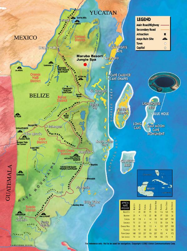
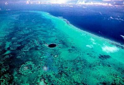
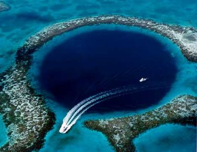
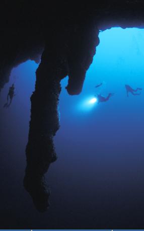
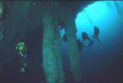
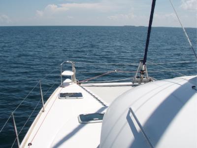
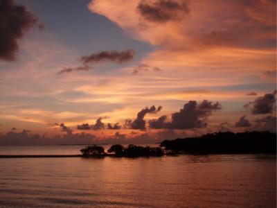

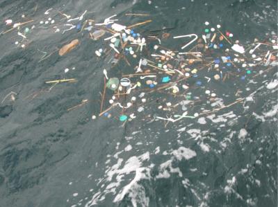
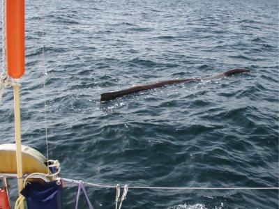
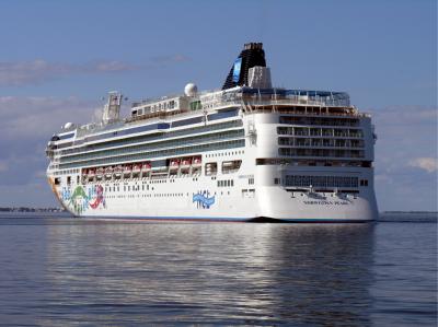
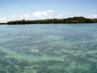
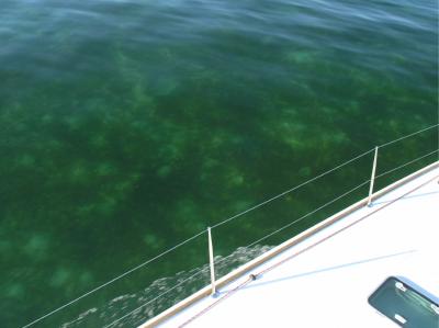
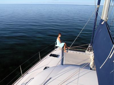
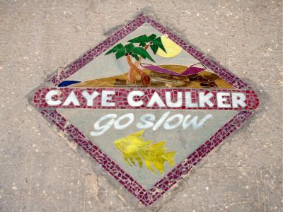
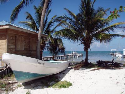
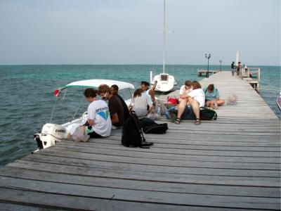
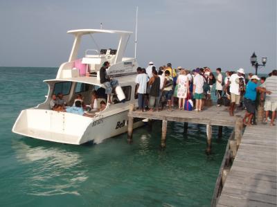
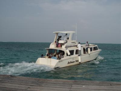
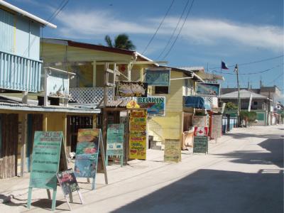
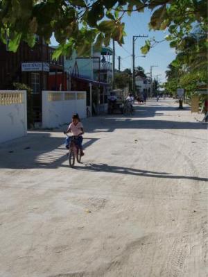
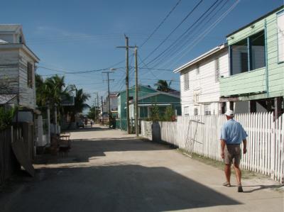
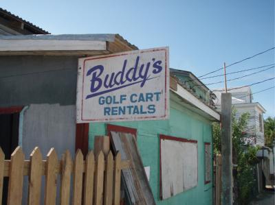

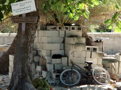
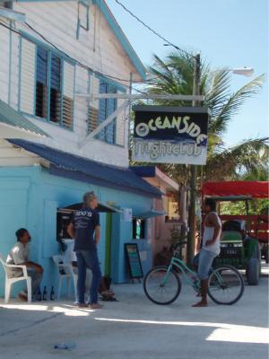
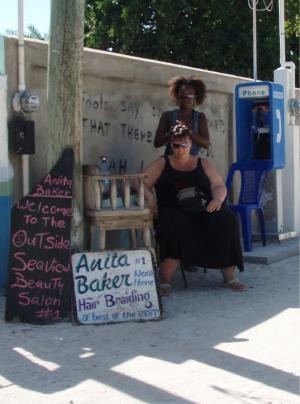
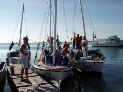
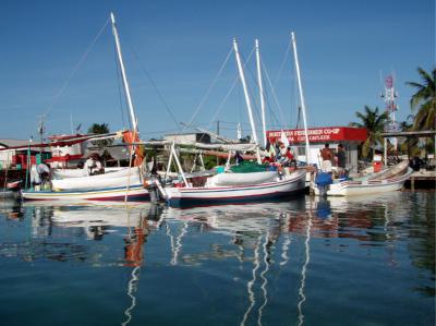
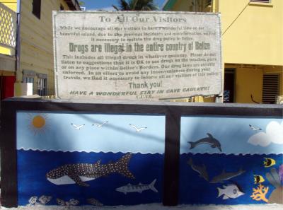
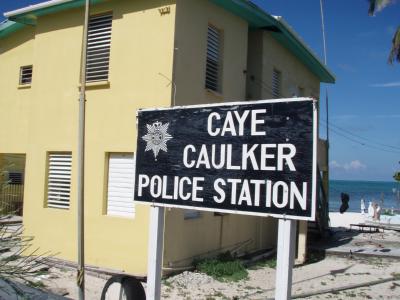

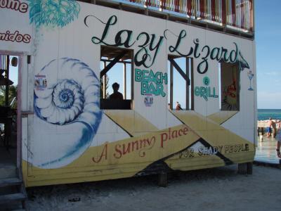
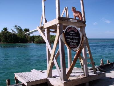
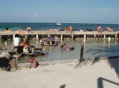
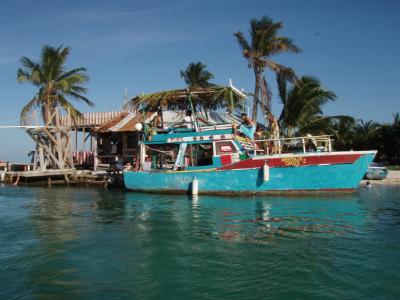
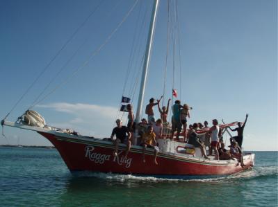
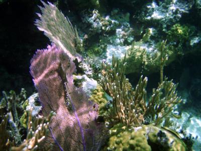
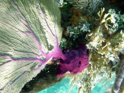
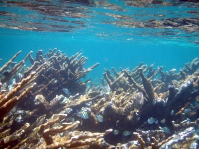
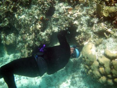
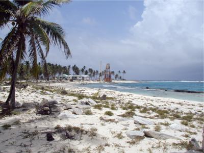
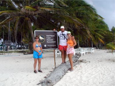
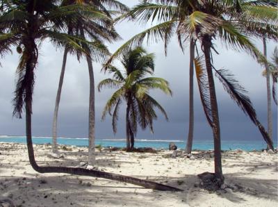
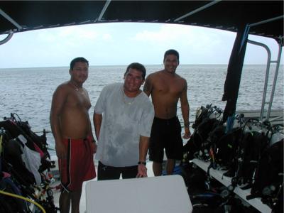
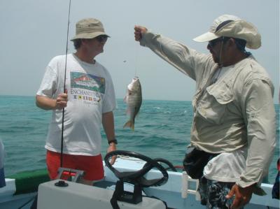
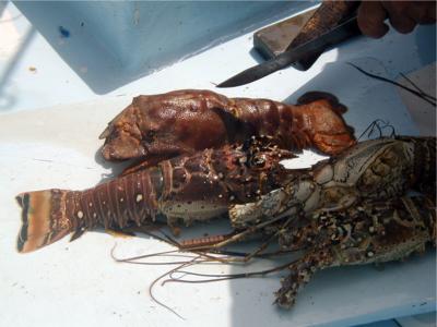
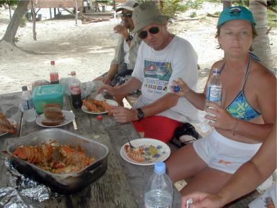
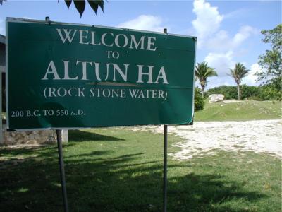
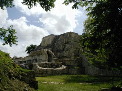
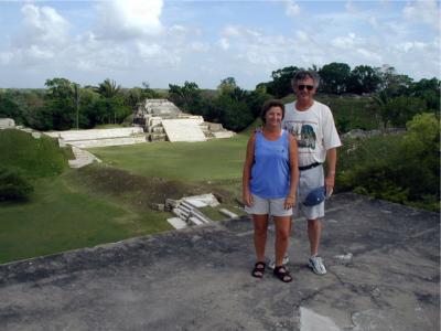
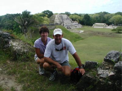
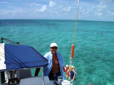
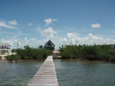
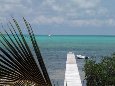
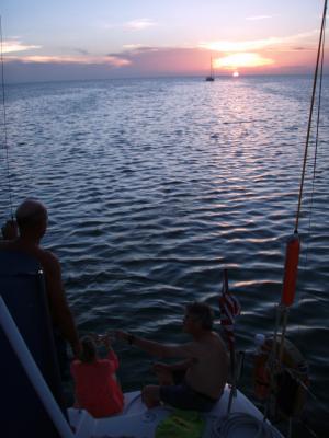
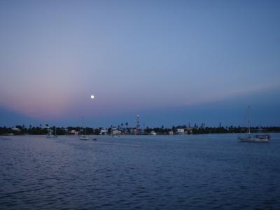
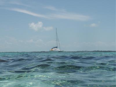

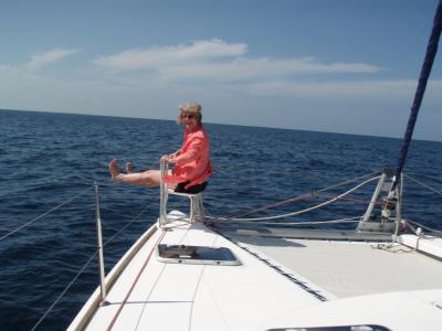
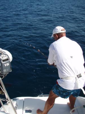
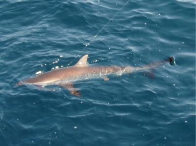
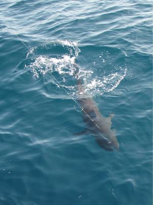
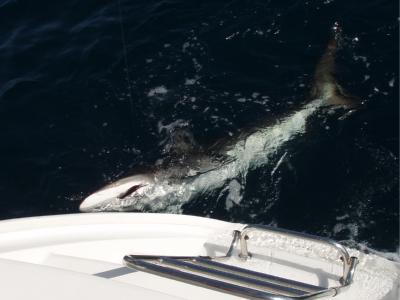
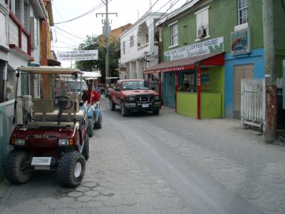
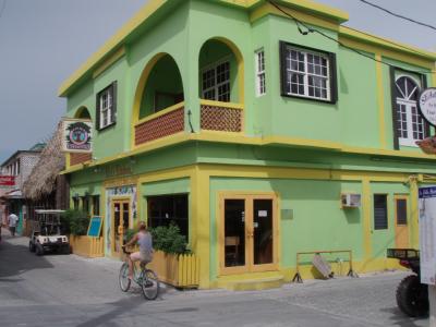
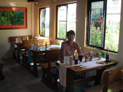
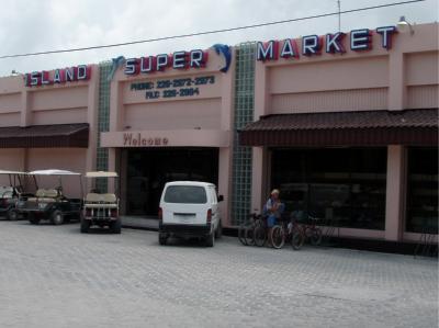
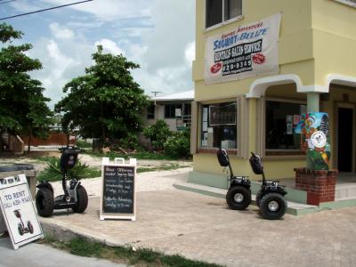
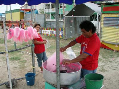
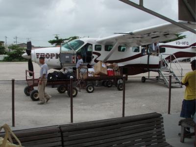
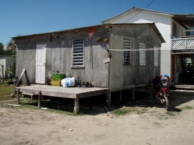
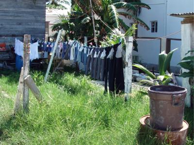
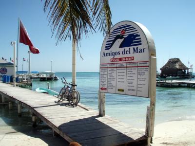
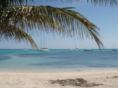
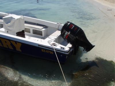
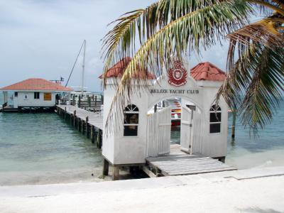
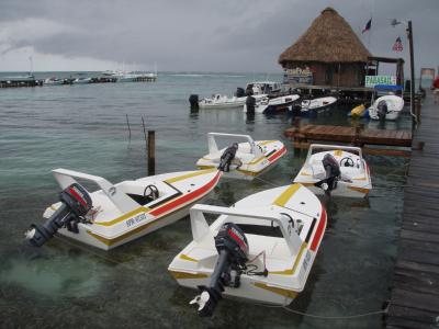
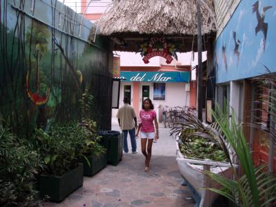
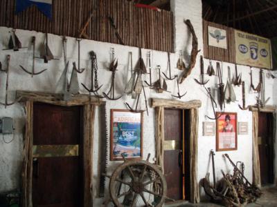
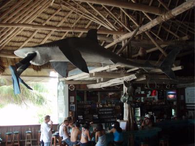
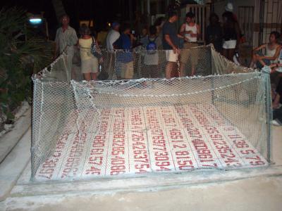
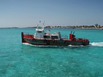
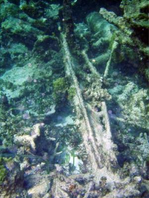
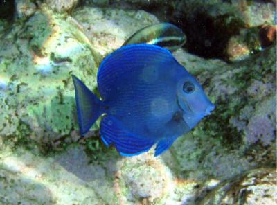
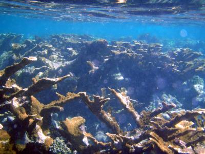
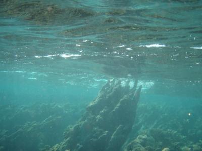
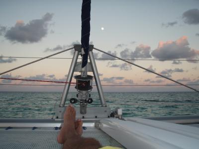
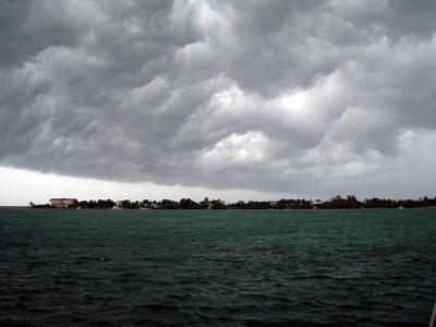
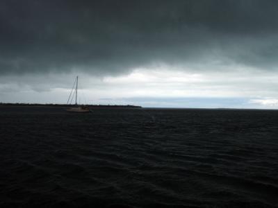
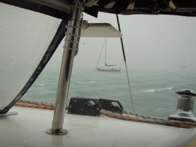


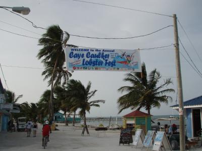

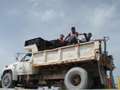
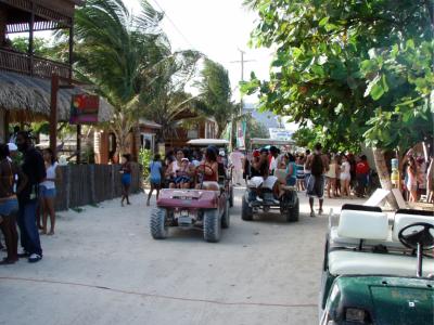
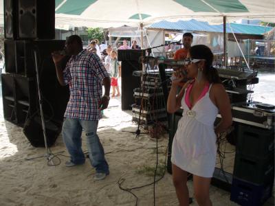
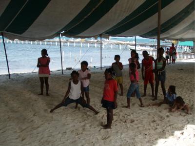
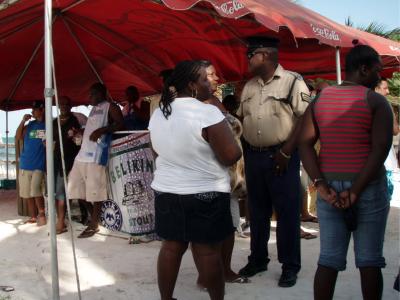
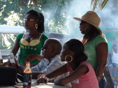
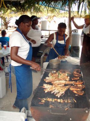
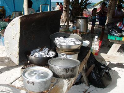
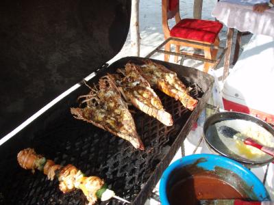
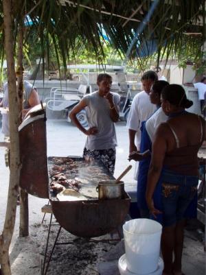
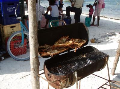
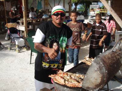
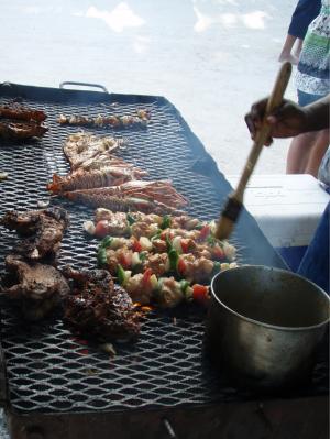
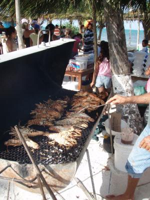
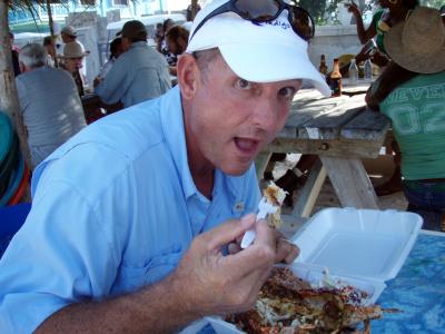
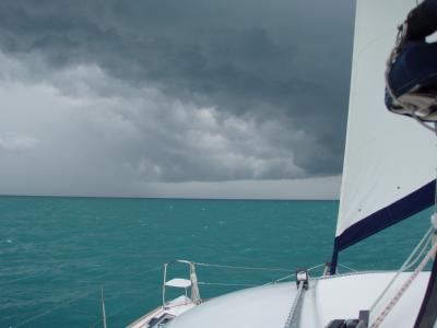
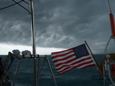
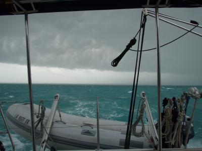
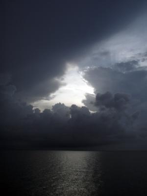
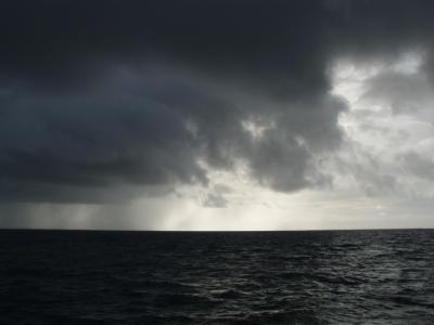
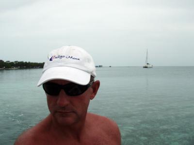
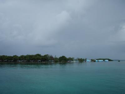
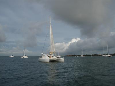
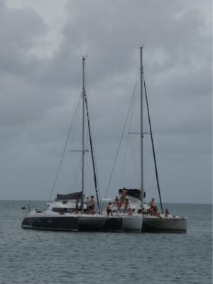
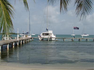
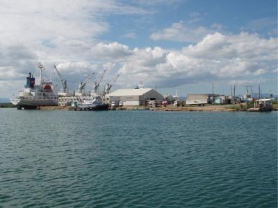

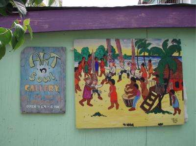
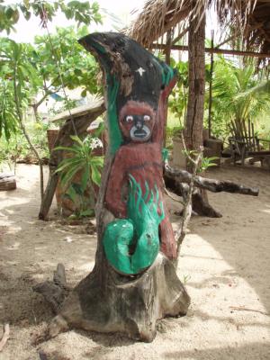

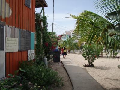
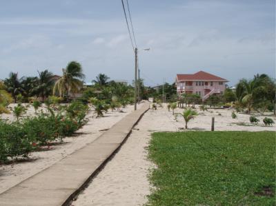
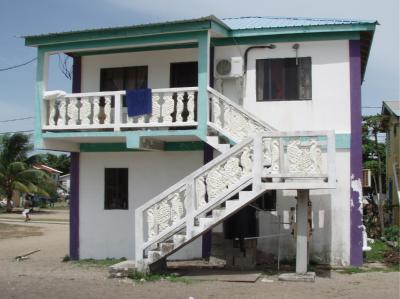
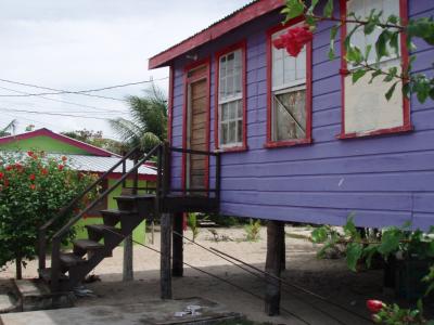
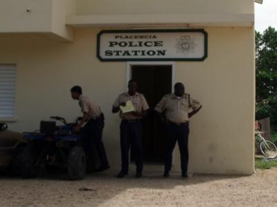
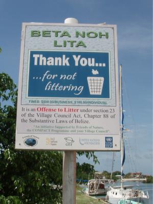

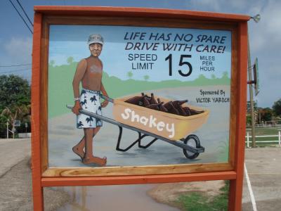

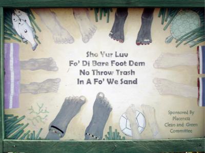
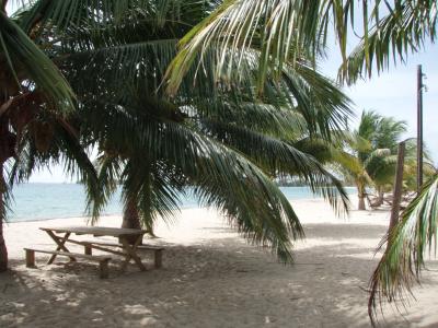
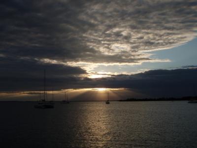
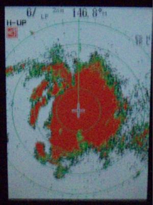
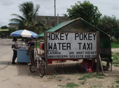
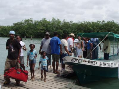
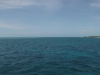
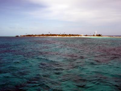
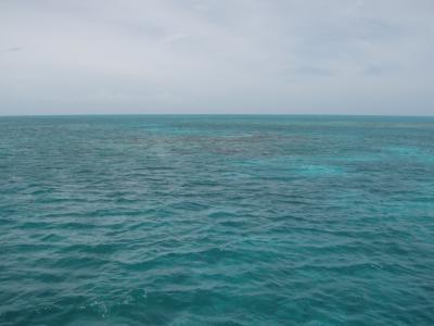
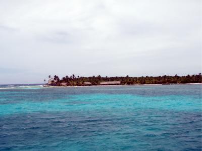
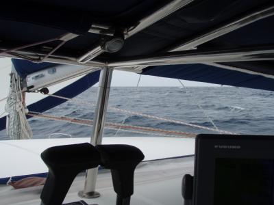
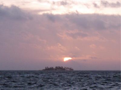
|
![]()